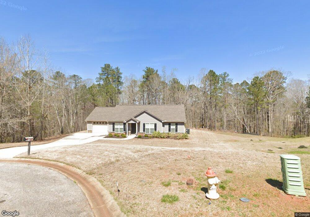
1761 New Franklin Rd Lagrange, GA 30240
Estimated Value: $566,000 - $998,360
4
Beds
4
Baths
4,335
Sq Ft
$180/Sq Ft
Est. Value
About This Home
This home is located at 1761 New Franklin Rd, Lagrange, GA 30240 and is currently estimated at $782,180, approximately $180 per square foot. 1761 New Franklin Rd is a home located in Troup County with nearby schools including Franklin Forest Elementary School, Hillcrest Elementary School, and Hollis Hand Elementary School.
Ownership History
Date
Name
Owned For
Owner Type
Purchase Details
Closed on
Jan 26, 2005
Sold by
Mcconnell Kathy Swanson
Bought by
Tucker Angela Christy
Current Estimated Value
Purchase Details
Closed on
Dec 12, 2001
Bought by
Mcconnell Kathy Swanson
Purchase Details
Closed on
Dec 8, 1998
Sold by
Walter H Waugh
Purchase Details
Closed on
Jan 1, 1965
Sold by
Winn H L
Bought by
Walter H Waugh
Create a Home Valuation Report for This Property
The Home Valuation Report is an in-depth analysis detailing your home's value as well as a comparison with similar homes in the area
Home Values in the Area
Average Home Value in this Area
Purchase History
| Date | Buyer | Sale Price | Title Company |
|---|---|---|---|
| Tucker Angela Christy | -- | -- | |
| Mcconnell Kathy Swanson | -- | -- | |
| -- | -- | -- | |
| Walter H Waugh | -- | -- |
Source: Public Records
Tax History Compared to Growth
Tax History
| Year | Tax Paid | Tax Assessment Tax Assessment Total Assessment is a certain percentage of the fair market value that is determined by local assessors to be the total taxable value of land and additions on the property. | Land | Improvement |
|---|---|---|---|---|
| 2024 | $7,455 | $330,240 | $70,400 | $259,840 |
| 2023 | $7,175 | $319,520 | $69,280 | $250,240 |
| 2022 | $6,763 | $298,960 | $69,280 | $229,680 |
| 2021 | $6,212 | $250,120 | $53,600 | $196,520 |
| 2020 | $6,206 | $250,120 | $53,600 | $196,520 |
| 2019 | $6,017 | $245,200 | $54,880 | $190,320 |
| 2018 | $5,542 | $230,800 | $56,120 | $174,680 |
| 2017 | $5,537 | $230,800 | $56,120 | $174,680 |
| 2016 | $5,394 | $226,235 | $56,154 | $170,081 |
| 2015 | $5,398 | $226,235 | $56,154 | $170,081 |
| 2014 | $5,131 | $217,283 | $56,154 | $161,129 |
| 2013 | -- | $207,050 | $38,063 | $168,987 |
Source: Public Records
Map
Nearby Homes
- 91 Richmond Dr
- LOT 106 River Oaks Dr
- 209 River Oaks Dr
- 127 Oakmont Dr
- 1784 New Franklin Rd
- 104 Hidden Branches Ln
- 107 Windridge
- 109 Windridge
- 118 Moss Creek Dr
- 117 Woodchase
- 127 Ashling Dr
- 105 Ridgeview Dr
- 129 Sunny Point Cir
- 89 Chase Rd
- 100 Canterbury Dr
- 101 Sheffield Dr
- 104 Canterbury Dr
- 102 Canterbury Dr
- 107 Dixie Creek Dr
- 100 Creekside Dr Unit LOT 60A
- 0 Genes Place Unit 7057442
- 0 Genes Place
- 107 Genes Place
- 109 Genes Place
- 105 Genes Place
- 103 Genes Place
- 106 Genes Place
- 83 Richmond Dr
- 101 Genes Place
- 145 Oakmont Dr
- 81 Richmond Dr
- 104 Genes Place
- 102 Genes Place
- 85 Richmond Dr
- 143 Oakmont Dr
- 100 Genes Place
- 80 Richmond Dr
- 141 Oakmont Dr
- 87 Richmond Dr
- 305 High Pointe Dr