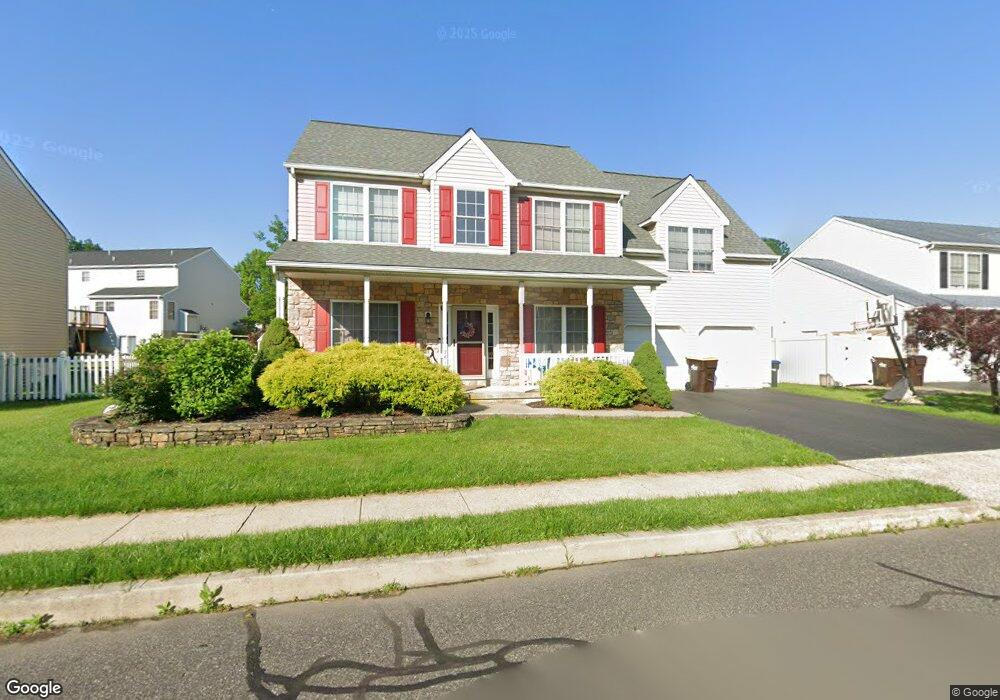
1761 Red Bud Rd Quakertown, PA 18951
Milford-Quakertown NeighborhoodEstimated Value: $512,000 - $555,000
4
Beds
3
Baths
2,172
Sq Ft
$245/Sq Ft
Est. Value
About This Home
This home is located at 1761 Red Bud Rd, Quakertown, PA 18951 and is currently estimated at $532,808, approximately $245 per square foot. 1761 Red Bud Rd is a home located in Bucks County with nearby schools including Pfaff Elementary School, Quakertown Community Senior High School, and United Friends School.
Ownership History
Date
Name
Owned For
Owner Type
Purchase Details
Closed on
Apr 23, 2009
Sold by
Wheeler Eric C and Wheeler Maria E
Bought by
Zarenkiewicz David S and Zarenkiewicz Rachelle
Current Estimated Value
Home Financials for this Owner
Home Financials are based on the most recent Mortgage that was taken out on this home.
Original Mortgage
$15,000
Outstanding Balance
$3,946
Interest Rate
4.9%
Mortgage Type
Stand Alone Second
Estimated Equity
$528,862
Purchase Details
Closed on
Jan 25, 2002
Sold by
Wheeler Eric C and Terwilliger Maria E
Bought by
Wheeler Eric C and Wheeler Maria E
Home Financials for this Owner
Home Financials are based on the most recent Mortgage that was taken out on this home.
Original Mortgage
$170,800
Interest Rate
7.13%
Create a Home Valuation Report for This Property
The Home Valuation Report is an in-depth analysis detailing your home's value as well as a comparison with similar homes in the area
Home Values in the Area
Average Home Value in this Area
Purchase History
| Date | Buyer | Sale Price | Title Company |
|---|---|---|---|
| Zarenkiewicz David S | $295,000 | None Available | |
| Wheeler Eric C | -- | -- |
Source: Public Records
Mortgage History
| Date | Status | Borrower | Loan Amount |
|---|---|---|---|
| Open | Zarenkiewicz David S | $15,000 | |
| Open | Zarenkiewicz David S | $236,000 | |
| Previous Owner | Wheeler Eric C | $170,800 |
Source: Public Records
Tax History Compared to Growth
Tax History
| Year | Tax Paid | Tax Assessment Tax Assessment Total Assessment is a certain percentage of the fair market value that is determined by local assessors to be the total taxable value of land and additions on the property. | Land | Improvement |
|---|---|---|---|---|
| 2025 | $6,542 | $32,440 | $4,520 | $27,920 |
| 2024 | $6,542 | $32,440 | $4,520 | $27,920 |
| 2023 | $916 | $32,440 | $4,520 | $27,920 |
| 2022 | $6,367 | $32,440 | $4,520 | $27,920 |
| 2021 | $6,367 | $32,440 | $4,520 | $27,920 |
| 2020 | $6,367 | $32,440 | $4,520 | $27,920 |
| 2019 | $6,191 | $32,440 | $4,520 | $27,920 |
| 2018 | $5,976 | $32,440 | $4,520 | $27,920 |
| 2017 | $5,791 | $32,440 | $4,520 | $27,920 |
| 2016 | $5,791 | $32,440 | $4,520 | $27,920 |
| 2015 | -- | $32,440 | $4,520 | $27,920 |
| 2014 | -- | $32,440 | $4,520 | $27,920 |
Source: Public Records
Map
Nearby Homes
- 1805 Leedum Ln
- 1999 Crossing Way
- 1856 Alamingo Dr
- 444 Enclave Dr Unit SAVANNAH
- 444 Enclave Dr Unit COVINGTON
- 444 Enclave Dr Unit SEBASTIAN
- 444 Enclave Dr Unit DEVONSHIRE
- 444 Enclave Dr Unit PARKER
- 444 Enclave Dr Unit HAWTHORNE
- 1615 Canary Rd
- 1625 Canary Rd
- 1844 Enclave Dr
- 1605 Canary Rd
- 8769 Spinnerstown Rd
- 1765 Old Plains Rd
- 1270 Fennel Rd
- 2365 E Swamp Rd
- 1410 Fels Rd
- 1940 Geryville Pike
- 2060 Rohrbach Ln
- 1765 Red Bud Rd
- 1757 Red Bud Rd
- 1893 Strong Rd
- 1889 Strong Rd
- 1897 Strong Rd
- 1762 Red Bud Rd
- 1753 Red Bud Rd
- 1769 Red Bud Rd
- 1758 Red Bud Rd
- 1885 Strong Rd
- 1766 Red Bud Rd
- 1754 Red Bud Rd
- 1850 Leedum Ln
- 1770 Red Bud Rd
- 1846 Leedum Ln
- 1749 Red Bud Rd
- 1892 Strong Rd
- 1881 Strong Rd
- 1854 Leedum Ln
- 1888 Strong Rd