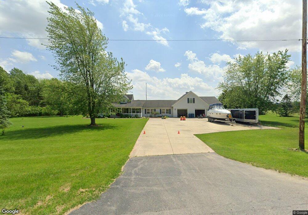
1761 State Route 412 Fremont, OH 43420
Estimated Value: $381,000 - $448,000
2
Beds
2
Baths
2,757
Sq Ft
$146/Sq Ft
Est. Value
About This Home
This home is located at 1761 State Route 412, Fremont, OH 43420 and is currently estimated at $403,138, approximately $146 per square foot. 1761 State Route 412 is a home located in Sandusky County with nearby schools including Fremont Ross High School, Temple Christian Academy, and Bishop Hoffman Catholic School - This is St Joe's School now.
Ownership History
Date
Name
Owned For
Owner Type
Purchase Details
Closed on
Mar 7, 2018
Sold by
Ginnever James F and Ginnever James F
Bought by
Darr Michael
Current Estimated Value
Home Financials for this Owner
Home Financials are based on the most recent Mortgage that was taken out on this home.
Original Mortgage
$260,993
Outstanding Balance
$221,919
Interest Rate
4.15%
Mortgage Type
VA
Estimated Equity
$181,219
Purchase Details
Closed on
Aug 1, 1993
Sold by
Ginnever James F
Bought by
Ginnever James F
Purchase Details
Closed on
Oct 1, 1990
Sold by
Ginnever James F
Bought by
Ginnever James F
Purchase Details
Closed on
Jul 1, 1989
Sold by
Ginnever James F
Bought by
Ginnever James F
Purchase Details
Closed on
Feb 1, 1989
Bought by
Ginnever James F
Create a Home Valuation Report for This Property
The Home Valuation Report is an in-depth analysis detailing your home's value as well as a comparison with similar homes in the area
Home Values in the Area
Average Home Value in this Area
Purchase History
| Date | Buyer | Sale Price | Title Company |
|---|---|---|---|
| Darr Michael | $255,500 | First American Title | |
| Ginnever James F | -- | -- | |
| Ginnever James F | -- | -- | |
| Ginnever James F | -- | -- | |
| Ginnever James F | $10,000 | -- |
Source: Public Records
Mortgage History
| Date | Status | Borrower | Loan Amount |
|---|---|---|---|
| Open | Darr Michael | $260,993 |
Source: Public Records
Tax History Compared to Growth
Tax History
| Year | Tax Paid | Tax Assessment Tax Assessment Total Assessment is a certain percentage of the fair market value that is determined by local assessors to be the total taxable value of land and additions on the property. | Land | Improvement |
|---|---|---|---|---|
| 2024 | $3,429 | $91,010 | $16,700 | $74,310 |
| 2023 | $3,429 | $91,010 | $16,700 | $74,310 |
| 2022 | $3,616 | $91,010 | $16,700 | $74,310 |
| 2021 | $3,731 | $91,010 | $16,700 | $74,310 |
| 2020 | $3,764 | $90,520 | $15,160 | $75,360 |
| 2019 | $3,759 | $90,520 | $15,160 | $75,360 |
| 2018 | $3,766 | $90,520 | $15,160 | $75,360 |
| 2017 | $2,682 | $64,300 | $15,160 | $49,140 |
| 2016 | $2,360 | $64,300 | $15,160 | $49,140 |
| 2015 | $2,321 | $64,300 | $15,160 | $49,140 |
| 2014 | $2,892 | $76,270 | $12,530 | $63,740 |
| 2013 | $2,830 | $76,270 | $12,530 | $63,740 |
Source: Public Records
Map
Nearby Homes
- 263 Saint Paul Dr
- 251 Saint Paul Dr
- 199 Saint Thomas Dr
- 315 Ethan Dr
- 318 Ethan Dr
- 2248 E State St
- 711 Bloom Rd
- 1014 S County Road 198
- 230 N Pennsylvania Ave
- 1526 Sunrise Blvd
- 0 Cr 214 Unit 20253055
- 612 2nd St
- 533 Sandusky Ave Unit 535
- 800 Lawndale Dr
- 546 Oaklawn Ave
- 714 E State St
- 322 4th St
- 314 S Collinwood Blvd
- 433 Sandusky Ave
- 340 340 Sandusky Ave
- 1761 Ohio 412
- 1768 State Route 412
- 1731 State Route 412
- 1731 Ohio 412
- 1756 State Route 412
- 1784 State Route 412 Unit 17
- 1742 State Route 412
- 1789 State Route 412
- 1788 State Route 412
- 1699 State Route 412
- 1806 State Route 412
- 1816 State Route 412
- 1667 State Route 412
- 1657 Ohio 412
- 1657 State Route 412
- 1876 State Route 412
- 1625 State Route 412
- 412 Sr
- 1615 State Route 412
- 1615 Ohio 412