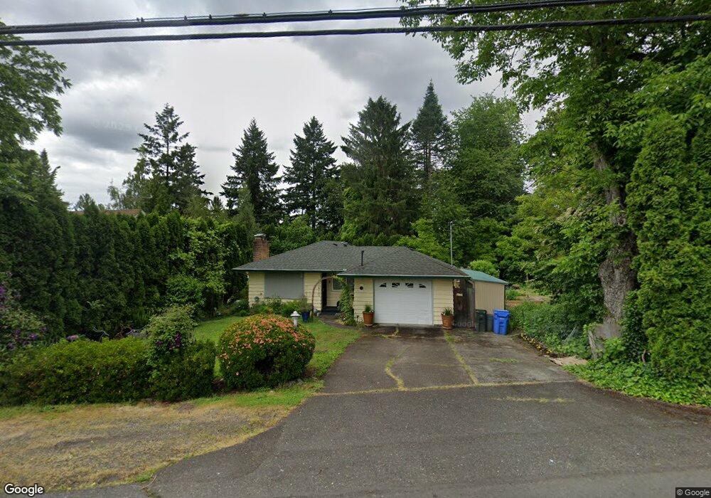
17610 SE River Rd Milwaukie, OR 97267
Estimated Value: $556,173 - $581,000
4
Beds
2
Baths
2,048
Sq Ft
$277/Sq Ft
Est. Value
About This Home
This home is located at 17610 SE River Rd, Milwaukie, OR 97267 and is currently estimated at $567,793, approximately $277 per square foot. 17610 SE River Rd is a home located in Clackamas County with nearby schools including Jennings Lodge Elementary School, Candy Lane Elementary School, and Gardiner Middle School.
Ownership History
Date
Name
Owned For
Owner Type
Purchase Details
Closed on
Dec 27, 2001
Sold by
Ammerman Robert
Bought by
Ammerman Robert and Horsch Ammerman Cindy A
Current Estimated Value
Home Financials for this Owner
Home Financials are based on the most recent Mortgage that was taken out on this home.
Original Mortgage
$31,000
Outstanding Balance
$2,325
Interest Rate
6.94%
Mortgage Type
Stand Alone Second
Estimated Equity
$565,468
Purchase Details
Closed on
Oct 1, 1993
Bought by
Ammerman R A and Ammerman Horsch-Ammerman C
Create a Home Valuation Report for This Property
The Home Valuation Report is an in-depth analysis detailing your home's value as well as a comparison with similar homes in the area
Home Values in the Area
Average Home Value in this Area
Purchase History
| Date | Buyer | Sale Price | Title Company |
|---|---|---|---|
| Ammerman Robert | -- | -- | |
| Ammerman R A | $122,000 | -- |
Source: Public Records
Mortgage History
| Date | Status | Borrower | Loan Amount |
|---|---|---|---|
| Open | Ammerman Robert | $31,000 |
Source: Public Records
Tax History Compared to Growth
Tax History
| Year | Tax Paid | Tax Assessment Tax Assessment Total Assessment is a certain percentage of the fair market value that is determined by local assessors to be the total taxable value of land and additions on the property. | Land | Improvement |
|---|---|---|---|---|
| 2025 | $4,325 | $248,911 | -- | -- |
| 2024 | $3,900 | $241,662 | -- | -- |
| 2023 | $3,900 | $234,624 | $0 | $0 |
| 2022 | $3,575 | $227,791 | $0 | $0 |
| 2021 | $3,424 | $221,157 | $0 | $0 |
| 2020 | $3,065 | $197,820 | $0 | $0 |
| 2019 | $3,004 | $192,059 | $0 | $0 |
| 2018 | $2,845 | $186,465 | $0 | $0 |
| 2017 | $2,773 | $181,034 | $0 | $0 |
| 2016 | $2,711 | $175,761 | $0 | $0 |
| 2015 | $2,640 | $170,642 | $0 | $0 |
| 2014 | $2,566 | $165,672 | $0 | $0 |
Source: Public Records
Map
Nearby Homes
- 4424 SE Roethe Rd Unit 42
- 4424 SE Roethe Rd
- 16731 SE Blanton St
- 3405 SE Vineyard Rd Unit SP 49
- 3405 SE Vineyard Rd Unit 55
- 4801 SE Ina Ave
- 4803 SE Ina Ave
- 4807 SE Ina Ave
- 4828 SE Ina Ave
- 16642 SE Harold Ave
- 3419 SE Kingsley Rd
- 4711 SE Roethe Rd
- 18515 SE River Rd
- 4400 Calaroga Dr
- 19155 Nixon Ave
- 18418 Old River Landing
- 3446 Fernvilla Dr
- 4819 SE Roethe Rd
- 16365 SE Sterling Cir
- 17770 SE Cook St
- 17606 SE River Rd
- 3750 SE Roethe Rd
- 17614 SE River Rd
- 3599 SE River Bluff Ct
- 3762 SE Roethe Rd
- 3721 SE Roethe Rd
- 3729 SE Roethe Rd
- 17518 SE River Rd
- 17601 SE River Rd
- 17617 SE River Rd
- 3591 SE River Bluff Ct
- 17548 SE Paradise Dr
- 17546 SE Paradise Dr
- 17613 SE River Rd
- 17595 SE River Rd
- 3784 SE Roethe Rd
- 17623 SE River Rd
- 3723 SE Roethe Rd
- 3717 SE Roethe Rd
- 17552 SE Paradise Dr