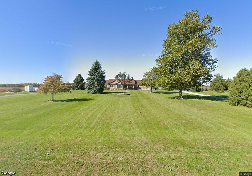
17613 Santa Fe Line Rd Waynesfield, OH 45896
Estimated Value: $297,000 - $467,000
3
Beds
2
Baths
1,638
Sq Ft
$241/Sq Ft
Est. Value
About This Home
This home is located at 17613 Santa Fe Line Rd, Waynesfield, OH 45896 and is currently estimated at $395,072, approximately $241 per square foot. 17613 Santa Fe Line Rd is a home located in Auglaize County with nearby schools including Waynesfield-Goshen Local Elementary School and Waynesfield-Goshen Local High School.
Ownership History
Date
Name
Owned For
Owner Type
Purchase Details
Closed on
Aug 29, 2023
Sold by
Plaugher Nicole L and Plaugher James L
Bought by
Plaugher Nicole L and Plaugher James L
Current Estimated Value
Purchase Details
Closed on
Jun 25, 2010
Sold by
Eutsler Darren P
Bought by
Eutsler Nicole L
Purchase Details
Closed on
Nov 23, 1993
Sold by
Wagner Richard
Bought by
Eutsler Darren P
Create a Home Valuation Report for This Property
The Home Valuation Report is an in-depth analysis detailing your home's value as well as a comparison with similar homes in the area
Home Values in the Area
Average Home Value in this Area
Purchase History
| Date | Buyer | Sale Price | Title Company |
|---|---|---|---|
| Plaugher Nicole L | -- | None Listed On Document | |
| Eutsler Nicole L | -- | None Available | |
| Eutsler Darren P | $8,000 | -- |
Source: Public Records
Tax History Compared to Growth
Tax History
| Year | Tax Paid | Tax Assessment Tax Assessment Total Assessment is a certain percentage of the fair market value that is determined by local assessors to be the total taxable value of land and additions on the property. | Land | Improvement |
|---|---|---|---|---|
| 2024 | $6,250 | $99,840 | $8,240 | $91,600 |
| 2023 | $3,620 | $99,840 | $8,240 | $91,600 |
| 2022 | $3,034 | $71,800 | $7,490 | $64,310 |
| 2021 | $3,029 | $71,800 | $7,490 | $64,310 |
| 2020 | $3,033 | $71,796 | $7,490 | $64,306 |
| 2019 | $2,487 | $60,144 | $6,244 | $53,900 |
| 2018 | $2,339 | $59,252 | $6,244 | $53,008 |
| 2017 | $2,299 | $59,252 | $6,244 | $53,008 |
| 2016 | $1,969 | $52,248 | $5,943 | $46,305 |
| 2015 | $1,970 | $52,248 | $5,943 | $46,305 |
| 2014 | $1,973 | $52,248 | $5,943 | $46,305 |
| 2013 | $2,173 | $52,248 | $5,943 | $46,305 |
Source: Public Records
Map
Nearby Homes
- 105 Guthrie St
- 202 W Mulberry St
- 25836 Ohio 67
- 22275 Buckland Holden Rd
- 5065 Amherst Rd
- 20630 State Route 67
- 8150 Amherst Rd
- 17 E Walnut St
- 37 N Main St
- 0 Ohio 67
- 7165 Faulkner Rd
- 6616 Bellefontaine Rd
- 6381 McPheron Rd
- E Hanthorn Rd
- 5600 E Hanthorn Rd
- 4160 E Hanthorn Rd
- 17946 National Rd
- 3080 E Hanthorn Rd
- 1200 E Breese Rd
- 1855 S Cool Rd
- 17371 Santa Fe Line Rd
- 17693 Santa Fe Line Rd
- 17753 Santa Fe Line Rd
- 17371 Santa Fe Line Rd
- 17915 Santa Fe Line Rd
- 17961 Santa Fe Line Rd
- 17385 Santa Fe Line Rd
- 17385 Santa Fe Line Rd
- 17015 Santa Fe Line Rd
- 23897 Fairmount Rd
- 18093 Santa Fe Line Rd
- 23524 Fairmount Rd
- 23739 Fairmount Rd
- 23691 Fairmount Rd
- 24340 Fairmount Rd
- 18140 Santa Fe Line Rd
- 23526 Fairmount Rd
- 23526 Fairmount Rd
- 18186 Santa Fe Line Rd
- 18143 Santa Fe Line Rd