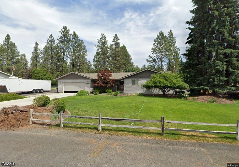
17614 N Michael Rd Colbert, WA 99005
Estimated Value: $504,456 - $566,000
3
Beds
2
Baths
1,594
Sq Ft
$339/Sq Ft
Est. Value
About This Home
This home is located at 17614 N Michael Rd, Colbert, WA 99005 and is currently estimated at $541,114, approximately $339 per square foot. 17614 N Michael Rd is a home located in Spokane County with nearby schools including Colbert Elementary School, Mountainside Middle School, and Mt. Spokane High School.
Ownership History
Date
Name
Owned For
Owner Type
Purchase Details
Closed on
Nov 2, 1998
Sold by
Mccollim Brian J and Mccollim Dee Ann
Bought by
Ellingson James R and Ellingson Peggy L
Current Estimated Value
Home Financials for this Owner
Home Financials are based on the most recent Mortgage that was taken out on this home.
Original Mortgage
$89,400
Outstanding Balance
$19,548
Interest Rate
6.61%
Estimated Equity
$521,566
Create a Home Valuation Report for This Property
The Home Valuation Report is an in-depth analysis detailing your home's value as well as a comparison with similar homes in the area
Home Values in the Area
Average Home Value in this Area
Purchase History
| Date | Buyer | Sale Price | Title Company |
|---|---|---|---|
| Ellingson James R | $157,500 | Pacific Nw Title |
Source: Public Records
Mortgage History
| Date | Status | Borrower | Loan Amount |
|---|---|---|---|
| Open | Ellingson James R | $89,400 |
Source: Public Records
Tax History Compared to Growth
Tax History
| Year | Tax Paid | Tax Assessment Tax Assessment Total Assessment is a certain percentage of the fair market value that is determined by local assessors to be the total taxable value of land and additions on the property. | Land | Improvement |
|---|---|---|---|---|
| 2025 | $4,447 | $435,800 | $110,000 | $325,800 |
| 2024 | $4,447 | $436,600 | $105,000 | $331,600 |
| 2023 | $4,192 | $444,900 | $95,000 | $349,900 |
| 2022 | $3,634 | $458,400 | $85,000 | $373,400 |
| 2021 | $3,146 | $295,200 | $50,000 | $245,200 |
| 2020 | $3,143 | $279,800 | $50,000 | $229,800 |
| 2019 | $2,911 | $261,400 | $46,500 | $214,900 |
| 2018 | $3,279 | $247,400 | $46,500 | $200,900 |
| 2017 | $3,020 | $229,300 | $46,500 | $182,800 |
| 2016 | $2,782 | $206,500 | $40,000 | $166,500 |
| 2015 | $2,685 | $204,700 | $40,000 | $164,700 |
| 2014 | -- | $202,900 | $40,000 | $162,900 |
| 2013 | -- | $0 | $0 | $0 |
Source: Public Records
Map
Nearby Homes
- 17211 N Ranchette Rd
- 177XX N Saddle Hill Rd
- 18015 N Ranchette Rd
- 18004 N Ranchette Rd
- 3611 E Pine Needle Ave
- 17022 N Golden Dr
- 3810 E Evan Ln
- 18204 N Palomino Rd
- 16906 N Golden Dr
- 16822 N Golden Dr
- 2406 E Colbert Rd
- 17221 N Little Spokane Dr
- XXXX E Greenbluff Rd
- 16417 N Napa Ln
- 1225 E Paske Rd
- 3912 E Siskin Ln
- 1611 E Heritage Ln
- 19228 N Little Spokane Dr
- 3916 E Tanager Ln
- 18097 N Morton Ct
- 17606 N Michael Rd
- 17626 N Michael Rd
- 17615 N Kimberly Rd
- 17615 N Michael Rd
- 17623 N Kimberly Rd
- 17603 N Michael Rd
- 17605 N Kimberly Rd
- 17710 N Michael Rd
- 17524 N Michael Rd
- 17705 N Michael Rd
- 17516 N Michael Rd
- 17509 N Michael Rd
- 17709 N Kimberly Rd
- 17616 N Judy Dr
- 17519 N Kimberly Rd
- 17720 N Michael Rd
- 17612 N Judy Dr
- 17713 N Michael Rd
- 17704 N Judy Dr
- 17721 N Kimberly Rd