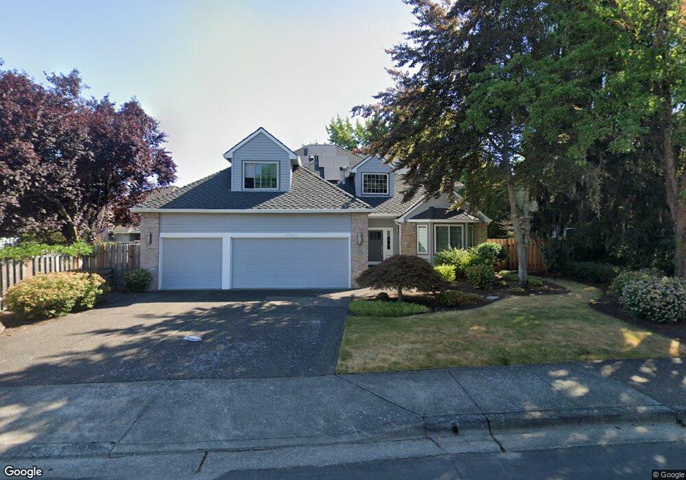
17619 NW Lone Rock Dr Portland, OR 97229
Estimated Value: $765,000 - $812,000
3
Beds
3
Baths
2,853
Sq Ft
$277/Sq Ft
Est. Value
About This Home
This home is located at 17619 NW Lone Rock Dr, Portland, OR 97229 and is currently estimated at $790,168, approximately $276 per square foot. 17619 NW Lone Rock Dr is a home located in Washington County with nearby schools including Bethany Elementary School, Five Oaks Middle School, and Westview High School.
Ownership History
Date
Name
Owned For
Owner Type
Purchase Details
Closed on
Oct 19, 2001
Sold by
Goodman George O and Goodman Marsha S
Bought by
Goodman George O and Goodman Marsha S
Current Estimated Value
Home Financials for this Owner
Home Financials are based on the most recent Mortgage that was taken out on this home.
Original Mortgage
$228,000
Interest Rate
5.75%
Purchase Details
Closed on
Jul 30, 1999
Sold by
Goodman George O and Goodman Marsha S
Bought by
Goodman George O and Goodman Marsha S
Create a Home Valuation Report for This Property
The Home Valuation Report is an in-depth analysis detailing your home's value as well as a comparison with similar homes in the area
Home Values in the Area
Average Home Value in this Area
Purchase History
| Date | Buyer | Sale Price | Title Company |
|---|---|---|---|
| Goodman George O | -- | Fidelity National Title Co | |
| Goodman George O | -- | -- |
Source: Public Records
Mortgage History
| Date | Status | Borrower | Loan Amount |
|---|---|---|---|
| Closed | Goodman George O | $228,000 |
Source: Public Records
Tax History Compared to Growth
Tax History
| Year | Tax Paid | Tax Assessment Tax Assessment Total Assessment is a certain percentage of the fair market value that is determined by local assessors to be the total taxable value of land and additions on the property. | Land | Improvement |
|---|---|---|---|---|
| 2025 | $8,684 | $476,440 | -- | -- |
| 2024 | $8,156 | $462,570 | -- | -- |
| 2023 | $8,156 | $449,100 | $0 | $0 |
| 2022 | $7,878 | $449,100 | $0 | $0 |
| 2021 | $7,594 | $423,330 | $0 | $0 |
| 2020 | $7,364 | $411,000 | $0 | $0 |
| 2019 | $7,128 | $399,030 | $0 | $0 |
| 2018 | $6,896 | $387,410 | $0 | $0 |
| 2017 | $6,648 | $376,130 | $0 | $0 |
| 2016 | $6,411 | $365,180 | $0 | $0 |
| 2015 | $6,133 | $354,550 | $0 | $0 |
| 2014 | $6,017 | $344,230 | $0 | $0 |
Source: Public Records
Map
Nearby Homes
- 17734 NW Lone Rock Dr
- 17628 NW Gilbert Ln
- 17472 NW Gilbert Ln
- 4255 NW 174th Ave
- 3376 NW Brandt Place
- 17638 NW Layla Dr Unit Lot 31
- 17716 NW Layla Dr Unit Lot 28
- 17641 NW Layla Dr
- 4420 NW 178 Terrace Unit Lot 27
- Lot 1 Plan at Creekside at Westview
- Lot 27 Plan at Creekside at Westview
- Lot 3 Plan at Creekside at Westview
- Lot 17 Plan at Creekside at Westview
- Lot 24 Plan at Creekside at Westview
- Lot 23 Plan at Creekside at Westview
- Lot 28 Plan at Creekside at Westview
- Lot 20 Plan at Creekside at Westview
- Lot 4 Plan at Creekside at Westview
- Lot 31 Plan at Creekside at Westview
- Lot 7 Plan at Creekside at Westview
- 17605 NW Lone Rock Dr
- 17634 NW Country Dr
- 17600 NW Country Dr
- 17588 NW Country Dr
- 17576 NW Country Dr
- 17591 NW Lone Rock Dr
- 17568 NW Country Dr
- 17648 NW Country Dr
- 17608 NW Lone Rock Dr
- 17564 NW Country Dr
- 17602 NW Lone Rock Dr
- 17579 NW Lone Rock Dr
- 17677 NW Lone Rock Dr
- 17664 NW Country Dr
- 17607 NW Country Dr
- 17641 NW Country Dr
- 17595 NW Country Dr
- 17615 NW Country Dr
- 17565 NW Country Dr
- 17588 NW Lone Rock Dr