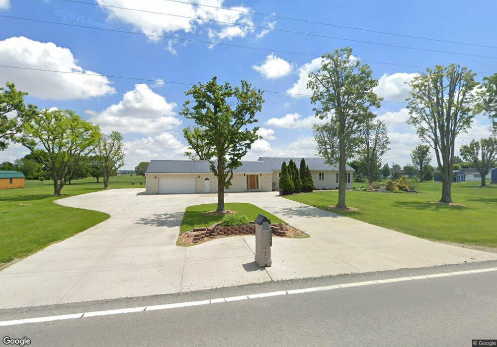
17623 State Route 66 Fort Jennings, OH 45844
Estimated Value: $261,000 - $295,000
3
Beds
2
Baths
1,788
Sq Ft
$156/Sq Ft
Est. Value
About This Home
This home is located at 17623 State Route 66, Fort Jennings, OH 45844 and is currently estimated at $278,852, approximately $155 per square foot. 17623 State Route 66 is a home located in Putnam County with nearby schools including Ottoville Elementary School and Ottoville High School.
Ownership History
Date
Name
Owned For
Owner Type
Purchase Details
Closed on
Sep 4, 2025
Sold by
Klausing Joseph P and Klausing Yvonne D
Bought by
Joseph & Yvonne Klausing Family Living Trust and Klausing
Current Estimated Value
Purchase Details
Closed on
Jul 26, 2024
Sold by
Makara Brian K and Makara Tammy J
Bought by
Klausing Joseph and Klausing Yvonne
Purchase Details
Closed on
Jun 10, 2020
Sold by
Clementz Marsha K and Epstein Phillip M
Bought by
Makara Brian K and Makara Tammy J
Create a Home Valuation Report for This Property
The Home Valuation Report is an in-depth analysis detailing your home's value as well as a comparison with similar homes in the area
Home Values in the Area
Average Home Value in this Area
Purchase History
| Date | Buyer | Sale Price | Title Company |
|---|---|---|---|
| Joseph & Yvonne Klausing Family Living Trust | -- | Baker & Mcclure Law & Title Ll | |
| Joseph & Yvonne Klausing Family Living Trust | -- | Baker & Mcclure Law & Title Ll | |
| Klausing Joseph | $250,000 | None Listed On Document | |
| Makara Brian K | $188,000 | None Available |
Source: Public Records
Tax History Compared to Growth
Tax History
| Year | Tax Paid | Tax Assessment Tax Assessment Total Assessment is a certain percentage of the fair market value that is determined by local assessors to be the total taxable value of land and additions on the property. | Land | Improvement |
|---|---|---|---|---|
| 2024 | $2,209 | $73,810 | $5,440 | $68,370 |
| 2023 | $2,281 | $44,120 | $4,200 | $39,920 |
| 2022 | $1,577 | $44,121 | $4,200 | $39,921 |
| 2021 | $1,640 | $44,120 | $4,200 | $39,920 |
| 2020 | $1,290 | $41,320 | $3,530 | $37,790 |
| 2019 | $1,143 | $40,490 | $4,200 | $36,290 |
| 2018 | $1,102 | $40,490 | $4,200 | $36,290 |
| 2017 | $1,147 | $40,490 | $4,200 | $36,290 |
| 2016 | $1,147 | $41,320 | $3,530 | $37,790 |
| 2015 | $1,153 | $41,320 | $3,530 | $37,790 |
| 2014 | $1,132 | $41,320 | $3,530 | $37,790 |
| 2013 | $1,190 | $41,320 | $3,530 | $37,790 |
Source: Public Records
Map
Nearby Homes
- 0 Road 24-Q
- 320 Auglaize St
- 0 Heritage Cir Unit 6112034
- 0 Heritage Cir Unit 303239
- 7510 State Route 66
- 8951 Brickner Rd
- 17736 Road 20p
- 1303 Carolyn Dr
- 1220 Rose Anna Dr
- 810 N Franklin St
- 704 N Franklin St
- 628 N Pierce St
- 610 N Washington St
- 604 W 6th St
- 650 E 6th St
- 503 W 6th St
- 616 W 5th St
- 25853 Road M
- 405 N Franklin St
- 409 N Bredeick St
- 17623 State Route
- 17623 Ohio 66
- 17653 State Route 66
- 17902 Road 24q
- 17587 State Route 66
- 17932 Road 24q
- 17592 State Route 66
- 25166 Road R
- 24990 Road R
- 24940 Road R
- 24906 Road R
- 17861 Road 24q
- 24969 Road R
- 24951 Road R
- 17539 State Route 66
- 24931 Road R
- 17923 Road 24q
- 17675 State Route 66
- 17707 State Route 66
- 24885 Road R