Estimated Value: $278,000 - $338,000
4
Beds
3
Baths
2,655
Sq Ft
$117/Sq Ft
Est. Value
About This Home
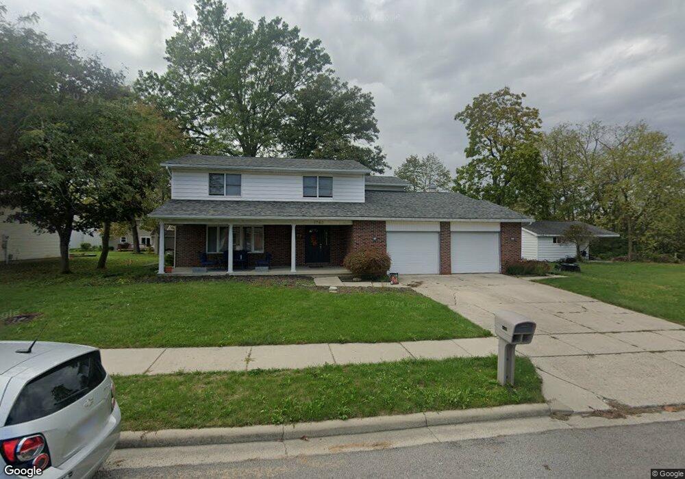
This home is located at 1763 Benham Dr, Lima, OH 45805 and is currently estimated at $309,672, approximately $116 per square foot. 1763 Benham Dr is a home located in Allen County with nearby schools including Elida Elementary School, Elida Middle School, and Elida High School.
Ownership History
Date
Name
Owned For
Owner Type
Purchase Details
Closed on
Jun 29, 2001
Sold by
Trst David L Kessler
Bought by
Hampshire Matthew Diana
Current Estimated Value
Home Financials for this Owner
Home Financials are based on the most recent Mortgage that was taken out on this home.
Original Mortgage
$139,500
Interest Rate
7.18%
Mortgage Type
New Conventional
Purchase Details
Closed on
Oct 1, 1980
Bought by
Kessler Rebecca J
Create a Home Valuation Report for This Property
The Home Valuation Report is an in-depth analysis detailing your home's value as well as a comparison with similar homes in the area
Purchase History
| Date | Buyer | Sale Price | Title Company |
|---|---|---|---|
| Hampshire Matthew Diana | $155,000 | -- | |
| Kessler Rebecca J | $15,000 | -- |
Source: Public Records
Mortgage History
| Date | Status | Borrower | Loan Amount |
|---|---|---|---|
| Closed | Hampshire Matthew Diana | $139,500 |
Source: Public Records
Tax History
| Year | Tax Paid | Tax Assessment Tax Assessment Total Assessment is a certain percentage of the fair market value that is determined by local assessors to be the total taxable value of land and additions on the property. | Land | Improvement |
|---|---|---|---|---|
| 2024 | $4,399 | $101,220 | $16,100 | $85,120 |
| 2023 | $3,921 | $80,330 | $12,780 | $67,550 |
| 2022 | $4,000 | $80,330 | $12,780 | $67,550 |
| 2021 | $4,018 | $80,330 | $12,780 | $67,550 |
| 2020 | $3,572 | $66,330 | $16,980 | $49,350 |
| 2019 | $3,572 | $66,330 | $16,980 | $49,350 |
| 2018 | $3,415 | $66,330 | $16,980 | $49,350 |
| 2017 | $3,241 | $61,850 | $16,980 | $44,870 |
| 2016 | $3,234 | $61,850 | $16,980 | $44,870 |
| 2015 | $3,255 | $61,850 | $16,980 | $44,870 |
| 2014 | $3,284 | $60,310 | $15,790 | $44,520 |
| 2013 | $2,949 | $60,310 | $15,790 | $44,520 |
Source: Public Records
Map
Nearby Homes
- 1641 Whitehall Dr
- 174 Bridle Trail
- 224 Buckingham Dr
- 272 Deer Run
- 14 Deer Run
- 1558 Chancellor Dr
- 1392 Chancellor Dr
- 3660 Comanche Dr
- 3624 Comanche Dr
- 3790 Comanche Dr
- 3619 Comanche Dr
- 3705 Comanche
- 3721 Comanche
- 1515 Cessna Ave
- 2225 N Cable Rd
- 2275 N Cable Rd Unit 178
- 2275 N Cable Rd Unit 130
- 2275 N Cable Rd Unit 43 Unit Package
- 2275 N Cable Rd Unit 42
- 2275 N Cable Rd Unit 12
Your Personal Tour Guide
Ask me questions while you tour the home.