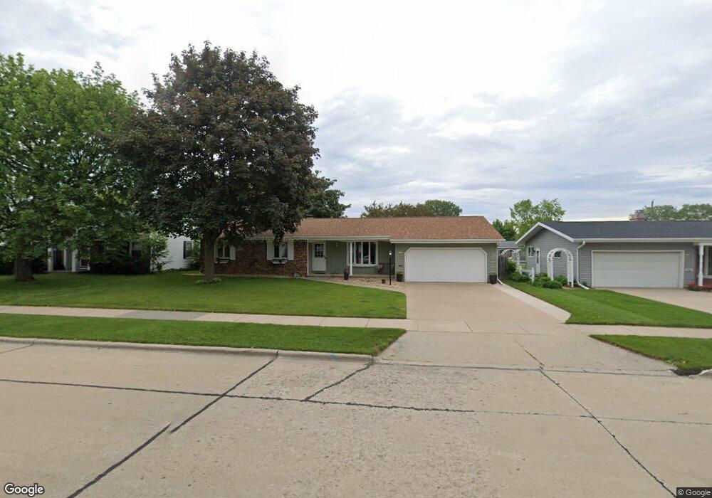
1764 Southland Ave Oshkosh, WI 54902
Estimated Value: $269,000 - $316,000
3
Beds
2
Baths
1,420
Sq Ft
$204/Sq Ft
Est. Value
About This Home
This home is located at 1764 Southland Ave, Oshkosh, WI 54902 and is currently estimated at $289,355, approximately $203 per square foot. 1764 Southland Ave is a home located in Winnebago County with nearby schools including Roosevelt Elementary School, Tipler Middle School, and West High School.
Ownership History
Date
Name
Owned For
Owner Type
Purchase Details
Closed on
Aug 13, 2018
Sold by
Binder Stephanie M and Demler Stephanie M
Bought by
Binder Craig M and Binder Stephanie M
Current Estimated Value
Purchase Details
Closed on
Mar 30, 2007
Sold by
Stephenson Christopher J
Bought by
Demler Stephanie M
Home Financials for this Owner
Home Financials are based on the most recent Mortgage that was taken out on this home.
Original Mortgage
$121,500
Outstanding Balance
$74,267
Interest Rate
6.35%
Mortgage Type
Adjustable Rate Mortgage/ARM
Estimated Equity
$215,088
Create a Home Valuation Report for This Property
The Home Valuation Report is an in-depth analysis detailing your home's value as well as a comparison with similar homes in the area
Home Values in the Area
Average Home Value in this Area
Purchase History
| Date | Buyer | Sale Price | Title Company |
|---|---|---|---|
| Binder Craig M | -- | None Available | |
| Demler Stephanie M | $135,000 | None Available |
Source: Public Records
Mortgage History
| Date | Status | Borrower | Loan Amount |
|---|---|---|---|
| Open | Demler Stephanie M | $121,500 |
Source: Public Records
Tax History Compared to Growth
Tax History
| Year | Tax Paid | Tax Assessment Tax Assessment Total Assessment is a certain percentage of the fair market value that is determined by local assessors to be the total taxable value of land and additions on the property. | Land | Improvement |
|---|---|---|---|---|
| 2024 | $4,361 | $244,700 | $35,700 | $209,000 |
| 2023 | $4,212 | $153,300 | $21,000 | $132,300 |
| 2022 | $3,548 | $131,000 | $21,000 | $110,000 |
| 2021 | $3,320 | $131,000 | $21,000 | $110,000 |
| 2020 | $3,220 | $131,000 | $21,000 | $110,000 |
| 2019 | $3,125 | $131,000 | $21,000 | $110,000 |
| 2018 | $3,062 | $131,000 | $21,000 | $110,000 |
| 2017 | $3,140 | $131,000 | $21,000 | $110,000 |
| 2016 | $3,279 | $134,300 | $21,000 | $113,300 |
| 2015 | $3,982 | $134,300 | $21,000 | $113,300 |
| 2014 | $3,248 | $134,300 | $21,000 | $113,300 |
| 2013 | $3,260 | $134,300 | $21,000 | $113,300 |
Source: Public Records
Map
Nearby Homes
- 765 N Washburn St
- 2240 Meadowbrook Ct Unit C
- 2290 Patriot Ln Unit B
- 435 Dove St
- 239 Lake Pointe Dr
- 1779 W 5th Ave
- 2411 Patriot Ln
- 1194 N Koeller St
- 933 N Lark St
- 2441 Patriot Ln
- 3009 Omro Rd
- 2456 Blake Ct
- 2455 Blake Ct
- 926 Dove St
- 1322 W 5th Ave
- 0 Josslyn St
- 1875 Rath Ln
- 220 Guenther St
- 214 Guenther St
- 208 Guenther St
- 1756 Southland Ave
- 1772 Southland Ave
- 1763 Southland Ave
- 1755 Southland Ave
- 1769 Lombard Ave
- 1763 Lombard Ave
- 1775 Lombard Ave
- 1757 Lombard Ave
- 1748 Southland Ave
- 1747 Southland Ave
- 1751 Lombard Ave
- 280 Sullivan St
- 1742 Southland Ave
- 1745 Lombard Ave
- 1739 Southland Ave
- 1739 Lombard Ave
- 1732 Southland Ave
- 1764 Skyview Ave
- 279 Sullivan St
- 250 Sullivan St