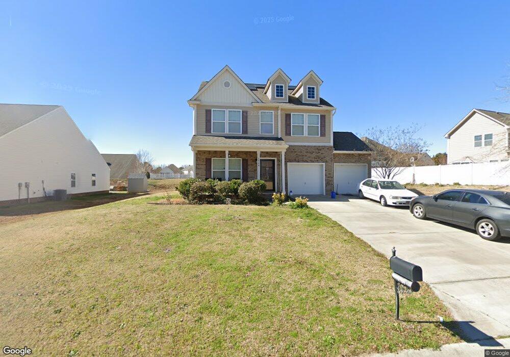
1764 Stuart Carter Ave Rock Hill, SC 29730
Estimated Value: $378,497 - $436,000
--
Bed
1
Bath
2,184
Sq Ft
$187/Sq Ft
Est. Value
About This Home
This home is located at 1764 Stuart Carter Ave, Rock Hill, SC 29730 and is currently estimated at $409,374, approximately $187 per square foot. 1764 Stuart Carter Ave is a home with nearby schools including Independence Elementary School, Castle Heights Middle School, and Rock Hill High School.
Ownership History
Date
Name
Owned For
Owner Type
Purchase Details
Closed on
Aug 28, 2014
Sold by
True Homes Llc
Bought by
Rogers Myron
Current Estimated Value
Home Financials for this Owner
Home Financials are based on the most recent Mortgage that was taken out on this home.
Original Mortgage
$175,393
Outstanding Balance
$134,522
Interest Rate
4.19%
Mortgage Type
FHA
Estimated Equity
$274,852
Purchase Details
Closed on
Apr 11, 2014
Sold by
Carolina Development Services Llc
Bought by
True Homes Llc
Create a Home Valuation Report for This Property
The Home Valuation Report is an in-depth analysis detailing your home's value as well as a comparison with similar homes in the area
Home Values in the Area
Average Home Value in this Area
Purchase History
| Date | Buyer | Sale Price | Title Company |
|---|---|---|---|
| Rogers Myron | $178,630 | -- | |
| True Homes Llc | $210,000 | -- |
Source: Public Records
Mortgage History
| Date | Status | Borrower | Loan Amount |
|---|---|---|---|
| Open | Rogers Myron | $175,393 |
Source: Public Records
Tax History Compared to Growth
Tax History
| Year | Tax Paid | Tax Assessment Tax Assessment Total Assessment is a certain percentage of the fair market value that is determined by local assessors to be the total taxable value of land and additions on the property. | Land | Improvement |
|---|---|---|---|---|
| 2024 | $1,117 | $7,958 | $959 | $6,999 |
| 2023 | $1,146 | $7,958 | $959 | $6,999 |
| 2022 | $1,150 | $7,958 | $959 | $6,999 |
| 2021 | -- | $7,958 | $959 | $6,999 |
| 2020 | $1,146 | $7,958 | $0 | $0 |
| 2019 | $1,045 | $6,920 | $0 | $0 |
| 2018 | $1,037 | $6,920 | $0 | $0 |
| 2017 | $977 | $6,920 | $0 | $0 |
| 2016 | $947 | $6,920 | $0 | $0 |
| 2014 | -- | $10,380 | $1,800 | $8,580 |
| 2013 | -- | $1,800 | $1,800 | $0 |
Source: Public Records
Map
Nearby Homes
- 1780 Stuart Carter Ave
- 1177 Ellis Pond Dr
- 1354 Springwood Ln
- 2021 Eddie Massey Ln
- 1255 Church Rd
- 953 Church Rd
- 1715 Hopewell Rd
- 1014 Holly Rd
- Drexel Plan at Waterford Commons
- Oxford Plan at Waterford Commons
- Avery Plan at Waterford Commons
- Newberry Plan at Waterford Commons
- Fenwick Plan at Waterford Commons
- Wescott Plan at Waterford Commons
- Mayfair Plan at Waterford Commons
- Davidson Plan at Waterford Commons
- Wilmington Plan at Waterford Commons
- Cypress Plan at Waterford Commons
- 529 Cheryl Lynn Dr
- 535 Cheryl Lynn Dr
- 1772 Stuart Carter Ave Unit 103
- 1772 Stuart Carter Ave
- 1748 Stuart Carter Ave
- 1468 Juanita Ave
- 1615 Natalie Ln
- 1765 Stuart Carter Ave
- 1757 Stuart Carter Ave Unit 53
- 1621 Natalie Ln Unit 113
- 1609 Natalie Ln
- 1609 Natalie Ln Unit 99
- 1609 Natalie Ln
- 1749 Stuart Carter Ave
- 1773 Stuart Carter Ave
- 1627 Natalie Ln
- 1741 Stuart Carter Ave
- 1784 Stuart Carter Ave
- 1781 Stuart Carter Ave Unit 50
- 1781 Stuart Carter Ave
- 1732 Stuart Carter Ave
- 1465 Juanita Ave
