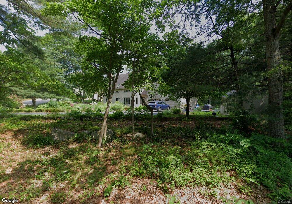
1764 West St Stoughton, MA 02072
Estimated Value: $744,000 - $940,000
5
Beds
3
Baths
2,115
Sq Ft
$405/Sq Ft
Est. Value
About This Home
This home is located at 1764 West St, Stoughton, MA 02072 and is currently estimated at $855,972, approximately $404 per square foot. 1764 West St is a home located in Norfolk County with nearby schools including Joseph H. Gibbons Elementary School, Dr. Robert G. O'Donnell Middle School, and Stoughton High School.
Ownership History
Date
Name
Owned For
Owner Type
Purchase Details
Closed on
Jul 10, 2012
Sold by
Clem Stephen and Thomson Linda
Bought by
Clem Stephen and Thomson Linda
Current Estimated Value
Home Financials for this Owner
Home Financials are based on the most recent Mortgage that was taken out on this home.
Original Mortgage
$400,000
Outstanding Balance
$276,563
Interest Rate
3.78%
Mortgage Type
New Conventional
Estimated Equity
$579,409
Purchase Details
Closed on
Jul 31, 2007
Sold by
West Street Nt and Hall
Bought by
Clem Stephen and Thomson Linda
Purchase Details
Closed on
Mar 30, 2006
Sold by
Bonner Katharine H and Bonner Gregory B
Bought by
West Street Nt and Hall
Purchase Details
Closed on
May 20, 1998
Sold by
Haskell Kenneth W and Haskell Sally E
Bought by
Bonner Katharine H and Bonner Gregory B
Create a Home Valuation Report for This Property
The Home Valuation Report is an in-depth analysis detailing your home's value as well as a comparison with similar homes in the area
Home Values in the Area
Average Home Value in this Area
Purchase History
| Date | Buyer | Sale Price | Title Company |
|---|---|---|---|
| Clem Stephen | -- | -- | |
| Clem Stephen | -- | -- | |
| Clem Stephen | -- | -- | |
| Clem Stephen | $530,000 | -- | |
| Clem Stephen | $530,000 | -- | |
| West Street Nt | $544,500 | -- | |
| West Street Nt | $544,500 | -- | |
| Bonner Katharine H | $265,750 | -- | |
| Bonner Katharine H | $265,750 | -- |
Source: Public Records
Mortgage History
| Date | Status | Borrower | Loan Amount |
|---|---|---|---|
| Open | Clem Stephen | $400,000 | |
| Closed | Bonner Katharine H | $400,000 |
Source: Public Records
Tax History Compared to Growth
Tax History
| Year | Tax Paid | Tax Assessment Tax Assessment Total Assessment is a certain percentage of the fair market value that is determined by local assessors to be the total taxable value of land and additions on the property. | Land | Improvement |
|---|---|---|---|---|
| 2025 | $9,364 | $756,400 | $270,000 | $486,400 |
| 2024 | $9,107 | $715,400 | $246,700 | $468,700 |
| 2023 | $8,958 | $661,100 | $225,400 | $435,700 |
| 2022 | $8,722 | $605,300 | $216,900 | $388,400 |
| 2021 | $8,500 | $562,900 | $192,600 | $370,300 |
| 2020 | $8,261 | $554,800 | $192,600 | $362,200 |
| 2019 | $8,050 | $524,800 | $192,600 | $332,200 |
| 2018 | $7,270 | $490,900 | $188,300 | $302,600 |
| 2017 | $7,003 | $483,300 | $186,100 | $297,200 |
| 2016 | $6,847 | $457,400 | $175,400 | $282,000 |
| 2015 | $6,759 | $446,700 | $164,700 | $282,000 |
| 2014 | $6,630 | $421,200 | $149,800 | $271,400 |
Source: Public Records
Map
Nearby Homes
- 93 Palisades Cir
- 1600 West St
- 175 N Main St
- 4 Eagle Rock Rd
- 12 Holmes St
- 15 King Ave
- 8 Hobart Way
- 2 Palace Ct
- 11 Olde Stable Ln
- 14 Marshall Rd
- 79 Lucas Dr
- Lot 4 West St
- 1 Whittier Ln Unit 1
- 18 Prudence Crandall Ln Unit 18
- 93 McEachron Dr
- 86 Union St
- 110 Union St
- Lot 8 Cooper Ln
- Lot 1 Winterberry Ln
- Lot 2 Winterberry Ln
- 1749 West St
- 310 Palisades Cir
- 1725 West St
- 294 Palisades Cir
- 319 Palisades Cir
- 38 Conservation Way
- 1709 West St
- 37 Conservation Way
- 36 Conservation Way
- 35 Conservation Way
- 284 Palisades Cir
- 52 Lake Dr
- 55 Lake Dr
- 40 Conservation Way
- 39 Conservation Way
- 34 Conservation Way
- 33 Conservation Way
- 301 Palisades Cir
- 1698 West St
- 3 Conservation Way