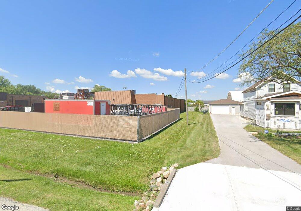
17640 Paxton Ave Lansing, IL 60438
Estimated Value: $362,232
--
Bed
--
Bath
--
Sq Ft
0.85
Acres
About This Home
This home is located at 17640 Paxton Ave, Lansing, IL 60438 and is currently estimated at $362,232. 17640 Paxton Ave is a home located in Cook County with nearby schools including Oak Glen Elementary School, Memorial Jr High School, and Thornton Fractnl So High School.
Ownership History
Date
Name
Owned For
Owner Type
Purchase Details
Closed on
May 20, 2019
Sold by
Metropolitan Steel Inc
Bought by
Tmar Llc
Current Estimated Value
Purchase Details
Closed on
Dec 18, 2014
Sold by
Chicago Title Land Trust Company
Bought by
Metropolitan Steel Inc
Purchase Details
Closed on
May 30, 1997
Sold by
Preuss William R
Bought by
First National Bank Of Evergreen Park and Trust #15472
Create a Home Valuation Report for This Property
The Home Valuation Report is an in-depth analysis detailing your home's value as well as a comparison with similar homes in the area
Home Values in the Area
Average Home Value in this Area
Purchase History
| Date | Buyer | Sale Price | Title Company |
|---|---|---|---|
| Tmar Llc | $170,000 | None Available | |
| Metropolitan Steel Inc | $205,000 | Chicago Title Land Trust Co | |
| First National Bank Of Evergreen Park | -- | -- | |
| First National Bank Of Evergreen Park | $180,000 | -- |
Source: Public Records
Tax History Compared to Growth
Tax History
| Year | Tax Paid | Tax Assessment Tax Assessment Total Assessment is a certain percentage of the fair market value that is determined by local assessors to be the total taxable value of land and additions on the property. | Land | Improvement |
|---|---|---|---|---|
| 2024 | $28,988 | $59,911 | $28,125 | $31,786 |
| 2023 | $33,574 | $70,229 | $28,125 | $42,104 |
| 2022 | $33,574 | $51,662 | $32,813 | $18,849 |
| 2021 | $32,657 | $51,660 | $32,812 | $18,848 |
| 2020 | $30,308 | $51,660 | $32,812 | $18,848 |
| 2019 | $29,178 | $51,250 | $30,468 | $20,782 |
| 2018 | $28,637 | $51,250 | $30,468 | $20,782 |
| 2017 | $28,916 | $51,250 | $30,468 | $20,782 |
| 2016 | $28,023 | $51,250 | $28,125 | $23,125 |
| 2015 | $26,037 | $51,249 | $28,125 | $23,124 |
| 2014 | $35,981 | $71,812 | $28,125 | $43,687 |
| 2013 | $25,451 | $56,523 | $28,125 | $28,398 |
Source: Public Records
Map
Nearby Homes
- 1991 Indiana Ave
- 2216 177th St
- 2237 175th St Unit 1B
- 2237 175th St Unit 2B
- 2306 Holiday Terrace Unit 163
- 2306 Holiday Terrace Unit 149
- 2306 Holiday Terrace Unit 146
- 2155 Bernice Rd
- 17871 Locust St
- 17934 Locust St
- 2304 Holiday Terrace Unit 503
- 2304 Holiday Terrace Unit 303
- 2307 177th St
- 18038 Whitman Ln
- 1555 Thornton Lansing Rd
- 18020 Ridgeland Ave
- 17750 Clyde Ave
- 2201 Thornton Lansing Rd
- 18036 Crystal Ln
- 18049 Brittany Ln
- 17606 Paxton Ave
- 1954 177th St
- 17600 Paxton Ave
- 17704 Paxton Ave
- 1938 177th St
- 17613 Paxton Ave
- 17601 Paxton Ave
- 17607 Paxton Ave
- 17611 Paxton Ave
- 17710 Paxton Ave
- 17627 Paxton Ave
- 17712 Paxton Ave
- 17595 Paxton Ave
- 17711 Paxton Ave
- 17614 Rosewood Dr
- 17713 Paxton Ave
- 2050 176th Place
- 2052 176th Place
- 2054 176th Place
- 17630 Rosewood Dr Unit 1B