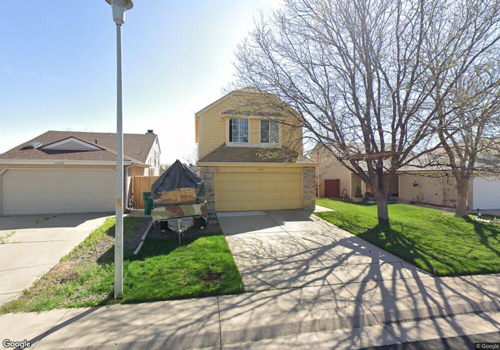
17641 E Brown Cir Aurora, CO 80013
Aurora Knolls-Hutchinson Heights NeighborhoodEstimated Value: $437,000 - $473,000
2
Beds
3
Baths
1,308
Sq Ft
$348/Sq Ft
Est. Value
About This Home
This home is located at 17641 E Brown Cir, Aurora, CO 80013 and is currently estimated at $454,630, approximately $347 per square foot. 17641 E Brown Cir is a home located in Arapahoe County with nearby schools including Dalton Elementary School, Columbia Middle School, and Rangeview High School.
Ownership History
Date
Name
Owned For
Owner Type
Purchase Details
Closed on
Feb 15, 2024
Sold by
Therburg Rosemarie Lemmen and Therburg Manfred
Bought by
Lemmen Scott Michael
Current Estimated Value
Purchase Details
Closed on
Jun 8, 1999
Sold by
Lemmen Scott M
Bought by
Lemmen Lemmen Scott M Scott M and Lemmen Therburg Rosemarie
Purchase Details
Closed on
Apr 7, 1999
Sold by
Kortesis Philip E
Bought by
Lemmen Scott M
Home Financials for this Owner
Home Financials are based on the most recent Mortgage that was taken out on this home.
Original Mortgage
$110,000
Interest Rate
6.92%
Purchase Details
Closed on
Jun 26, 1987
Sold by
Conversion Arapco
Bought by
Kortesis Philip E
Purchase Details
Closed on
Dec 9, 1983
Bought by
Conversion Arapco
Create a Home Valuation Report for This Property
The Home Valuation Report is an in-depth analysis detailing your home's value as well as a comparison with similar homes in the area
Home Values in the Area
Average Home Value in this Area
Purchase History
| Date | Buyer | Sale Price | Title Company |
|---|---|---|---|
| Lemmen Scott Michael | -- | None Listed On Document | |
| Lemmen Lemmen Scott M Scott M | -- | -- | |
| Lemmen Scott M | $144,000 | -- | |
| Kortesis Philip E | -- | -- | |
| Conversion Arapco | -- | -- |
Source: Public Records
Mortgage History
| Date | Status | Borrower | Loan Amount |
|---|---|---|---|
| Previous Owner | Lemmen Scott M | $110,000 |
Source: Public Records
Tax History
| Year | Tax Paid | Tax Assessment Tax Assessment Total Assessment is a certain percentage of the fair market value that is determined by local assessors to be the total taxable value of land and additions on the property. | Land | Improvement |
|---|---|---|---|---|
| 2025 | $2,241 | $28,019 | -- | -- |
| 2024 | $2,797 | $30,090 | -- | -- |
| 2023 | $2,797 | $30,090 | $0 | $0 |
| 2022 | $2,267 | $22,574 | $0 | $0 |
| 2021 | $2,340 | $22,574 | $0 | $0 |
| 2020 | $2,260 | $21,707 | $0 | $0 |
| 2019 | $2,248 | $21,707 | $0 | $0 |
| 2018 | $1,945 | $18,396 | $0 | $0 |
| 2017 | $1,692 | $18,396 | $0 | $0 |
| 2016 | $1,546 | $16,454 | $0 | $0 |
| 2015 | $1,492 | $16,454 | $0 | $0 |
| 2014 | $1,009 | $10,714 | $0 | $0 |
| 2013 | -- | $12,940 | $0 | $0 |
Source: Public Records
Map
Nearby Homes
- 17940 E Brown Place
- 2884 S Salida Ct
- 17655 E Bethany Cir
- 17753 E Bethany Place
- 2761 S Salida Way
- 17867 E Cornell Dr
- 2824 S Walden Way
- 3082 S Truckee St
- 3159 S Sedalia Way
- 2551 S Richfield St
- 2970 S Yampa Way
- 2687 S Pagosa St
- 17538 E Baker Place
- 2974 S Zeno Ct
- 3076 S Yampa Way
- 18456 E Bethany Place
- 2835 S Tower Way
- 2585 S Truckee Way
- 2515 S Pagosa St
- 2509 S Truckee Way
- 17633 E Brown Cir
- 17643 E Brown Cir
- 17631 E Brown Cir
- 17645 E Brown Cir
- 2821 S Truckee St
- 2813 S Truckee St
- 2831 S Truckee St
- 17625 E Brown Cir
- 17647 E Brown Cir
- 2811 S Truckee St
- 2841 S Truckee St
- 17642 E Brown Cir
- 17632 E Brown Cir
- 17623 E Brown Cir
- 2803 S Truckee St
- 17649 E Brown Cir
- 17644 E Brown Cir
- 2851 S Truckee St
- 17626 E Brown Cir
- 17646 E Brown Cir
Your Personal Tour Guide
Ask me questions while you tour the home.