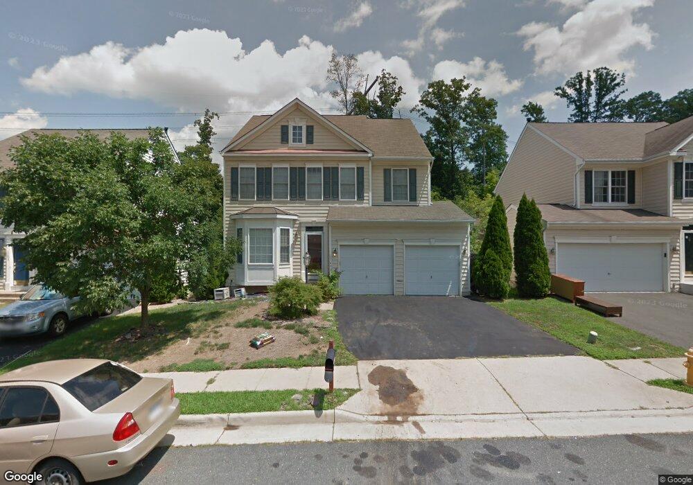
17641 Hampstead Ridge Ct Dumfries, VA 22026
Estimated Value: $646,000 - $680,400
4
Beds
4
Baths
2,439
Sq Ft
$272/Sq Ft
Est. Value
About This Home
This home is located at 17641 Hampstead Ridge Ct, Dumfries, VA 22026 and is currently estimated at $663,600, approximately $272 per square foot. 17641 Hampstead Ridge Ct is a home located in Prince William County with nearby schools including Swans Creek Elementary School, Potomac Middle School, and Potomac High School.
Ownership History
Date
Name
Owned For
Owner Type
Purchase Details
Closed on
Feb 11, 2005
Sold by
Farrow Novell K
Bought by
Clark Michael Patrick and Stanley,Derrick Wayne
Current Estimated Value
Home Financials for this Owner
Home Financials are based on the most recent Mortgage that was taken out on this home.
Original Mortgage
$400,000
Outstanding Balance
$204,383
Interest Rate
5.83%
Mortgage Type
New Conventional
Estimated Equity
$459,217
Purchase Details
Closed on
Mar 13, 2002
Sold by
Beazer Homes Corp
Bought by
Clark Michael
Home Financials for this Owner
Home Financials are based on the most recent Mortgage that was taken out on this home.
Original Mortgage
$252,900
Interest Rate
6.91%
Mortgage Type
New Conventional
Purchase Details
Closed on
Sep 24, 2001
Sold by
Ve Vmif and Ve Anden Southbridge
Bought by
Beazer Homes Corp
Create a Home Valuation Report for This Property
The Home Valuation Report is an in-depth analysis detailing your home's value as well as a comparison with similar homes in the area
Home Values in the Area
Average Home Value in this Area
Purchase History
| Date | Buyer | Sale Price | Title Company |
|---|---|---|---|
| Clark Michael Patrick | $500,000 | -- | |
| Clark Michael | $316,140 | -- | |
| Beazer Homes Corp | $190,000 | -- |
Source: Public Records
Mortgage History
| Date | Status | Borrower | Loan Amount |
|---|---|---|---|
| Open | Clark Michael Patrick | $400,000 | |
| Previous Owner | Clark Michael | $252,900 |
Source: Public Records
Tax History Compared to Growth
Tax History
| Year | Tax Paid | Tax Assessment Tax Assessment Total Assessment is a certain percentage of the fair market value that is determined by local assessors to be the total taxable value of land and additions on the property. | Land | Improvement |
|---|---|---|---|---|
| 2025 | -- | $606,100 | $209,300 | $396,800 |
| 2024 | -- | $577,800 | $199,300 | $378,500 |
| 2023 | $5,647 | $542,700 | $186,300 | $356,400 |
| 2022 | $5,921 | $524,300 | $179,100 | $345,200 |
| 2021 | $5,572 | $456,200 | $155,700 | $300,500 |
| 2020 | $6,676 | $430,700 | $146,800 | $283,900 |
| 2019 | $6,555 | $422,900 | $143,900 | $279,000 |
| 2018 | $5,088 | $421,400 | $143,900 | $277,500 |
| 2017 | $4,888 | $396,000 | $134,500 | $261,500 |
| 2016 | $4,637 | $378,900 | $128,100 | $250,800 |
| 2015 | $4,240 | $377,300 | $126,900 | $250,400 |
| 2014 | $4,240 | $338,300 | $113,300 | $225,000 |
Source: Public Records
Map
Nearby Homes
- 17575 Deweys Run Ln
- 17616 Chisholm Ln
- 3066 Antrim Cir
- 17460 Wilson St
- 2989 Birch Creek Ct
- 2880 Myrtlewood Dr
- 3681 Dahlgren Place
- 17421 Tripoli Blvd
- 3108 Butterfly Way
- 2857 Myrtlewood Dr
- 17665 Avenel Ln
- 3084 Pony Ridge Turn
- 3615 Wharf Ln
- 16894 Porters Inn Dr
- 16884 Porters Inn Dr
- 1832 Fort Pulaski Ct
- 17003 Hoskins Way Unit 80
- 3681 Masthead Trail
- 17012 Cass Brook Ln
- 17640 Washington St
- 17645 Hampstead Ridge Ct
- 17637 Hampstead Ridge Ct
- 17649 Hampstead Ridge Ct
- 17633 Hampstead Ridge Ct
- 17653 Hampstead Ridge Ct
- 17629 Hampstead Ridge Ct
- 17638 Hampstead Ridge Ct
- 17625 Hampstead Ridge Ct
- 17642 Hampstead Ridge Ct
- 17657 Hampstead Ridge Ct
- 17634 Hampstead Ridge Ct
- 17630 Hampstead Ridge Ct
- 17650 Hampstead Ridge Ct
- 17621 Hampstead Ridge Ct
- 17661 Hampstead Ridge Ct
- 17660 Hampstead Ridge Ct
- 17617 Hampstead Ridge Ct
- 17600 Hampstead Ridge Ct
- 17665 Hampstead Ridge Ct
- 17664 Hampstead Ridge Ct