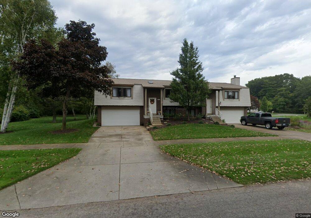
17642 Dustin Dr Unit 15 Spring Lake, MI 49456
Estimated Value: $329,777 - $379,000
1
Bed
1
Bath
1,228
Sq Ft
$288/Sq Ft
Est. Value
About This Home
This home is located at 17642 Dustin Dr Unit 15, Spring Lake, MI 49456 and is currently estimated at $353,944, approximately $288 per square foot. 17642 Dustin Dr Unit 15 is a home located in Ottawa County with nearby schools including Lake Hills Elementary School, Central High School, and White Pines Intermediate School.
Ownership History
Date
Name
Owned For
Owner Type
Purchase Details
Closed on
Apr 18, 2008
Sold by
Wright Pamela A and Holtz Pamela A
Bought by
Holtz Pamela A
Current Estimated Value
Home Financials for this Owner
Home Financials are based on the most recent Mortgage that was taken out on this home.
Original Mortgage
$136,000
Outstanding Balance
$87,045
Interest Rate
6.17%
Mortgage Type
New Conventional
Estimated Equity
$266,899
Purchase Details
Closed on
Jun 7, 2006
Sold by
Treeline Properties Llc
Bought by
Wright Pamela A
Home Financials for this Owner
Home Financials are based on the most recent Mortgage that was taken out on this home.
Original Mortgage
$136,000
Interest Rate
6.66%
Mortgage Type
Fannie Mae Freddie Mac
Purchase Details
Closed on
Feb 27, 2004
Sold by
Lam Danny and Lam Sue
Bought by
Treeline Properties Llc
Create a Home Valuation Report for This Property
The Home Valuation Report is an in-depth analysis detailing your home's value as well as a comparison with similar homes in the area
Home Values in the Area
Average Home Value in this Area
Purchase History
| Date | Buyer | Sale Price | Title Company |
|---|---|---|---|
| Holtz Pamela A | -- | Safe Title Inc | |
| Wright Pamela A | $170,000 | Lighthouse Title Inc | |
| Treeline Properties Llc | $150,000 | Lighthouse Title Inc |
Source: Public Records
Mortgage History
| Date | Status | Borrower | Loan Amount |
|---|---|---|---|
| Open | Holtz Pamela A | $136,000 | |
| Closed | Wright Pamela A | $136,000 |
Source: Public Records
Tax History Compared to Growth
Tax History
| Year | Tax Paid | Tax Assessment Tax Assessment Total Assessment is a certain percentage of the fair market value that is determined by local assessors to be the total taxable value of land and additions on the property. | Land | Improvement |
|---|---|---|---|---|
| 2025 | $2,402 | $154,900 | $0 | $0 |
| 2024 | $2,268 | $152,700 | $0 | $0 |
| 2023 | $2,385 | $124,200 | $0 | $0 |
| 2022 | $2,539 | $102,600 | $0 | $0 |
| 2021 | $2,359 | $98,700 | $0 | $0 |
| 2020 | $2,343 | $99,800 | $0 | $0 |
| 2019 | $2,317 | $90,200 | $0 | $0 |
| 2018 | $4,129 | $83,300 | $7,500 | $75,800 |
| 2017 | -- | $82,300 | $0 | $0 |
| 2016 | -- | $74,100 | $0 | $0 |
| 2015 | -- | $70,300 | $0 | $0 |
| 2014 | -- | $66,400 | $0 | $0 |
Source: Public Records
Map
Nearby Homes
- 17267 Roosevelt Rd
- 17343 Michigan Ave Unit 17345
- 17083 Spahr St
- 17561 Beechwood Ln Unit 6
- 17308 Lane Ave Unit B
- 16933 Royal Ln
- 17340 Hazel St
- 16905 Highland Ave
- 512 5th St
- 0 Country Ln
- 17836 Cove St
- 517 Pine St
- 17797 168th Ave
- 17545 Reenders St
- 16928 Landing Dr
- Wilshire Plan at Deer Creek Meadows
- Remington Plan at Deer Creek Meadows
- Linden Plan at Deer Creek Meadows
- Enclave Plan at Deer Creek Meadows
- Croswell Plan at Deer Creek Meadows
- 17643 Connie Dr Unit 20
- 17641 Connie Dr Unit 19
- 17644 Dustin Dr Unit 16
- 17645 Connie Dr Unit 21
- 17635 Connie Dr
- 17634 Dustin Dr
- 17648 Dustin Dr Unit 18
- 17647 Connie Dr Unit 22
- 17637 Connie Dr
- 17638 Dustin Dr
- 17632 Dustin Dr
- 17633 Connie Dr
- 17631 Connie Dr Unit 5
- 17636 Dustin Dr
- 17720 Connie Dr
- 17730 Connie Dr
- 17732 Connie Dr Unit 30
- 17710 Connie Dr
- 17702 Connie Dr
- 17740 Connie Dr Unit 31