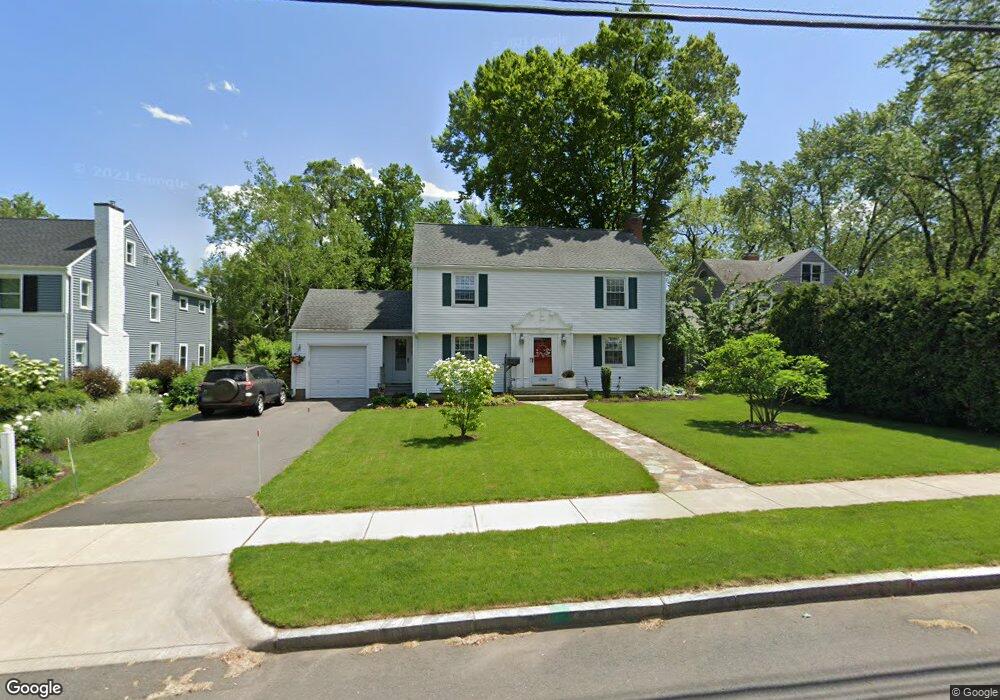
1765 Boulevard West Hartford, CT 06107
Estimated Value: $505,000 - $664,000
3
Beds
3
Baths
1,907
Sq Ft
$314/Sq Ft
Est. Value
About This Home
This home is located at 1765 Boulevard, West Hartford, CT 06107 and is currently estimated at $598,837, approximately $314 per square foot. 1765 Boulevard is a home located in Hartford County with nearby schools including Duffy School, Sedgwick Middle School, and Conard High School.
Ownership History
Date
Name
Owned For
Owner Type
Purchase Details
Closed on
Apr 24, 1990
Sold by
Byrne Thomas
Bought by
Carroll William
Current Estimated Value
Home Financials for this Owner
Home Financials are based on the most recent Mortgage that was taken out on this home.
Original Mortgage
$117,500
Interest Rate
10.21%
Create a Home Valuation Report for This Property
The Home Valuation Report is an in-depth analysis detailing your home's value as well as a comparison with similar homes in the area
Home Values in the Area
Average Home Value in this Area
Purchase History
| Date | Buyer | Sale Price | Title Company |
|---|---|---|---|
| Carroll William | $207,500 | -- |
Source: Public Records
Mortgage History
| Date | Status | Borrower | Loan Amount |
|---|---|---|---|
| Closed | Carroll William | $15,000 | |
| Closed | Carroll William | $114,000 | |
| Closed | Carroll William | $120,000 | |
| Closed | Carroll William | $117,500 |
Source: Public Records
Tax History Compared to Growth
Tax History
| Year | Tax Paid | Tax Assessment Tax Assessment Total Assessment is a certain percentage of the fair market value that is determined by local assessors to be the total taxable value of land and additions on the property. | Land | Improvement |
|---|---|---|---|---|
| 2025 | $12,323 | $275,190 | $125,600 | $149,590 |
| 2024 | $11,654 | $275,190 | $125,600 | $149,590 |
| 2023 | $11,261 | $275,190 | $125,600 | $149,590 |
| 2022 | $11,195 | $275,190 | $125,600 | $149,590 |
| 2021 | $10,102 | $238,140 | $120,400 | $117,740 |
| 2020 | $9,954 | $238,140 | $112,800 | $125,340 |
| 2019 | $9,954 | $238,140 | $112,770 | $125,370 |
| 2018 | $9,764 | $238,140 | $112,770 | $125,370 |
| 2017 | $9,773 | $238,140 | $112,770 | $125,370 |
| 2016 | $9,210 | $233,100 | $104,440 | $128,660 |
| 2015 | $8,930 | $233,100 | $104,440 | $128,660 |
| 2014 | $8,711 | $233,100 | $104,440 | $128,660 |
Source: Public Records
Map
Nearby Homes
- 51 Lemay St
- 1640 Boulevard
- 632 Park Rd
- 2 Arapahoe Rd Unit 308
- 2 Arapahoe Rd Unit 415
- 2 Arapahoe Rd Unit 611
- 2 Arapahoe Rd Unit 613
- 2 Arapahoe Rd Unit 311
- 2 Arapahoe Rd Unit 312
- 2 Arapahoe Rd Unit 510
- 2 Arapahoe Rd Unit 610
- 2 Arapahoe Rd Unit 609
- 2 Arapahoe Rd Unit 606
- 2 Arapahoe Rd Unit 505
- 2 Arapahoe Rd Unit 605
- 2 Arapahoe Rd Unit 313
- 2 Arapahoe Rd Unit 604
- 2 Arapahoe Rd Unit 607
- 2 Arapahoe Rd Unit 603
- 2 Arapahoe Rd Unit 602
- 62 Newport Ave
- 1759 Boulevard
- 66 Newport Ave
- 127 Four Mile Rd
- 135 Four Mile Rd
- 70 Newport Ave
- 61 Newport Ave
- 141 Four Mile Rd
- 1768 Boulevard
- 1760 Boulevard
- 65 Newport Ave
- 52 Newport Ave
- 1758 Boulevard
- 1785 Boulevard
- 72 Newport Ave
- 147 Four Mile Rd
- 130 Four Mile Rd
- 109 Four Mile Rd
- 69 Newport Ave
- 1789 Boulevard