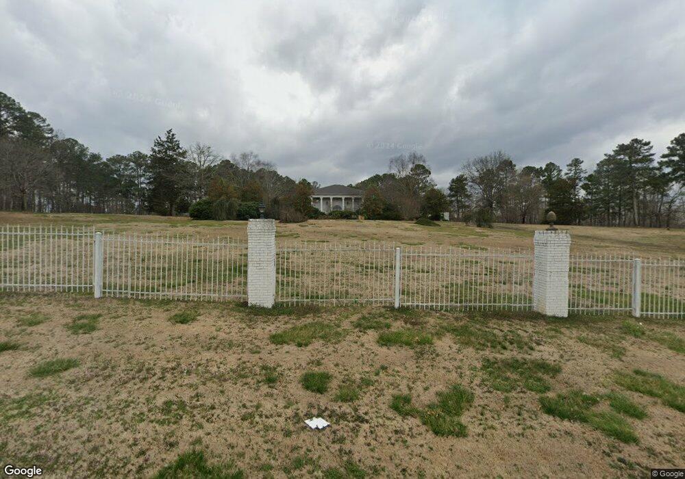
1765 Center Point Rd Temple, GA 30179
Abilene NeighborhoodEstimated Value: $1,101,000 - $1,653,921
5
Beds
6
Baths
9,317
Sq Ft
$148/Sq Ft
Est. Value
About This Home
This home is located at 1765 Center Point Rd, Temple, GA 30179 and is currently estimated at $1,377,461, approximately $147 per square foot. 1765 Center Point Rd is a home located in Carroll County with nearby schools including Sharp Creek Elementary School, Temple Middle School, and Temple High School.
Ownership History
Date
Name
Owned For
Owner Type
Purchase Details
Closed on
Jul 18, 2017
Sold by
Thomas P Worthan
Bought by
Farmer Kenneth
Current Estimated Value
Home Financials for this Owner
Home Financials are based on the most recent Mortgage that was taken out on this home.
Original Mortgage
$500,000
Outstanding Balance
$417,005
Interest Rate
4.03%
Estimated Equity
$960,456
Purchase Details
Closed on
Aug 23, 2001
Sold by
Wilson Robert
Bought by
Farmer Kenneth
Purchase Details
Closed on
May 2, 1988
Sold by
Farmer Kenneth
Bought by
Farmer Kenneth
Purchase Details
Closed on
Jun 1, 1987
Bought by
Wilson
Purchase Details
Closed on
May 1, 1987
Bought by
Wilson
Purchase Details
Closed on
Jul 1, 1983
Bought by
Wilson
Create a Home Valuation Report for This Property
The Home Valuation Report is an in-depth analysis detailing your home's value as well as a comparison with similar homes in the area
Home Values in the Area
Average Home Value in this Area
Purchase History
| Date | Buyer | Sale Price | Title Company |
|---|---|---|---|
| Farmer Kenneth | -- | -- | |
| Farmer Kenneth | $1,300,000 | -- | |
| Farmer Kenneth | -- | -- | |
| Wilson | -- | -- | |
| Wilson | -- | -- | |
| Wilson | -- | -- |
Source: Public Records
Mortgage History
| Date | Status | Borrower | Loan Amount |
|---|---|---|---|
| Open | Farmer Kenneth | $500,000 | |
| Closed | Farmer Kenneth | -- |
Source: Public Records
Tax History Compared to Growth
Tax History
| Year | Tax Paid | Tax Assessment Tax Assessment Total Assessment is a certain percentage of the fair market value that is determined by local assessors to be the total taxable value of land and additions on the property. | Land | Improvement |
|---|---|---|---|---|
| 2024 | $2,637 | $1,056,359 | $56,347 | $1,000,012 |
| 2023 | $2,637 | $954,863 | $45,078 | $909,785 |
| 2022 | $16,406 | $760,266 | $30,052 | $730,214 |
| 2021 | $14,832 | $650,511 | $24,042 | $626,469 |
| 2020 | $13,449 | $572,927 | $21,856 | $551,071 |
| 2019 | $12,726 | $527,914 | $21,856 | $506,058 |
| 2018 | $11,538 | $453,010 | $20,426 | $432,584 |
| 2017 | $11,572 | $453,010 | $20,426 | $432,584 |
| 2016 | $11,576 | $453,010 | $20,426 | $432,584 |
| 2015 | $11,668 | $421,255 | $21,590 | $399,666 |
| 2014 | $11,718 | $421,256 | $21,590 | $399,666 |
Source: Public Records
Map
Nearby Homes
- 1249 Center Point Rd
- Jordan Plan at Azalea Hills
- 124 Meadowview Dr
- 116 Meadowview Dr
- 116 Meadowview Dr Unit 8
- 122 Meadowview Dr
- 118 Meadowview Dr
- 120 Meadowview Dr
- 120 Meadowview Dr Unit 10
- 114 Meadowview Dr Unit 7
- 118 Meadowview Dr Unit 9
- 124 Meadowview Dr Unit 12
- 114 Meadowview Dr
- 122 Meadowview Dr Unit 11
- 505 Azalea Way
- 509 Azalea Way Unit 53
- 235 Ivey Terrace
- 505 Azalea Way Unit 51
- 507 Azalea Way Unit 52
- 550 Harmon Rd
- 1765 Center Point Rd
- 1829 Center Point Rd
- 1502 Center Point Rd
- 1481 Center Point Rd
- 1481 Center Point Rd
- 1554 Center Point Rd
- 1929 Centr Point Rd
- 1929 Center Point Rd
- 1560 Center Point Rd
- 1461 Center Point Rd
- 1980 Center Point Rd
- 1447 Center Point Rd
- 1568 Center Point Rd
- 1995 Center Point Rd
- 1478 Center Point Rd
- 1405 Center Point Rd
- 307 Oak Grove Rd
- 277 Oak Grove Rd
- 2009 Center Point Rd
- 425 Oak Grove Rd