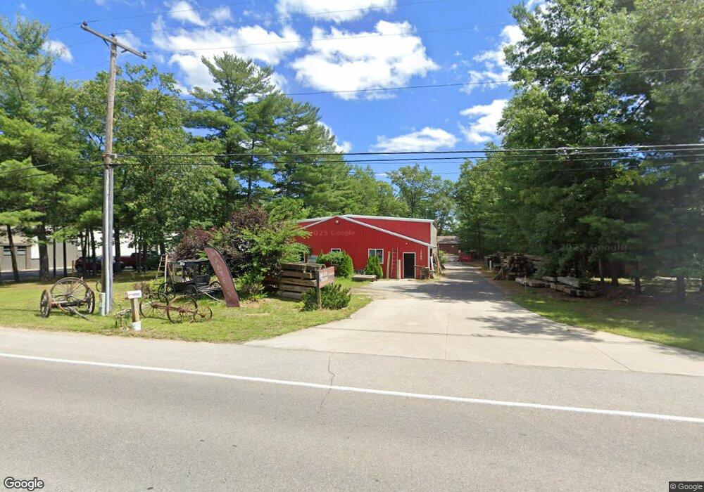
1765 Park Dr Traverse City, MI 49686
Estimated Value: $601,849
--
Bed
--
Bath
4,616
Sq Ft
$130/Sq Ft
Est. Value
About This Home
This home is located at 1765 Park Dr, Traverse City, MI 49686 and is currently estimated at $601,849, approximately $130 per square foot. 1765 Park Dr is a home located in Grand Traverse County with nearby schools including Traverse Heights Elementary School, East Middle School, and Central High School.
Ownership History
Date
Name
Owned For
Owner Type
Purchase Details
Closed on
Aug 26, 2019
Sold by
Hammond Gregory S
Bought by
Bn Park Dr Llc
Current Estimated Value
Purchase Details
Closed on
Sep 23, 2015
Purchase Details
Closed on
Jul 17, 2015
Purchase Details
Closed on
Mar 28, 2011
Purchase Details
Closed on
Jan 15, 2008
Purchase Details
Closed on
Oct 31, 2007
Purchase Details
Closed on
Apr 18, 2007
Purchase Details
Closed on
Dec 10, 1993
Purchase Details
Closed on
Dec 9, 1993
Create a Home Valuation Report for This Property
The Home Valuation Report is an in-depth analysis detailing your home's value as well as a comparison with similar homes in the area
Home Values in the Area
Average Home Value in this Area
Purchase History
| Date | Buyer | Sale Price | Title Company |
|---|---|---|---|
| Bn Park Dr Llc | $315,000 | -- | |
| -- | -- | -- | |
| -- | -- | -- | |
| -- | $142,500 | -- | |
| -- | -- | -- | |
| -- | -- | -- | |
| -- | $216,100 | -- | |
| -- | $145,000 | -- | |
| -- | -- | -- |
Source: Public Records
Tax History Compared to Growth
Tax History
| Year | Tax Paid | Tax Assessment Tax Assessment Total Assessment is a certain percentage of the fair market value that is determined by local assessors to be the total taxable value of land and additions on the property. | Land | Improvement |
|---|---|---|---|---|
| 2025 | $6,616 | $248,700 | $0 | $0 |
| 2024 | $5,331 | $210,900 | $0 | $0 |
| 2023 | $5,089 | $131,700 | $0 | $0 |
| 2022 | $6,125 | $147,300 | $0 | $0 |
| 2021 | $5,925 | $131,700 | $0 | $0 |
| 2020 | $7,184 | $159,200 | $0 | $0 |
| 2019 | $4,512 | $121,200 | $0 | $0 |
| 2018 | $0 | $123,800 | $0 | $0 |
| 2017 | -- | $103,100 | $0 | $0 |
| 2016 | -- | $110,600 | $0 | $0 |
| 2014 | -- | $97,900 | $0 | $0 |
| 2012 | -- | $89,000 | $0 | $0 |
Source: Public Records
Map
Nearby Homes
- 1741 Linden Ave Unit 15
- 859 Carson St
- 1285 Terrace Bluff Dr
- 2751 Ray Blvd
- 883 Crestwood Ln
- 1160 Terrace Bluff Dr
- 1548 Simsbury St Unit 9
- 1548 Simsbury St Unit 8
- 1548 Simsbury St Unit 10
- 1502 Simsbury St Unit 4
- 1502 Simsbury St Unit 10
- 1554 Simsbury St Unit 2
- 1663 David Place
- 1619 David Place
- 1587 David Place
- 1629 Edgewater Ridge Unit 12
- 1637 Edgewater Ridge Unit 13
- 1077 Oak Terrace Dr
- 1215 Santo St
- 2454 Friendship Dr
- 1767 Park Dr Unit B
- 1767 Park Dr
- 1771 Park Dr
- 1757 Park Dr
- 1760 & 1764 Forest Ridge Dr
- 1764 Forest Ridge Dr
- 1764 Forest Ridge Dr
- 1764 Forest Ridge Dr
- 1764 Forest Ridge Dr
- 1797 Park Dr
- 1760 Forest Ridge Dr
- 1760 Forest Ridge Dr
- 1760 Forest Ridge Dr
- 1760 Forest Ridge Dr Unit suite A
- 1760 Forest Ridge Dr Unit suite B
- 1760 Forest Ridge Dr Unit suite A &B
- 1760 Forest Ridge Dr
- 1760 Forest Ridge Dr Unit A
- 1616 W S Airport Rd
- 1746 Barlow St Unit 3