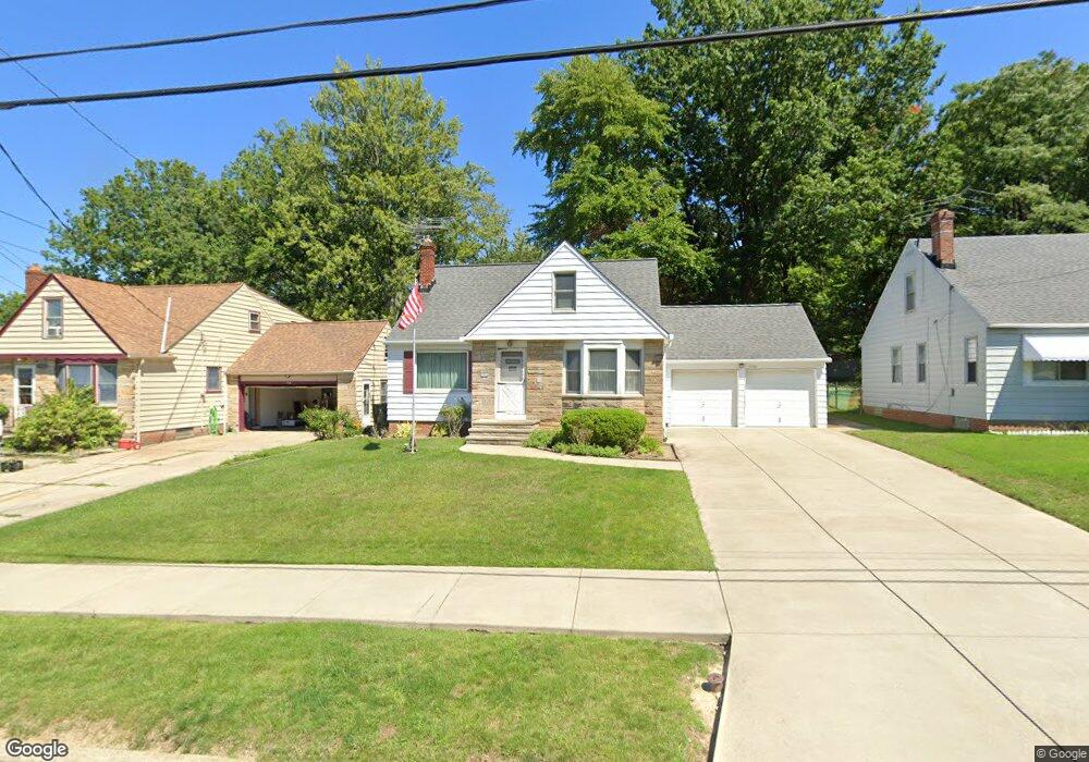
1765 Pontiac Dr Euclid, OH 44117
Estimated Value: $159,000 - $183,706
4
Beds
1
Bath
1,428
Sq Ft
$120/Sq Ft
Est. Value
About This Home
This home is located at 1765 Pontiac Dr, Euclid, OH 44117 and is currently estimated at $171,177, approximately $119 per square foot. 1765 Pontiac Dr is a home located in Cuyahoga County with nearby schools including Bluestone Elementary School, Euclid Middle School, and Euclid High School.
Ownership History
Date
Name
Owned For
Owner Type
Purchase Details
Closed on
Dec 10, 2015
Sold by
Williams Gregory A
Bought by
Williams Gregory A
Current Estimated Value
Purchase Details
Closed on
Jan 5, 2014
Sold by
Williams Gregory A and Williams Linda
Bought by
Williams Gregory A
Purchase Details
Closed on
Mar 28, 1985
Sold by
Williams Gregory A
Bought by
Williams Gregory A and Williams Linda
Purchase Details
Closed on
Apr 16, 1980
Sold by
Holmes Ralph E
Bought by
Williams Gregory A
Purchase Details
Closed on
Jun 6, 1977
Sold by
Debevec James V
Bought by
Holmes Ralph E
Purchase Details
Closed on
Jan 1, 1975
Bought by
Debevec James
Create a Home Valuation Report for This Property
The Home Valuation Report is an in-depth analysis detailing your home's value as well as a comparison with similar homes in the area
Home Values in the Area
Average Home Value in this Area
Purchase History
| Date | Buyer | Sale Price | Title Company |
|---|---|---|---|
| Williams Gregory A | -- | Attorney | |
| Williams Gregory A | $52,440 | Attorney | |
| Williams Gregory A | -- | -- | |
| Williams Gregory A | $55,100 | -- | |
| Holmes Ralph E | $49,900 | -- | |
| Debevec James | -- | -- |
Source: Public Records
Tax History Compared to Growth
Tax History
| Year | Tax Paid | Tax Assessment Tax Assessment Total Assessment is a certain percentage of the fair market value that is determined by local assessors to be the total taxable value of land and additions on the property. | Land | Improvement |
|---|---|---|---|---|
| 2024 | $3,352 | $48,650 | $9,765 | $38,885 |
| 2023 | $3,446 | $40,150 | $8,580 | $31,570 |
| 2022 | $3,367 | $40,150 | $8,580 | $31,570 |
| 2021 | $3,754 | $40,150 | $8,580 | $31,570 |
| 2020 | $3,559 | $34,620 | $7,390 | $27,230 |
| 2019 | $3,203 | $98,900 | $21,100 | $77,800 |
| 2018 | $3,193 | $34,620 | $7,390 | $27,230 |
| 2017 | $3,421 | $30,600 | $5,360 | $25,240 |
| 2016 | $3,429 | $30,600 | $5,360 | $25,240 |
| 2015 | $3,118 | $30,600 | $5,360 | $25,240 |
| 2014 | $3,118 | $30,600 | $5,360 | $25,240 |
Source: Public Records
Map
Nearby Homes
- 1721 Grand Blvd
- 19871 Upper Valley Dr
- 19201 Shawnee Rd
- 1860 Glenridge Rd
- 19201 Genesee Rd
- 2150 Glenridge Rd
- 1477 E 195th St
- 24 Washington Square
- 1524 E 204th St
- 1777 Catalpa Rd
- 1563 Clermont Rd
- 1707 Catalpa Rd
- 209 Greenbriar Ct
- 2010 E 221st St
- 237 Greenbriar Ct Unit F237
- 1517 Larchmont Rd
- 1617 Catalpa Rd
- 2441 Malden Rd
- 22601 Harms Rd
- 1362 E 187th St
- 1769 Pontiac Dr
- 1759 Pontiac Dr
- 1751 Pontiac Dr
- 1775 Pontiac Dr
- 1770 Buena Vista Dr
- 1760 Buena Vista Dr
- 1745 Pontiac Dr
- 1779 Pontiac Dr
- 1750 Buena Vista Dr
- 1764 Pontiac Dr
- 1758 Pontiac Dr
- 1800 Buena Vista Dr
- 1750 Pontiac Dr
- 1776 Pontiac Dr
- 1814 Buena Vista Dr
- 1785 Pontiac Dr
- 1778 Pontiac Dr
- 1744 Pontiac Dr
- 1771 Buena Vista Dr
- 1820 Buena Vista Dr