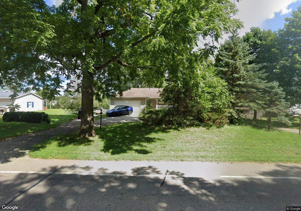
1765 S Patterson Rd Wayland, MI 49348
Estimated Value: $309,000 - $400,000
3
Beds
2
Baths
2,344
Sq Ft
$150/Sq Ft
Est. Value
About This Home
This home is located at 1765 S Patterson Rd, Wayland, MI 49348 and is currently estimated at $351,191, approximately $149 per square foot. 1765 S Patterson Rd is a home located in Barry County with nearby schools including Wayland High School.
Ownership History
Date
Name
Owned For
Owner Type
Purchase Details
Closed on
Nov 30, 2009
Sold by
Secretary Of Housing & Urban Development
Bought by
Scott Lindsay
Current Estimated Value
Purchase Details
Closed on
Apr 29, 2009
Sold by
Mortgage Electronic Registration Systems
Bought by
U S Department Of Housing & Urban Develo
Purchase Details
Closed on
Aug 21, 2008
Sold by
Tobin Gene M and Tobin Wendi J
Bought by
Mortgage Electronic Registration Systems
Purchase Details
Closed on
Dec 15, 2004
Sold by
Whitehead Marvin and Whitehead Bertha
Bought by
Tobin Gene M and Tobin Wendi J
Home Financials for this Owner
Home Financials are based on the most recent Mortgage that was taken out on this home.
Original Mortgage
$123,600
Interest Rate
7.9%
Mortgage Type
Purchase Money Mortgage
Create a Home Valuation Report for This Property
The Home Valuation Report is an in-depth analysis detailing your home's value as well as a comparison with similar homes in the area
Home Values in the Area
Average Home Value in this Area
Purchase History
| Date | Buyer | Sale Price | Title Company |
|---|---|---|---|
| Scott Lindsay | $125,000 | None Available | |
| U S Department Of Housing & Urban Develo | -- | None Available | |
| Mortgage Electronic Registration Systems | $166,650 | None Available | |
| Tobin Gene M | $154,500 | Metropolitan Title Company |
Source: Public Records
Mortgage History
| Date | Status | Borrower | Loan Amount |
|---|---|---|---|
| Previous Owner | Tobin Gene M | $123,600 | |
| Closed | Tobin Gene M | $30,900 |
Source: Public Records
Tax History Compared to Growth
Tax History
| Year | Tax Paid | Tax Assessment Tax Assessment Total Assessment is a certain percentage of the fair market value that is determined by local assessors to be the total taxable value of land and additions on the property. | Land | Improvement |
|---|---|---|---|---|
| 2025 | $2,253 | $128,700 | $0 | $0 |
| 2024 | $2,253 | $109,100 | $0 | $0 |
| 2023 | $2,107 | $89,500 | $0 | $0 |
| 2022 | $2,107 | $89,500 | $0 | $0 |
| 2021 | $2,107 | $85,100 | $0 | $0 |
| 2020 | $2,046 | $85,900 | $0 | $0 |
| 2019 | $2,046 | $78,900 | $0 | $0 |
| 2018 | $1,957 | $73,600 | $8,700 | $64,900 |
| 2017 | $1,957 | $73,600 | $0 | $0 |
| 2016 | -- | $64,100 | $0 | $0 |
| 2015 | -- | $60,600 | $0 | $0 |
| 2014 | -- | $60,600 | $0 | $0 |
Source: Public Records
Map
Nearby Homes
- 1736 Parker Dr
- 12712 Sunrise Ct
- 1980 Parker Dr
- 2724 Pasture Ln
- 35 Cannonball Ln
- 12169 Pine Meadows Dr
- 12031 Sandstone Dr
- 12940 Cleland Ave
- 3140 Sandy Beach St
- 11065 W M 179 Hwy
- 3298 Elmwood Beach Rd
- 2919 Beatrice Ave
- 2919 Beatrice Ave
- 12720 S Grey Ct
- 1164 E Bernie Ct
- 590 129th Ave
- 11908 Erica Ln Unit Site 66
- 516 131st Ave
- 12857 Michael Dr Unit 49
- 1391 Shadowridge Dr
- 1733 S Patterson Rd
- 1775 S Patterson Rd
- 1707 S Patterson Rd
- 1785 S Patterson Rd
- 2846 Patterson Rd
- 12921 Goldenrod Ct
- 12909 Goldenrod Ct
- 12897 Goldenrod Ct Unit 3
- 12885 Goldenrod Ct Unit 4
- 1641 S Patterson Rd
- 12922 Goldenrod Ct
- 12896 Goldenrod Ct
- 1686 Turtle Head Ln
- ?1686 Turtle Head Ln
- 1885 S Patterson Rd
- Lot-29 Turtle Head Ln
- 1639 S Patterson Rd
- 1681 Turtle Head Ln
- 12813 Goldenrod Ct Unit 5
- 0 Goldenrod Ct