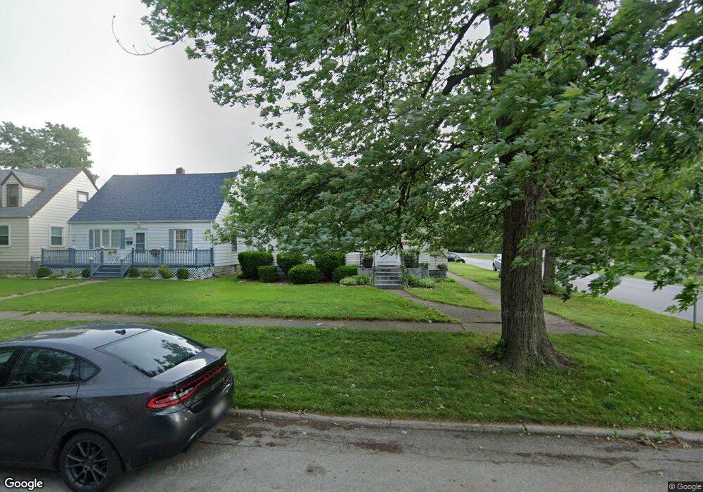
17657 Maple St Lansing, IL 60438
Estimated Value: $194,268 - $252,000
3
Beds
2
Baths
1,416
Sq Ft
$163/Sq Ft
Est. Value
About This Home
This home is located at 17657 Maple St, Lansing, IL 60438 and is currently estimated at $231,317, approximately $163 per square foot. 17657 Maple St is a home located in Cook County with nearby schools including Coolidge Elementary School, Memorial Jr High School, and Thornton Fractnl So High School.
Ownership History
Date
Name
Owned For
Owner Type
Purchase Details
Closed on
Nov 2, 1994
Sold by
Elwood Brian M and Elwood Kathleen
Bought by
Fritzsche James R and Rohm Theresa
Current Estimated Value
Home Financials for this Owner
Home Financials are based on the most recent Mortgage that was taken out on this home.
Original Mortgage
$74,400
Interest Rate
8.75%
Create a Home Valuation Report for This Property
The Home Valuation Report is an in-depth analysis detailing your home's value as well as a comparison with similar homes in the area
Home Values in the Area
Average Home Value in this Area
Purchase History
| Date | Buyer | Sale Price | Title Company |
|---|---|---|---|
| Fritzsche James R | $93,000 | -- |
Source: Public Records
Mortgage History
| Date | Status | Borrower | Loan Amount |
|---|---|---|---|
| Closed | Fritzsche James R | $74,400 |
Source: Public Records
Tax History
| Year | Tax Paid | Tax Assessment Tax Assessment Total Assessment is a certain percentage of the fair market value that is determined by local assessors to be the total taxable value of land and additions on the property. | Land | Improvement |
|---|---|---|---|---|
| 2025 | $5,169 | $14,001 | $2,270 | $11,731 |
| 2024 | $5,169 | $14,001 | $2,270 | $11,731 |
| 2023 | $3,710 | $14,001 | $2,270 | $11,731 |
| 2022 | $3,710 | $9,130 | $2,003 | $7,127 |
| 2021 | $3,666 | $9,129 | $2,002 | $7,127 |
| 2020 | $3,536 | $9,129 | $2,002 | $7,127 |
| 2019 | $4,280 | $10,947 | $1,869 | $9,078 |
| 2018 | $4,197 | $10,947 | $1,869 | $9,078 |
| 2017 | $4,272 | $10,947 | $1,869 | $9,078 |
| 2016 | $3,608 | $9,096 | $1,735 | $7,361 |
| 2015 | $3,289 | $9,096 | $1,735 | $7,361 |
| 2014 | $3,271 | $9,096 | $1,735 | $7,361 |
| 2013 | $3,494 | $10,390 | $1,735 | $8,655 |
Source: Public Records
Map
Nearby Homes
- 3645 177th Place
- 17702 Bernadine St
- 3520 Jackson St
- 108 Beverly Place
- 17945 Maple St
- 3617 Monroe St
- 7937 Forest Ave
- 17913 William St
- 3659 Madison St
- 222 Beacon Place
- 17519 Community St
- 17614 Community St
- 8039 Forest Ave
- 17831 Community St
- 3522 Washington St
- 17244 Wentworth Ave
- 17821 Roy St
- 17552 Roy St
- 222 Broadmoor Ave
- 17518 Roy St
- 17653 Maple St
- 17649 Maple St
- 17701 Maple St
- 17645 Maple St
- 17656 State Line Ave
- 17652 State Line Ave
- 17652 State Line Ave
- 3676 177th St
- 17707 Maple St
- 17639 Maple St
- 17704 State Line Ave
- 17704 State Line Ave
- 17704 State Line Ave
- 3670 177th St
- 17646 State Line Ave
- 17646 State Line Ave
- 17711 Maple St
- 17635 Maple St
- 17702 Maple St
- 17706 State Line Ave
Your Personal Tour Guide
Ask me questions while you tour the home.