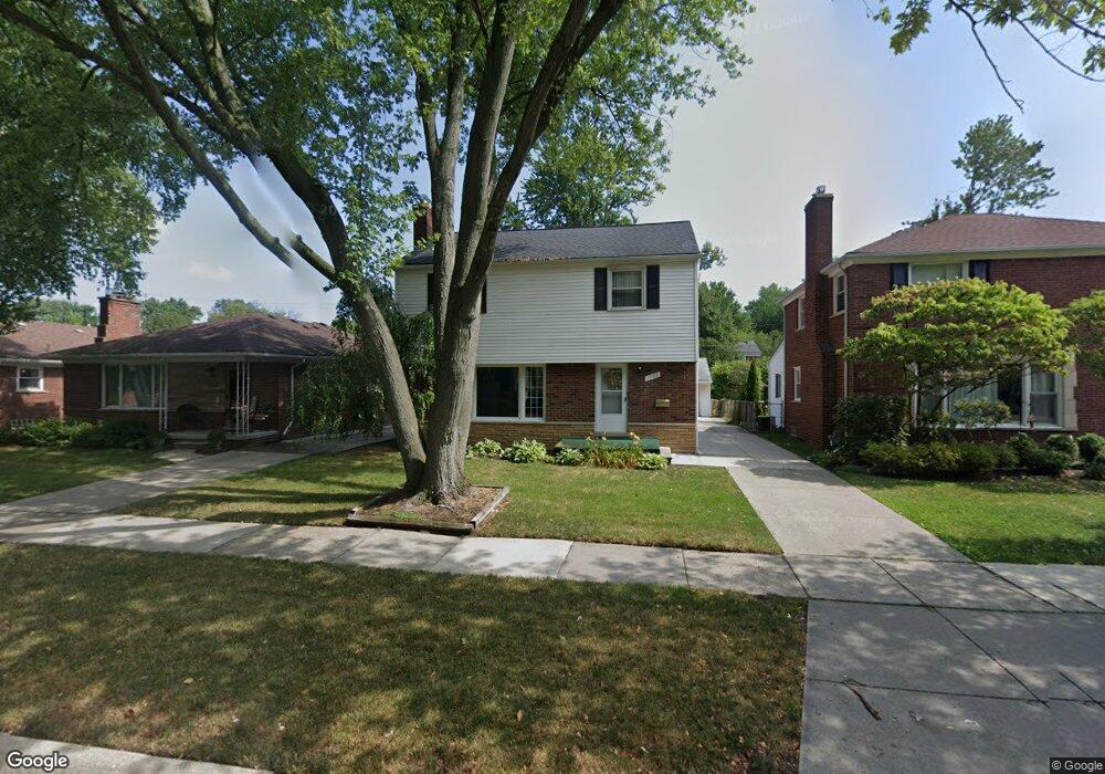
1766 Newcastle Rd Unit Bldg-Unit Grosse Pointe Woods, MI 48236
Estimated Value: $333,000 - $345,000
3
Beds
2
Baths
1,818
Sq Ft
$186/Sq Ft
Est. Value
About This Home
This home is located at 1766 Newcastle Rd Unit Bldg-Unit, Grosse Pointe Woods, MI 48236 and is currently estimated at $338,467, approximately $186 per square foot. 1766 Newcastle Rd Unit Bldg-Unit is a home located in Wayne County with nearby schools including John Monteith Elementary School, Brownell Middle School, and Grosse Pointe North High School.
Ownership History
Date
Name
Owned For
Owner Type
Purchase Details
Closed on
Feb 22, 2018
Sold by
Shepley Camille A and Jatkoe Bernice
Bought by
Porteous Malik
Current Estimated Value
Purchase Details
Closed on
Jun 5, 2007
Sold by
Jatkoe Bernice
Bought by
Jatkoe Bernice and Shepley Camille A
Create a Home Valuation Report for This Property
The Home Valuation Report is an in-depth analysis detailing your home's value as well as a comparison with similar homes in the area
Home Values in the Area
Average Home Value in this Area
Purchase History
| Date | Buyer | Sale Price | Title Company |
|---|---|---|---|
| Porteous Malik | $175,000 | Ata National Title Group | |
| Jatkoe Bernice | -- | None Available |
Source: Public Records
Tax History Compared to Growth
Tax History
| Year | Tax Paid | Tax Assessment Tax Assessment Total Assessment is a certain percentage of the fair market value that is determined by local assessors to be the total taxable value of land and additions on the property. | Land | Improvement |
|---|---|---|---|---|
| 2025 | $4,293 | $156,000 | $0 | $0 |
| 2024 | $4,293 | $146,500 | $0 | $0 |
| 2023 | $4,129 | $129,700 | $0 | $0 |
| 2022 | $8,045 | $118,000 | $0 | $0 |
| 2021 | $7,852 | $119,000 | $0 | $0 |
| 2020 | $7,694 | $116,600 | $0 | $0 |
| 2019 | $3,758 | $107,300 | $0 | $0 |
| 2018 | $2,215 | $86,800 | $0 | $0 |
| 2017 | $2,574 | $85,200 | $0 | $0 |
| 2016 | $3,509 | $83,400 | $0 | $0 |
| 2015 | $6,083 | $76,800 | $0 | $0 |
| 2013 | $5,880 | $60,000 | $0 | $0 |
| 2012 | -- | $65,600 | $16,400 | $49,200 |
Source: Public Records
Map
Nearby Homes
- 19299 Raymond St
- 1764 Prestwick Rd
- 1597 Newcastle Rd
- 19242 Eastborne St
- 19226 Eastborne St
- 21602 Newcastle Rd
- 486 Bournemouth Rd
- 463 Colonial Ct
- 22200 Moross Rd
- 5228 Hillcrest St
- 410 Roland Ct
- 450 Roland Rd
- 18929 Berden St
- 18721 Chandler Park Dr
- 21315 Prestwick Ave
- 21248 Newcastle Rd
- 21228 Newcastle Rd
- 21225 Bournemouth St
- 21237 Severn Rd
- 21216 Brierstone St
- 1766 Newcastle Rd
- 1774 Newcastle Rd
- 1758 Newcastle Rd
- 1782 Newcastle Rd
- 1749 Prestwick Rd
- 1750 Newcastle Rd
- 1765 Prestwick Rd
- 1790 Newcastle Rd
- 1733 Prestwick Rd
- 1773 Prestwick Rd
- 1742 Newcastle Rd
- 1798 Newcastle Rd
- 1781 Prestwick Rd
- 1755 Newcastle Rd
- 1747 Newcastle Rd
- 1726 Newcastle Rd
- 1789 Prestwick Rd
- 1806 Newcastle Rd
- 1739 Newcastle Rd
- 1717 Prestwick Rd