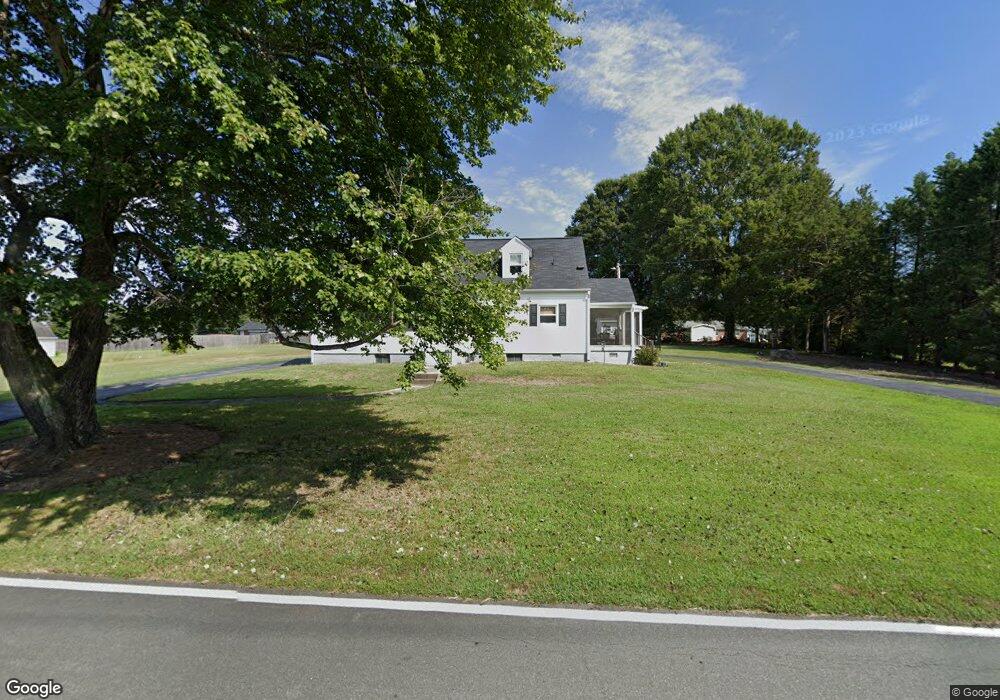
1767 Power Line Rd Elon, NC 27244
West Burlington NeighborhoodEstimated Value: $284,000 - $334,000
3
Beds
1
Bath
2,083
Sq Ft
$150/Sq Ft
Est. Value
About This Home
This home is located at 1767 Power Line Rd, Elon, NC 27244 and is currently estimated at $311,451, approximately $149 per square foot. 1767 Power Line Rd is a home located in Alamance County with nearby schools including Western Alamance Middle School, Western Alamance High School, and The Burlington School.
Ownership History
Date
Name
Owned For
Owner Type
Purchase Details
Closed on
Dec 10, 2020
Sold by
Smith Linda F
Bought by
Smith Linda F and Linda F Smith Revocable Trust
Current Estimated Value
Home Financials for this Owner
Home Financials are based on the most recent Mortgage that was taken out on this home.
Original Mortgage
$102,750
Outstanding Balance
$91,478
Interest Rate
2.7%
Mortgage Type
New Conventional
Estimated Equity
$219,973
Purchase Details
Closed on
Apr 4, 2017
Sold by
Smith Linda F
Bought by
Smith Linda F and The Linda F Smith Revocable Trust Agreem
Purchase Details
Closed on
Dec 17, 1999
Sold by
Bustard Murlen
Bought by
Smith Donald Page
Home Financials for this Owner
Home Financials are based on the most recent Mortgage that was taken out on this home.
Original Mortgage
$105,039
Interest Rate
7.85%
Create a Home Valuation Report for This Property
The Home Valuation Report is an in-depth analysis detailing your home's value as well as a comparison with similar homes in the area
Home Values in the Area
Average Home Value in this Area
Purchase History
| Date | Buyer | Sale Price | Title Company |
|---|---|---|---|
| Smith Linda F | -- | Amrock | |
| Smith Linda F | -- | None Available | |
| Smith Linda F | -- | None Available | |
| Smith Donald Page | $99,000 | -- |
Source: Public Records
Mortgage History
| Date | Status | Borrower | Loan Amount |
|---|---|---|---|
| Open | Smith Linda F | $102,750 | |
| Closed | Smith Donald Page | $105,039 |
Source: Public Records
Tax History Compared to Growth
Tax History
| Year | Tax Paid | Tax Assessment Tax Assessment Total Assessment is a certain percentage of the fair market value that is determined by local assessors to be the total taxable value of land and additions on the property. | Land | Improvement |
|---|---|---|---|---|
| 2025 | $1,760 | $296,318 | $42,656 | $253,662 |
| 2024 | $1,646 | $296,318 | $42,656 | $253,662 |
| 2023 | $1,529 | $296,318 | $42,656 | $253,662 |
| 2022 | $1,201 | $156,822 | $28,240 | $128,582 |
| 2021 | $1,217 | $156,822 | $28,240 | $128,582 |
| 2020 | $1,233 | $156,822 | $28,240 | $128,582 |
| 2019 | $1,223 | $156,822 | $28,240 | $128,582 |
| 2018 | $0 | $156,822 | $28,240 | $128,582 |
| 2017 | $1,055 | $152,862 | $24,280 | $128,582 |
| 2016 | $995 | $144,187 | $25,620 | $118,567 |
| 2015 | $835 | $121,618 | $25,620 | $95,998 |
| 2014 | $774 | $121,618 | $25,620 | $95,998 |
Source: Public Records
Map
Nearby Homes
- 1816 Chandler St
- 1735 Prince Edward Dr
- L1 Springhill Dr
- 1835 Greentree Rd
- 2518 Macleod St
- 1874 Stratford Rd
- 1526 Regency Ct
- 737 Spanish Oak Rd
- 0 Spanish Oak Rd
- 1818 Wellington Rd
- 825 Lockesley Ln
- 2297 Lakeview Terrace
- 2222 Sunset Hills Dr
- 1625 Robinhood Dr
- 1405 Cherry Dr
- 1413 Keogh St
- 1041 Wisteria Dr
- 2243 Durham Street Extension
- 1303 Cherry Dr
- 2249 Pinecroft Dr
- 1753 Power Line Rd
- 1810 Prince Edward Dr
- 1811 Power Line Rd
- 1818 Prince Edward Dr
- 1820 Prince Edward Dr
- 1770 Prince Edward Dr
- 1745 Power Line Rd
- 1826 Prince Edward Dr
- 1766 Prince Edward Dr
- 1739 Power Line Rd
- 1830 Prince Edward Dr
- 1762 Prince Edward Dr
- 1807 Prince Edward Dr
- 1813 Prince Edward Dr
- 1819 Prince Edward Dr
- 1733 Power Line Rd
- 1773 Prince Edward Dr
- 1846 Prince Edward Dr
- 1829 Prince Edward Dr
- 1754 Prince Edward Dr