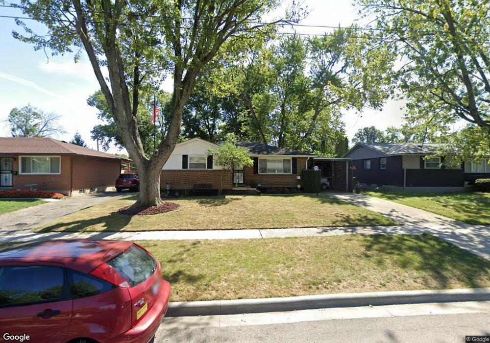
1768 Simpson Dr Columbus, OH 43227
Leawood NeighborhoodEstimated Value: $192,034 - $220,000
3
Beds
2
Baths
1,064
Sq Ft
$196/Sq Ft
Est. Value
About This Home
This home is located at 1768 Simpson Dr, Columbus, OH 43227 and is currently estimated at $208,759, approximately $196 per square foot. 1768 Simpson Dr is a home located in Franklin County with nearby schools including Leawood Elementary School, Sherwood Middle School, and Walnut Ridge High School.
Ownership History
Date
Name
Owned For
Owner Type
Purchase Details
Closed on
Aug 15, 2007
Sold by
Lewis Betsy A
Bought by
Swanson Ronita A
Current Estimated Value
Home Financials for this Owner
Home Financials are based on the most recent Mortgage that was taken out on this home.
Original Mortgage
$89,900
Outstanding Balance
$56,243
Interest Rate
6.79%
Mortgage Type
Purchase Money Mortgage
Estimated Equity
$152,516
Purchase Details
Closed on
Jul 6, 1998
Sold by
Wright Cynthia A
Bought by
Lewis Betsy A
Purchase Details
Closed on
Apr 2, 1992
Create a Home Valuation Report for This Property
The Home Valuation Report is an in-depth analysis detailing your home's value as well as a comparison with similar homes in the area
Home Values in the Area
Average Home Value in this Area
Purchase History
| Date | Buyer | Sale Price | Title Company |
|---|---|---|---|
| Swanson Ronita A | $89,900 | Talon Group | |
| Lewis Betsy A | $77,900 | Foundation Title Agency Inc | |
| -- | $64,900 | -- |
Source: Public Records
Mortgage History
| Date | Status | Borrower | Loan Amount |
|---|---|---|---|
| Open | Swanson Ronita A | $89,900 |
Source: Public Records
Tax History
| Year | Tax Paid | Tax Assessment Tax Assessment Total Assessment is a certain percentage of the fair market value that is determined by local assessors to be the total taxable value of land and additions on the property. | Land | Improvement |
|---|---|---|---|---|
| 2025 | $2,433 | $54,220 | $16,030 | $38,190 |
| 2024 | $2,433 | $54,220 | $16,030 | $38,190 |
| 2023 | $2,402 | $54,215 | $16,030 | $38,185 |
| 2022 | $1,823 | $35,140 | $7,070 | $28,070 |
| 2021 | $1,826 | $35,140 | $7,070 | $28,070 |
| 2020 | $1,828 | $35,140 | $7,070 | $28,070 |
| 2019 | $1,686 | $27,800 | $5,640 | $22,160 |
| 2018 | $1,587 | $27,800 | $5,640 | $22,160 |
| 2017 | $1,685 | $27,800 | $5,640 | $22,160 |
| 2016 | $2,176 | $24,780 | $5,530 | $19,250 |
| 2015 | $1,490 | $24,780 | $5,530 | $19,250 |
| 2014 | $1,494 | $24,780 | $5,530 | $19,250 |
| 2013 | $867 | $29,155 | $6,510 | $22,645 |
Source: Public Records
Map
Nearby Homes
- 4475 Ellery Dr
- 4589 Belfast Dr
- 4649 Dundee Ave
- 1639 Shady Lane Rd
- 1607 Baxter Dr
- 4701 Janis Dr
- 1654 Wilton Dr
- 4472 Aragon Ave
- 1646 Clyde Place
- 4677 E Livingston Ave
- 4467 Grimsby Rd
- 4819 Calvin Dr
- 4530 Amesbury Rd
- 1490 Elaine Rd Unit 1462
- 1666-1668 Carstare Dr
- 1284 Thurston Dr
- 4859 Folger Dr
- 1281 Maetzel Dr
- 0 Groves Rd
- 1472 Blaine Dr
- 1776 Simpson Dr
- 1760 Simpson Dr
- 1756 Simpson Dr
- 1784 Simpson Dr
- 1785 Shady Lane Rd
- 1791 Shady Lane Rd
- 1779 Shady Lane Rd
- 1750 Simpson Dr
- 4520 Ellery Dr
- 1761 Simpson Dr
- 4490 Ellery Dr
- 1769 Simpson Dr
- 1773 Shady Lane Rd
- 1751 Simpson Dr
- 1777 Simpson Dr
- 1744 Simpson Dr
- 1767 Shady Lane Rd
- 1785 Simpson Dr
- 1793 Simpson Dr
- 4479 Drifton Dr
Your Personal Tour Guide
Ask me questions while you tour the home.