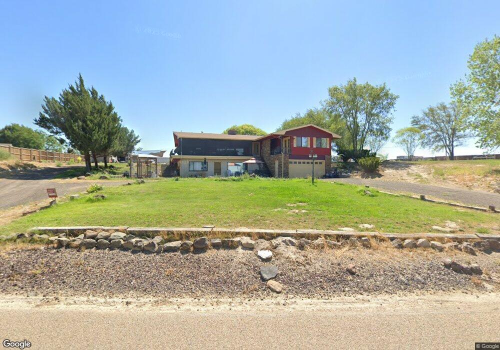
17683 Lower Pleasant Ridge Rd Caldwell, ID 83607
Estimated Value: $659,000 - $769,000
6
Beds
3
Baths
4,388
Sq Ft
$167/Sq Ft
Est. Value
About This Home
This home is located at 17683 Lower Pleasant Ridge Rd, Caldwell, ID 83607 and is currently estimated at $734,987, approximately $167 per square foot. 17683 Lower Pleasant Ridge Rd is a home located in Canyon County with nearby schools including West Canyon Elementary School, Vallivue Middle School, and Vallivue High School.
Ownership History
Date
Name
Owned For
Owner Type
Purchase Details
Closed on
Jun 23, 2011
Sold by
Fannie Mae
Bought by
Romero Felipe and Romero Hilda S
Current Estimated Value
Home Financials for this Owner
Home Financials are based on the most recent Mortgage that was taken out on this home.
Original Mortgage
$131,577
Outstanding Balance
$90,408
Interest Rate
4.56%
Mortgage Type
FHA
Estimated Equity
$644,579
Purchase Details
Closed on
Dec 16, 2010
Sold by
Brown Tim
Bought by
Federal National Mortgage Association
Purchase Details
Closed on
May 1, 2006
Sold by
Brown Meredith
Bought by
Brown Tim D
Home Financials for this Owner
Home Financials are based on the most recent Mortgage that was taken out on this home.
Original Mortgage
$51,460
Interest Rate
5.95%
Mortgage Type
Fannie Mae Freddie Mac
Create a Home Valuation Report for This Property
The Home Valuation Report is an in-depth analysis detailing your home's value as well as a comparison with similar homes in the area
Home Values in the Area
Average Home Value in this Area
Purchase History
| Date | Buyer | Sale Price | Title Company |
|---|---|---|---|
| Romero Felipe | -- | Alliance Title Production | |
| Federal National Mortgage Association | $365,521 | Pioneer Caldwell | |
| Brown Tim D | -- | Pioneer Title Company | |
| Brown Tim D | -- | Pioneer Title Company |
Source: Public Records
Mortgage History
| Date | Status | Borrower | Loan Amount |
|---|---|---|---|
| Open | Romero Felipe | $131,577 | |
| Previous Owner | Brown Tim D | $51,460 | |
| Previous Owner | Brown Tim D | $205,840 |
Source: Public Records
Tax History Compared to Growth
Tax History
| Year | Tax Paid | Tax Assessment Tax Assessment Total Assessment is a certain percentage of the fair market value that is determined by local assessors to be the total taxable value of land and additions on the property. | Land | Improvement |
|---|---|---|---|---|
| 2025 | $2,425 | $634,560 | $197,860 | $436,700 |
| 2024 | $2,425 | $619,160 | $197,860 | $421,300 |
| 2023 | $2,294 | $603,160 | $197,860 | $405,300 |
| 2022 | $3,516 | $636,670 | $205,370 | $431,300 |
| 2021 | $2,975 | $467,990 | $107,790 | $360,200 |
| 2020 | $2,912 | $377,200 | $89,100 | $288,100 |
| 2019 | $3,430 | $391,100 | $74,100 | $317,000 |
| 2018 | $2,752 | $0 | $0 | $0 |
| 2017 | $2,606 | $0 | $0 | $0 |
| 2016 | $2,410 | $0 | $0 | $0 |
| 2015 | $2,021 | $0 | $0 | $0 |
| 2014 | $1,986 | $223,660 | $35,060 | $188,600 |
Source: Public Records
Map
Nearby Homes
- 18396 Lower Pleasant Ridge Rd
- TBD Harvey
- 12904 Ashfield St
- 16277 Taggart Ave
- 12785 Devonshire St
- TBD Deer Flat Rd
- 12443 Varga St
- 12451 Varga St
- 24471 Himark Way
- 18835 Upper Pleasant Ridge Rd
- 18658 Tranquil Place
- 18998 Tranquil Place
- TBD Cabernet Ct Lot 1 Parcel 4
- TBD Dobie Rd
- 6513 Piper Ln
- TBD Commerce Comet
- TBD Iron Horse Dr
- TBD
- 2809 Dorman Ave
- 824 Manchester St
- 17585 Lower Pleasant Ridge Rd
- 17693 Lower Pleasant Ridge Rd
- 17693 Lower Pleasant Ridge Rd Unit 2
- 17353 Lower Pleasant Ridge Rd
- 19720 Malt Rd
- 17596 Upper Pleasant Ridge Rd
- 19511 Malt Rd
- 00 Upper Pleasant Ridge Rd
- 17556 Upper Pleasant Ridge Rd
- 17340 Upper Pleasant Ridge Rd
- 000 Upper Pleasant Ridge
- 17180 Lower Pleasant Ridge Rd
- 17559 Upper Pleasant Ridge Rd
- 19831 Malt Rd
- 17581 Upper Pleasant Ridge Rd
- 17476 Upper Pleasant Ridge Rd
- 17729 Upper Pleasant Ridge Rd
- 17729 Upper Pleasant Ridge Rd
- 19361 Malt Rd
- 17481 Upper Pleasant Ridge Rd