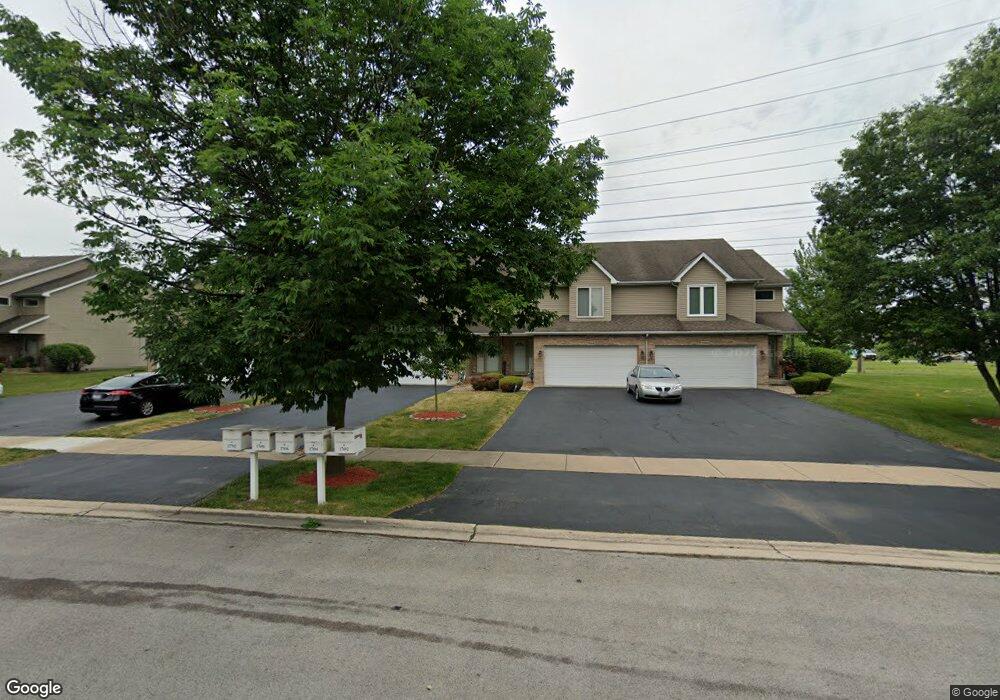
17696 Locust St Lansing, IL 60438
Estimated Value: $248,000 - $299,000
3
Beds
3
Baths
2,027
Sq Ft
$134/Sq Ft
Est. Value
About This Home
This home is located at 17696 Locust St, Lansing, IL 60438 and is currently estimated at $271,814, approximately $134 per square foot. 17696 Locust St is a home located in Cook County with nearby schools including Oak Glen Elementary School, Memorial Jr High School, and Thornton Fractnl So High School.
Ownership History
Date
Name
Owned For
Owner Type
Purchase Details
Closed on
May 9, 2014
Sold by
Secretary Of Housing & Urban Development
Bought by
Aremu Kayode and Aremu Serifat
Current Estimated Value
Purchase Details
Closed on
Jan 9, 2014
Sold by
Mccloud Kimberly O
Bought by
The Secretary Of Housing & Urban Develop
Purchase Details
Closed on
Sep 6, 2007
Sold by
Mayberry Debra A
Bought by
Mccloud Kimberly O
Home Financials for this Owner
Home Financials are based on the most recent Mortgage that was taken out on this home.
Original Mortgage
$184,070
Interest Rate
6.63%
Mortgage Type
FHA
Purchase Details
Closed on
Aug 11, 2003
Sold by
Great Lakes Trust Co Na
Bought by
Mayberry Debra A
Home Financials for this Owner
Home Financials are based on the most recent Mortgage that was taken out on this home.
Original Mortgage
$168,026
Interest Rate
5.97%
Mortgage Type
FHA
Create a Home Valuation Report for This Property
The Home Valuation Report is an in-depth analysis detailing your home's value as well as a comparison with similar homes in the area
Home Values in the Area
Average Home Value in this Area
Purchase History
| Date | Buyer | Sale Price | Title Company |
|---|---|---|---|
| Aremu Kayode | -- | Stewart Title | |
| The Secretary Of Housing & Urban Develop | -- | None Available | |
| Mccloud Kimberly O | $187,000 | First American | |
| Mayberry Debra A | $170,500 | Cti |
Source: Public Records
Mortgage History
| Date | Status | Borrower | Loan Amount |
|---|---|---|---|
| Previous Owner | Mccloud Kimberly O | $184,070 | |
| Previous Owner | Mayberry Debra A | $168,026 |
Source: Public Records
Tax History Compared to Growth
Tax History
| Year | Tax Paid | Tax Assessment Tax Assessment Total Assessment is a certain percentage of the fair market value that is determined by local assessors to be the total taxable value of land and additions on the property. | Land | Improvement |
|---|---|---|---|---|
| 2024 | $10,008 | $24,000 | $1,499 | $22,501 |
| 2023 | $7,084 | $24,000 | $1,499 | $22,501 |
| 2022 | $7,084 | $14,320 | $1,322 | $12,998 |
| 2021 | $6,947 | $14,320 | $1,322 | $12,998 |
| 2020 | $6,581 | $14,320 | $1,322 | $12,998 |
| 2019 | $7,742 | $17,028 | $1,234 | $15,794 |
| 2018 | $7,595 | $17,028 | $1,234 | $15,794 |
| 2017 | $7,703 | $17,028 | $1,234 | $15,794 |
| 2016 | $6,332 | $14,077 | $1,145 | $12,932 |
| 2015 | $7,152 | $14,077 | $1,145 | $12,932 |
| 2014 | $6,121 | $14,786 | $1,145 | $13,641 |
| 2013 | $4,224 | $12,010 | $1,145 | $10,865 |
Source: Public Records
Map
Nearby Homes
- 2306 Holiday Terrace Unit 144
- 2306 Holiday Terrace Unit 163
- 2306 Holiday Terrace Unit 146
- 2307 177th St
- 17871 Locust St
- 2237 175th St Unit 2B
- 2304 Holiday Terrace Unit 505
- 17934 Locust St
- 2036 Thornton Lansing Rd
- 2155 Bernice Rd
- 17001 Glen Oak Ave
- 2201 Thornton Lansing Rd
- 2080 Fairview Ln
- 2005 Fairview Ln
- 17825 Oakley Ave
- 18005 Arcadia Ave
- 17750 Clyde Ave
- 18038 Whitman Ln
- 17803 Escanaba Ave
- 2290 182nd Place
- 17696 Locust St Unit 96
- 17694 Locust St
- 17692 Locust St
- 17702 Locust St
- 17708 Locust St
- 17710 Locust St
- 17712 Locust St
- 17714 Locust St
- 2210 177th St
- 17716 Locust St
- 2211 177th St
- 2211 176th Place
- 17724 Locust St
- 2223 177th St
- 17726 Locust St
- 17728 Locust St
- 2215 176th Place
- 2234 177th St
- 17730 Locust St
- 2235 177th St