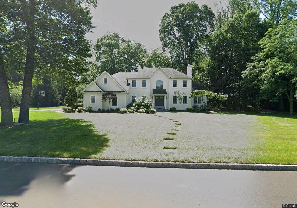
177 Ash Way Doylestown, PA 18901
Estimated Value: $1,186,000 - $1,365,000
4
Beds
3
Baths
4,173
Sq Ft
$297/Sq Ft
Est. Value
About This Home
This home is located at 177 Ash Way, Doylestown, PA 18901 and is currently estimated at $1,241,018, approximately $297 per square foot. 177 Ash Way is a home located in Bucks County with nearby schools including Doyle El School, Lenape Middle School, and Central Bucks High School-West.
Ownership History
Date
Name
Owned For
Owner Type
Purchase Details
Closed on
Jul 29, 1999
Sold by
Cohn Myrna L and Cohn Garrett U
Bought by
Drake Robert L and Drake Patricia M
Current Estimated Value
Home Financials for this Owner
Home Financials are based on the most recent Mortgage that was taken out on this home.
Original Mortgage
$455,050
Interest Rate
6.5%
Purchase Details
Closed on
Jul 29, 1996
Sold by
Lord Sterling Associates Lp
Bought by
Cohn Garrett U and Cohn Myrna L
Home Financials for this Owner
Home Financials are based on the most recent Mortgage that was taken out on this home.
Original Mortgage
$388,900
Interest Rate
8.08%
Create a Home Valuation Report for This Property
The Home Valuation Report is an in-depth analysis detailing your home's value as well as a comparison with similar homes in the area
Home Values in the Area
Average Home Value in this Area
Purchase History
| Date | Buyer | Sale Price | Title Company |
|---|---|---|---|
| Drake Robert L | $479,000 | Stewart Title Guaranty Compa | |
| Cohn Garrett U | $486,224 | -- |
Source: Public Records
Mortgage History
| Date | Status | Borrower | Loan Amount |
|---|---|---|---|
| Previous Owner | Drake Robert L | $455,050 | |
| Previous Owner | Cohn Garrett U | $388,900 |
Source: Public Records
Tax History Compared to Growth
Tax History
| Year | Tax Paid | Tax Assessment Tax Assessment Total Assessment is a certain percentage of the fair market value that is determined by local assessors to be the total taxable value of land and additions on the property. | Land | Improvement |
|---|---|---|---|---|
| 2025 | $14,074 | $79,530 | $7,520 | $72,010 |
| 2024 | $14,074 | $79,530 | $7,520 | $72,010 |
| 2023 | $13,420 | $79,530 | $7,520 | $72,010 |
| 2022 | $13,270 | $79,530 | $7,520 | $72,010 |
| 2021 | $12,997 | $79,530 | $7,520 | $72,010 |
| 2020 | $12,938 | $79,530 | $7,520 | $72,010 |
| 2019 | $12,798 | $79,530 | $7,520 | $72,010 |
| 2018 | $12,759 | $79,530 | $7,520 | $72,010 |
| 2017 | $12,659 | $79,530 | $7,520 | $72,010 |
| 2016 | $12,580 | $79,530 | $7,520 | $72,010 |
| 2015 | -- | $79,530 | $7,520 | $72,010 |
| 2014 | -- | $79,530 | $7,520 | $72,010 |
Source: Public Records
Map
Nearby Homes
- 121 Conestoga Dr
- 218 Vaux Dr
- 197 Spring Ln
- 200 N Shady Retreat Rd
- 4 Old Colonial Dr Unit 254
- 432 Ford Hook Rd
- 450 Ford Hook Rd
- 62 Constitution Ave
- 250 Wooded Dr
- 422 Fordhook Rd
- 1 Gatehouse Ln
- 84 Iron Hill Rd
- 60 Cedar Dr
- 114 Progress Dr
- 157 Pine Run Rd
- 333 Dorset Ct Unit 333
- 215 N Franklin St
- 9 Mill Creek Dr
- 37 N Clinton St
- 259 W Ashland St