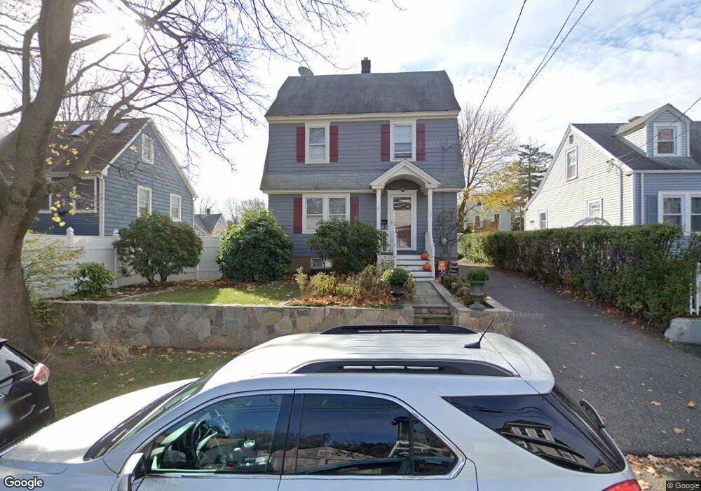
177 Berwick Ave Fairfield, CT 06825
Tunxis Hill NeighborhoodEstimated Value: $514,129 - $637,000
3
Beds
2
Baths
1,344
Sq Ft
$413/Sq Ft
Est. Value
About This Home
This home is located at 177 Berwick Ave, Fairfield, CT 06825 and is currently estimated at $555,282, approximately $413 per square foot. 177 Berwick Ave is a home located in Fairfield County with nearby schools including Mckinley Elementary School, Tomlinson Middle School, and Fairfield Warde High School.
Ownership History
Date
Name
Owned For
Owner Type
Purchase Details
Closed on
May 18, 2018
Sold by
Grillo Alfred F
Bought by
Grillo Misuk
Current Estimated Value
Purchase Details
Closed on
May 30, 2002
Sold by
Hursey Daniel D
Bought by
Grillo Alfred F and Grillo Misuk
Home Financials for this Owner
Home Financials are based on the most recent Mortgage that was taken out on this home.
Original Mortgage
$208,000
Interest Rate
7%
Create a Home Valuation Report for This Property
The Home Valuation Report is an in-depth analysis detailing your home's value as well as a comparison with similar homes in the area
Home Values in the Area
Average Home Value in this Area
Purchase History
| Date | Buyer | Sale Price | Title Company |
|---|---|---|---|
| Grillo Misuk | -- | -- | |
| Grillo Misuk | -- | -- | |
| Grillo Alfred F | $261,000 | -- | |
| Grillo Alfred F | $261,000 | -- |
Source: Public Records
Mortgage History
| Date | Status | Borrower | Loan Amount |
|---|---|---|---|
| Previous Owner | Grillo Alfred F | $208,000 | |
| Previous Owner | Grillo Alfred F | $60,000 |
Source: Public Records
Tax History Compared to Growth
Tax History
| Year | Tax Paid | Tax Assessment Tax Assessment Total Assessment is a certain percentage of the fair market value that is determined by local assessors to be the total taxable value of land and additions on the property. | Land | Improvement |
|---|---|---|---|---|
| 2025 | $6,244 | $219,940 | $153,580 | $66,360 |
| 2024 | $6,136 | $219,940 | $153,580 | $66,360 |
| 2023 | $6,051 | $219,940 | $153,580 | $66,360 |
| 2022 | $5,991 | $219,940 | $153,580 | $66,360 |
| 2021 | $5,934 | $219,940 | $153,580 | $66,360 |
| 2020 | $5,570 | $207,900 | $133,280 | $74,620 |
| 2019 | $5,570 | $207,900 | $133,280 | $74,620 |
| 2018 | $5,480 | $207,900 | $133,280 | $74,620 |
| 2017 | $5,368 | $207,900 | $133,280 | $74,620 |
| 2016 | $5,291 | $207,900 | $133,280 | $74,620 |
| 2015 | $5,220 | $210,560 | $141,050 | $69,510 |
| 2014 | $5,138 | $210,560 | $141,050 | $69,510 |
Source: Public Records
Map
Nearby Homes
- 130 Brentwood Ave
- 145 Brentwood Ave
- 118 Berwick Ave
- 378 Castle Ave
- 89 Grace St
- 17 Hazel St
- 101 Soundview Ave
- 62 Soundview Ave
- 82 Waldorf Ave
- 167 Scofield Ave
- 31 Whittier St
- 25 Whittier St
- 85 Ash St
- 270 Andrassy Ave
- 95 Bedford Ave
- 221 Hunyadi Ave
- 855 Brewster St Unit 857
- 155 Moody Ave
- 412 Dewey St
- 162 Country Rd Unit 162
- 215 Berwick Ave
- 187 Berwick Ave
- 197 Berwick Ave
- 155 Berwick Ave
- 165 Berwick Ave
- 192 Berwick Ave
- 150 Brentwood Ave
- 170 Brentwood Ave
- 204 Berwick Ave
- 142 Brentwood Ave
- 142 Brentwood Ave Unit 2
- 182 Berwick Ave
- 182 Berwick Ave Unit 2
- 174 Brentwood Ave
- 174 Brentwood Ave Unit 1st Floor
- 210 Berwick Ave
- 132 Brentwood Ave
- 194 Berwick Ave
- 141 Berwick Ave