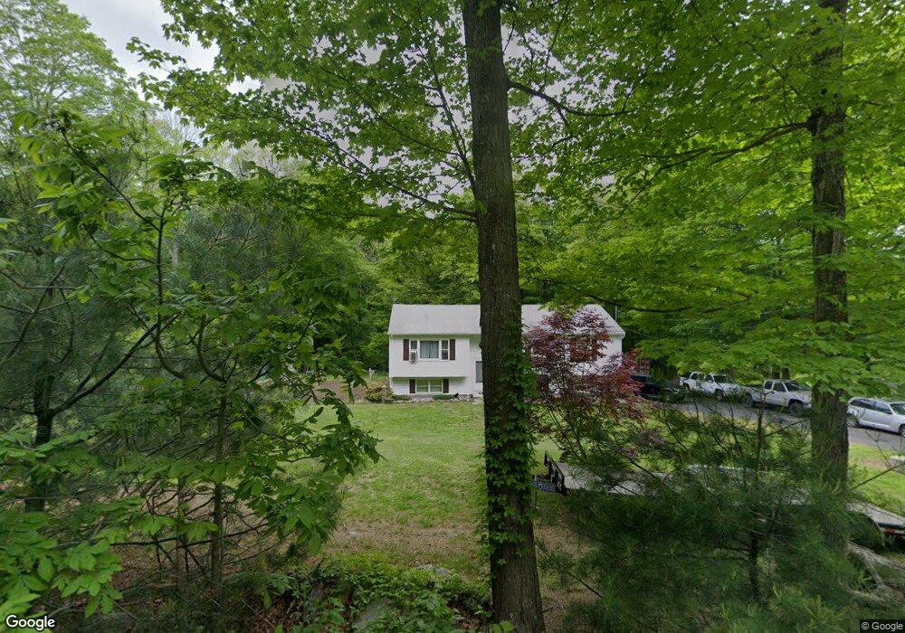
177 Branch Hill Rd Preston, CT 06365
Estimated Value: $325,000 - $398,415
3
Beds
2
Baths
1,332
Sq Ft
$273/Sq Ft
Est. Value
About This Home
This home is located at 177 Branch Hill Rd, Preston, CT 06365 and is currently estimated at $363,354, approximately $272 per square foot. 177 Branch Hill Rd is a home located in New London County.
Ownership History
Date
Name
Owned For
Owner Type
Purchase Details
Closed on
May 30, 2003
Sold by
Gorman Carl
Bought by
Gorman Matthew
Current Estimated Value
Home Financials for this Owner
Home Financials are based on the most recent Mortgage that was taken out on this home.
Original Mortgage
$109,000
Interest Rate
5.86%
Purchase Details
Closed on
Aug 4, 1987
Sold by
Maurice Robert
Bought by
Gorman Carl
Create a Home Valuation Report for This Property
The Home Valuation Report is an in-depth analysis detailing your home's value as well as a comparison with similar homes in the area
Home Values in the Area
Average Home Value in this Area
Purchase History
| Date | Buyer | Sale Price | Title Company |
|---|---|---|---|
| Gorman Matthew | $137,000 | -- | |
| Gorman Carl | $142,000 | -- |
Source: Public Records
Mortgage History
| Date | Status | Borrower | Loan Amount |
|---|---|---|---|
| Open | Gorman Carl | $268,986 | |
| Closed | Gorman Carl | $247,500 | |
| Closed | Gorman Carl | $35,000 | |
| Closed | Gorman Carl | $109,000 |
Source: Public Records
Tax History Compared to Growth
Tax History
| Year | Tax Paid | Tax Assessment Tax Assessment Total Assessment is a certain percentage of the fair market value that is determined by local assessors to be the total taxable value of land and additions on the property. | Land | Improvement |
|---|---|---|---|---|
| 2024 | $5,086 | $217,630 | $59,850 | $157,780 |
| 2023 | $4,995 | $217,630 | $59,850 | $157,780 |
| 2022 | $4,118 | $147,700 | $53,500 | $94,200 |
| 2021 | $3,979 | $147,700 | $53,500 | $94,200 |
| 2020 | $3,973 | $147,700 | $53,500 | $94,200 |
| 2019 | $3,904 | $147,700 | $53,500 | $94,200 |
| 2018 | $3,845 | $147,700 | $53,500 | $94,200 |
| 2017 | $3,432 | $143,000 | $53,500 | $89,500 |
| 2016 | $3,396 | $143,000 | $53,500 | $89,500 |
| 2015 | $3,289 | $143,000 | $53,500 | $89,500 |
| 2014 | $3,309 | $143,000 | $53,500 | $89,500 |
Source: Public Records
Map
Nearby Homes
- 57 NW Corner Rd
- 381 Route 164
- 6 Stanton Ln
- 39 Doolittle Rd
- 23A Tanglewood Dr
- 4 Wilderness Acres
- 55A Anna Farm Rd W
- 42 Pierce Rd
- 63 Route 165
- 59 Long Society Rd
- 5 Mattern Rd
- 6 Lake of Isles Rd
- 381 Route 2
- 146 Route 2
- 17 Daniel St
- 3 Webster Dr
- 168 Corning Rd
- 79 Roosevelt Ave
- 296 Hamilton Ave Unit 7
- 296 Hamilton Ave Unit 30
- 179 Branch Hill Rd
- 175 Branch Hill Rd
- 200 Branch Hill Rd
- 196 Branch Hill Rd
- 181 Branch Hill Rd
- 192 Branch Hill Rd
- 171 Branch Hill Rd
- 184 Branch Hill Rd
- 209 Branch Hill Rd
- 198 Branch Hill Rd
- 198A Branch Hill Rd
- 188 Branch Hill Rd
- 173 Branch Hill Rd
- 169 Branch Hill Rd
- 70 Benjamin Rd
- 75 Benjamin Rd
- 54 Benjamin Rd
- 165 Branch Hill Rd
- 178 Branch Hill Rd
- 167 Branch Hill Rd