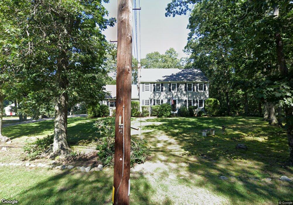
177 Cedar St Holliston, MA 01746
Estimated Value: $814,000 - $869,000
3
Beds
3
Baths
2,550
Sq Ft
$330/Sq Ft
Est. Value
About This Home
This home is located at 177 Cedar St, Holliston, MA 01746 and is currently estimated at $841,491, approximately $329 per square foot. 177 Cedar St is a home located in Middlesex County with nearby schools including Placentino Elementary School, Miller Elementary School, and Robert H. Adams Middle School.
Ownership History
Date
Name
Owned For
Owner Type
Purchase Details
Closed on
Jul 31, 2006
Sold by
Hession Susan L
Bought by
Glidden James Lp
Current Estimated Value
Home Financials for this Owner
Home Financials are based on the most recent Mortgage that was taken out on this home.
Original Mortgage
$380,000
Interest Rate
6.67%
Mortgage Type
Purchase Money Mortgage
Create a Home Valuation Report for This Property
The Home Valuation Report is an in-depth analysis detailing your home's value as well as a comparison with similar homes in the area
Home Values in the Area
Average Home Value in this Area
Purchase History
| Date | Buyer | Sale Price | Title Company |
|---|---|---|---|
| Glidden James Lp | $475,000 | -- | |
| Glidden James Lp | $475,000 | -- |
Source: Public Records
Mortgage History
| Date | Status | Borrower | Loan Amount |
|---|---|---|---|
| Open | Glidden James Lp | $324,747 | |
| Closed | Glidden James Lp | $380,000 | |
| Previous Owner | Glidden James Lp | $150,900 |
Source: Public Records
Tax History
| Year | Tax Paid | Tax Assessment Tax Assessment Total Assessment is a certain percentage of the fair market value that is determined by local assessors to be the total taxable value of land and additions on the property. | Land | Improvement |
|---|---|---|---|---|
| 2025 | $11,242 | $767,400 | $284,300 | $483,100 |
| 2024 | $10,504 | $697,500 | $284,300 | $413,200 |
| 2023 | $9,510 | $617,500 | $237,000 | $380,500 |
| 2022 | $9,413 | $541,600 | $237,000 | $304,600 |
| 2021 | $9,512 | $532,900 | $228,300 | $304,600 |
| 2020 | $9,054 | $480,300 | $228,300 | $252,000 |
| 2019 | $8,487 | $450,700 | $198,700 | $252,000 |
| 2018 | $8,415 | $450,700 | $198,700 | $252,000 |
| 2017 | $8,078 | $436,200 | $190,800 | $245,400 |
| 2016 | $8,196 | $436,200 | $190,800 | $245,400 |
| 2015 | $7,704 | $397,500 | $148,700 | $248,800 |
Source: Public Records
Map
Nearby Homes
- 74 Meeting House Path
- 147 Turner Rd Unit 80
- 26 Meeting House Path Unit 26
- 9 Mountain Gate Rd
- 62 Ashland St
- 207 Eliot St
- 241 Trailside Way
- 306 Trailside Way
- 59 Brooksmont Dr Unit 59
- 18 Sherborne Cir
- 363 Eliot St
- 3 Danforth Dr
- 1 Danforth Dr
- 102 Captain Eames Cir
- 2 Arrowhead Cir Unit 2
- 269 Concord St
- 45 Half Crown Cir
- 1 Adams Ln Unit 1
- 9 Adams Ln Unit 9
- 140 Algonquin Trail
- 0 Lot 189 Indian Ridge S Unit 71653363
- 0 Lot 189 Indian Ridge S Unit 71729104
- 169 Cedar St
- 1 Cheryl Ln
- 3 Cheryl Ln
- 191 Cedar St
- 46 Indian Ridge Rd Unit 46
- 170 Cedar St
- 157 Cedar St
- LOT 189 Indian Ridge Rd S
- 6 Indian Ridge Rd
- 7 Indian Ridge Rd
- 199 Cedar St
- 162 Cedar St
- 182 Cedar St
- 154 Cedar St
- 151 Cedar St
- 8 Indian Ridge Rd
- 209 Cedar St
- 18 Cheryl Ln
Your Personal Tour Guide
Ask me questions while you tour the home.