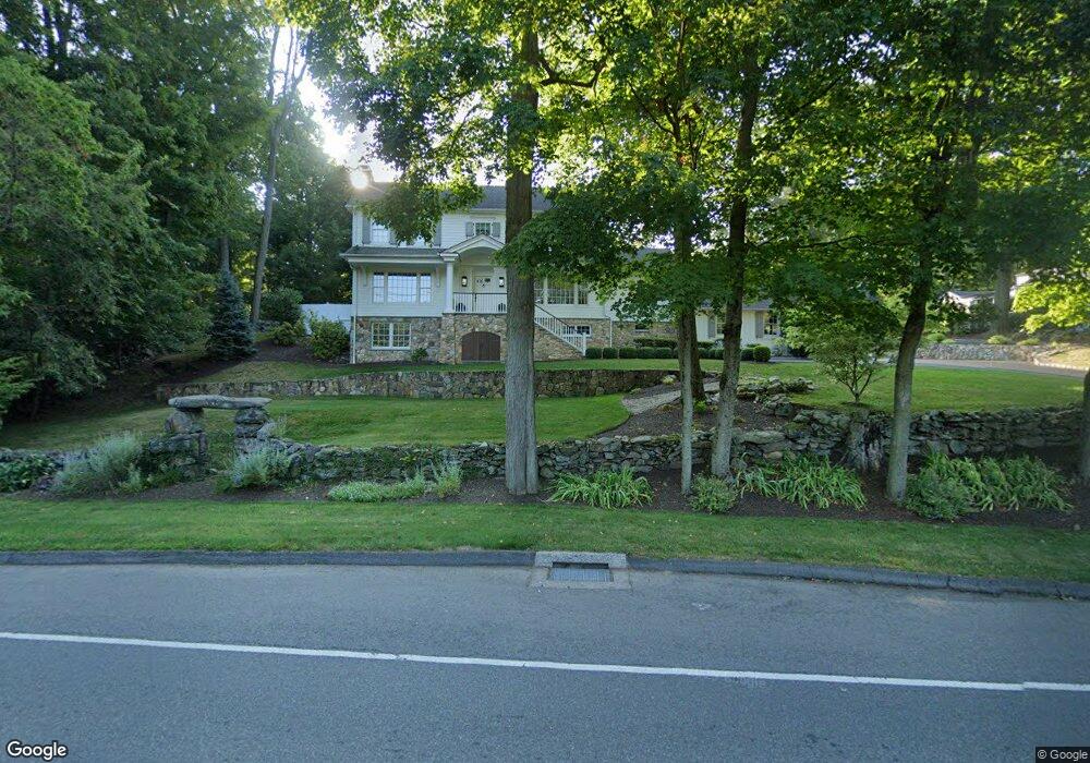
177 Compo Rd S Westport, CT 06880
Compo NeighborhoodEstimated Value: $1,797,000 - $1,992,000
4
Beds
3
Baths
2,550
Sq Ft
$741/Sq Ft
Est. Value
About This Home
This home is located at 177 Compo Rd S, Westport, CT 06880 and is currently estimated at $1,890,094, approximately $741 per square foot. 177 Compo Rd S is a home located in Fairfield County with nearby schools including Saugatuck Elementary School, Bedford Middle School, and Staples High School.
Ownership History
Date
Name
Owned For
Owner Type
Purchase Details
Closed on
Mar 26, 2013
Sold by
Heiser Jennifer M
Bought by
Heiser Jennifer M and Heiser Kenneth
Current Estimated Value
Home Financials for this Owner
Home Financials are based on the most recent Mortgage that was taken out on this home.
Original Mortgage
$190,000
Outstanding Balance
$39,115
Interest Rate
3.57%
Estimated Equity
$1,850,979
Purchase Details
Closed on
Oct 30, 2000
Sold by
Gershman Michael and Leberson Jay
Bought by
Heiser Kenneth and Heiser Jennifer
Purchase Details
Closed on
Apr 6, 1990
Sold by
Macdonald Gary
Bought by
Gershman Michael
Create a Home Valuation Report for This Property
The Home Valuation Report is an in-depth analysis detailing your home's value as well as a comparison with similar homes in the area
Home Values in the Area
Average Home Value in this Area
Purchase History
| Date | Buyer | Sale Price | Title Company |
|---|---|---|---|
| Heiser Jennifer M | -- | -- | |
| Heiser Jennifer M | -- | -- | |
| Heiser Jennifer M | -- | -- | |
| Heiser Kenneth | $277,500 | -- | |
| Heiser Kenneth | $277,500 | -- | |
| Heiser Kenneth | $277,500 | -- | |
| Gershman Michael | $335,000 | -- |
Source: Public Records
Mortgage History
| Date | Status | Borrower | Loan Amount |
|---|---|---|---|
| Open | Heiser Jennifer M | $190,000 | |
| Closed | Heiser Jennifer M | $190,000 |
Source: Public Records
Tax History Compared to Growth
Tax History
| Year | Tax Paid | Tax Assessment Tax Assessment Total Assessment is a certain percentage of the fair market value that is determined by local assessors to be the total taxable value of land and additions on the property. | Land | Improvement |
|---|---|---|---|---|
| 2025 | $14,245 | $755,300 | $321,900 | $433,400 |
| 2024 | $14,064 | $755,300 | $321,900 | $433,400 |
| 2023 | $13,860 | $755,300 | $321,900 | $433,400 |
| 2022 | $13,648 | $755,300 | $321,900 | $433,400 |
| 2021 | $9,285 | $755,300 | $321,900 | $433,400 |
| 2020 | $9,107 | $805,700 | $339,800 | $465,900 |
| 2019 | $13,584 | $805,700 | $339,800 | $465,900 |
| 2018 | $8,903 | $805,700 | $339,800 | $465,900 |
| 2017 | $8,738 | $762,500 | $357,700 | $404,800 |
| 2016 | $12,856 | $762,500 | $357,700 | $404,800 |
| 2015 | $11,035 | $610,000 | $262,600 | $347,400 |
| 2014 | $10,276 | $572,800 | $262,600 | $310,200 |
Source: Public Records
Map
Nearby Homes
- 171 & 169 Compo Rd S
- 5 Franklin Ave
- 23 Bridge St
- 3 Laurel Ln
- 102 Compo Rd S
- 6 Over Rock Ln
- 5A Sunrise Rd
- 39 Compo Pkwy
- 202 Bradley Ln Unit 202
- 33 Burnham Hill
- 11 Manitou Ct
- 26 Treadwell Ave
- 6 Stony Point Rd
- 109 Greens Farms Rd
- 42 Kings Hwy S
- 11 Edgewater Hillside
- 61 Edgewater Commons Ln
- 24 Edgemarth Hill Rd
- 11 Sterling Dr
- 195 Hillspoint Rd
- 175 Compo Rd S
- 178 Compo Rd S
- 181 Compo Rd S
- 179 Compo Rd S
- 184 Compo Rd S
- 176 Compo Rd S
- 176 Compo Rd S Unit A
- 173 Compo Rd S
- 185 Compo Rd S
- 168 Compo Rd S
- 171 Compo Rd S
- 16 Greens Farms Hollow
- 3 Farnham Ct
- 169 Compo Rd S
- 4 Pondside Dr
- 18 Keyser Rd
- 6 Pondside Dr
- 19 Keyser Rd
- 166 Compo Rd S
- 15 Greens Farms Hollow