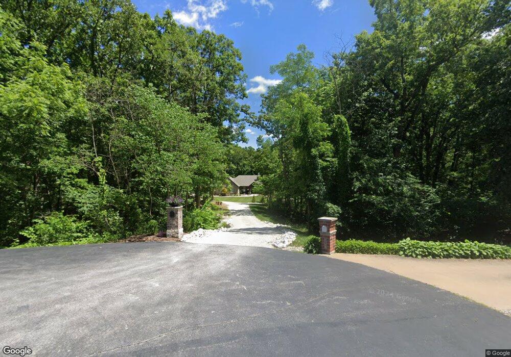
177 Falcon Woods Ct Foristell, MO 63348
Estimated Value: $711,000 - $798,075
4
Beds
5
Baths
2,645
Sq Ft
$285/Sq Ft
Est. Value
About This Home
This home is located at 177 Falcon Woods Ct, Foristell, MO 63348 and is currently estimated at $754,019, approximately $285 per square foot. 177 Falcon Woods Ct is a home located in St. Charles County with nearby schools including Wabash Elementary.
Ownership History
Date
Name
Owned For
Owner Type
Purchase Details
Closed on
Jan 4, 2016
Sold by
Ream Patrick N and Ream Patricia J
Bought by
Clohessy Joseph E and Clohessy Melissa L
Current Estimated Value
Home Financials for this Owner
Home Financials are based on the most recent Mortgage that was taken out on this home.
Original Mortgage
$63,200
Outstanding Balance
$50,231
Interest Rate
3.94%
Mortgage Type
Future Advance Clause Open End Mortgage
Estimated Equity
$703,788
Purchase Details
Closed on
Oct 15, 2004
Sold by
Montgomery Robert J and Montgomery Teresa M
Bought by
Ream Patrick N and Ream Patricia J
Purchase Details
Closed on
Mar 8, 2004
Sold by
Bickel Karl L and Bickel Linda K
Bought by
Montgomery Robert J and Montgomery Teresa M
Create a Home Valuation Report for This Property
The Home Valuation Report is an in-depth analysis detailing your home's value as well as a comparison with similar homes in the area
Home Values in the Area
Average Home Value in this Area
Purchase History
| Date | Buyer | Sale Price | Title Company |
|---|---|---|---|
| Clohessy Joseph E | $79,000 | None Available | |
| Ream Patrick N | $65,900 | -- | |
| Montgomery Robert J | -- | -- | |
| Bickel Karl L | -- | Stc |
Source: Public Records
Mortgage History
| Date | Status | Borrower | Loan Amount |
|---|---|---|---|
| Open | Clohessy Joseph E | $63,200 |
Source: Public Records
Tax History Compared to Growth
Tax History
| Year | Tax Paid | Tax Assessment Tax Assessment Total Assessment is a certain percentage of the fair market value that is determined by local assessors to be the total taxable value of land and additions on the property. | Land | Improvement |
|---|---|---|---|---|
| 2025 | $7,053 | $126,278 | -- | -- |
| 2023 | $7,053 | $111,256 | $0 | $0 |
| 2022 | $6,233 | $91,766 | $0 | $0 |
| 2021 | $6,240 | $91,766 | $0 | $0 |
| 2020 | $6,190 | $87,313 | $0 | $0 |
| 2019 | $5,744 | $87,313 | $0 | $0 |
| 2018 | $2,971 | $11,400 | $0 | $0 |
| 2017 | $787 | $11,400 | $0 | $0 |
| 2016 | $821 | $11,400 | $0 | $0 |
| 2015 | $810 | $11,400 | $0 | $0 |
| 2014 | $755 | $11,400 | $0 | $0 |
Source: Public Records
Map
Nearby Homes
- 0 Unknown Unit MIS22063488
- 0 Unknown Unit MIS22063456
- 0 Unknown Unit MIS22063473
- 0 Unknown Unit MIS22063511
- 0 Unknown Unit MIS22063497
- 0 Unknown Unit MIS22063493
- 0 Unknown Unit MIS22063500
- 0 Unknown Unit MIS22063480
- 0 Unknown Unit MIS22063469
- 627 Brinton Ct
- 614 Brinton Ct
- 4 Emma Ct
- 375 Valley Bluff Dr
- 414 Cedar Breaks Ct
- 414 Cedar Breaks Ct
- 421 Cedar Breaks Ct
- 56 Huntleigh Park Ct
- DaVinci Plan at Huntleigh Ridge - Estates - Maple Street Collection
- Jensen Plan at Huntleigh Ridge - Estates - Maple Street Collection
- Cumberland Plan at Huntleigh Ridge - Estates - Maple Street Collection
- 182 Falcon Woods Ct
- 169 Falcon Woods Ct
- 170 Falcon Woods Ct
- 86 Abby Kate Ln
- 159 Falcon Woods Ct
- 10acres Abby Kate Ln
- 160 Falcon Woods Ct
- 104 Abby Kate Ln
- 88 Abby Kate Ln
- 98 Abby Kate Ln
- 149 Falcon Woods Ct
- 98 Abby - Kate Lane 5ac Unit 5AC
- 98 Abby - Kate Ln
- 98 Abby - Kate Ln Unit 8AC
- 152 Falcon Woods Ct
- 79 Abby Kate Ln
- 66 Abby Kate Ln
- 58 Abby Ln
- 144 Falcon Woods Ct
- 0 Unknown Unit 675333