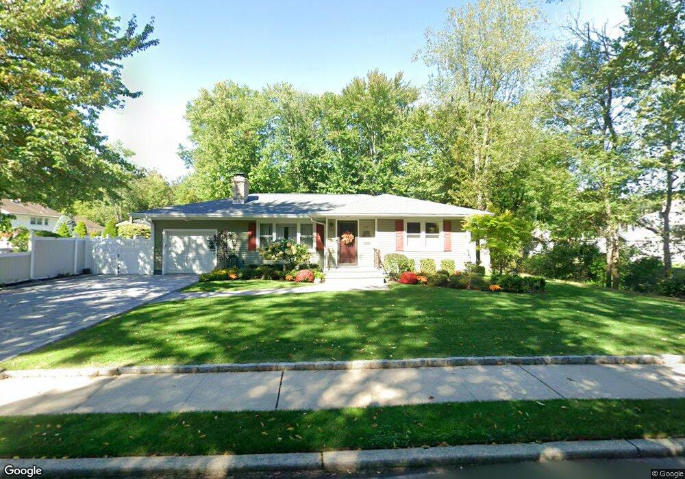
177 Howland Ave Paramus, NJ 07652
Estimated Value: $734,000 - $833,000
2
Beds
1
Bath
1,384
Sq Ft
$571/Sq Ft
Est. Value
About This Home
This home is located at 177 Howland Ave, Paramus, NJ 07652 and is currently estimated at $790,847, approximately $571 per square foot. 177 Howland Ave is a home located in Bergen County with nearby schools including Paramus High School, Ben Porat Yosef, and St. Peter Academy.
Ownership History
Date
Name
Owned For
Owner Type
Purchase Details
Closed on
May 15, 2019
Sold by
Us Bank Na Tr
Bought by
Kessler Barbara
Current Estimated Value
Purchase Details
Closed on
Aug 23, 2016
Sold by
Federal Home Loan Mortgage Corporation
Bought by
Lsfs Master Participation Trust
Purchase Details
Closed on
May 6, 2016
Sold by
Chambers Thomas J
Bought by
Federal Home Loan Mortgage Corp
Purchase Details
Closed on
May 21, 1990
Bought by
Chambers Thomas J and Chambers Joann G
Create a Home Valuation Report for This Property
The Home Valuation Report is an in-depth analysis detailing your home's value as well as a comparison with similar homes in the area
Home Values in the Area
Average Home Value in this Area
Purchase History
| Date | Buyer | Sale Price | Title Company |
|---|---|---|---|
| Kessler Barbara | $476,000 | -- | |
| Lsfs Master Participation Trust | -- | First American Title Insuran | |
| Federal Home Loan Mortgage Corp | -- | None Available | |
| Chambers Thomas J | $189,000 | -- |
Source: Public Records
Tax History
| Year | Tax Paid | Tax Assessment Tax Assessment Total Assessment is a certain percentage of the fair market value that is determined by local assessors to be the total taxable value of land and additions on the property. | Land | Improvement |
|---|---|---|---|---|
| 2025 | $8,492 | $599,400 | $369,400 | $230,000 |
| 2024 | $8,238 | $560,900 | $341,800 | $219,100 |
| 2023 | $8,053 | $537,000 | $325,600 | $211,400 |
| 2022 | $8,053 | $518,900 | $319,800 | $199,100 |
| 2021 | $7,914 | $478,500 | $295,200 | $183,300 |
| 2020 | $7,522 | $471,600 | $290,700 | $180,900 |
| 2019 | $6,695 | $360,700 | $269,300 | $91,400 |
| 2018 | $6,612 | $360,700 | $269,300 | $91,400 |
| 2017 | $6,496 | $360,700 | $269,300 | $91,400 |
| 2016 | $6,319 | $360,700 | $269,300 | $91,400 |
| 2015 | $6,255 | $360,700 | $269,300 | $91,400 |
| 2014 | $6,200 | $360,700 | $269,300 | $91,400 |
Source: Public Records
Map
Nearby Homes
- 127 Village Cir E
- 122 Village Cir E
- 56 Lilac Ln
- 189 Forest Ave Unit 317
- 189 Forest Ave Unit 216
- 46 Knollwood Dr
- 374 Valley Rd
- 81 Eastbrook Dr
- 405 Valley Rd
- 44 Forsythia Ln
- 302 Howland Ave
- 16 Coles Ct
- 160 Lawrence Dr
- 175 Valley Rd
- 177 Haase Ave
- 239 Greenway Terrace
- 457 the Fenway
- 219 N Farview Ave
- 210 Hillcrest Dr
- 192 Thomas Dr
- 110 Ramille Ct
- 173 Howland Ave
- 181 Howland Ave
- 114 Ramille Ct
- 121 Village Cir W
- 123 Village Cir W
- 115 Village Cir W
- 111 Village Cir W
- 117 Village Cir W
- 174 Howland Ave
- 91 Andrea Ct
- 125 Village Cir W
- 107 Ramille Ct
- 168 Howland Ave
- 111 Ramille Ct
- 89 Andrea Ct
- 124 Village Cir W
- 122 Village Cir W
- 191 Howland Ave
- 92 Andrea Ct
Your Personal Tour Guide
Ask me questions while you tour the home.