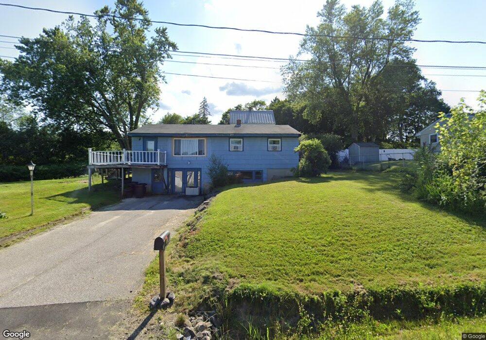
177 Huston Rd Gorham, ME 04038
Estimated Value: $466,547 - $551,000
3
Beds
2
Baths
1,568
Sq Ft
$322/Sq Ft
Est. Value
About This Home
This home is located at 177 Huston Rd, Gorham, ME 04038 and is currently estimated at $504,137, approximately $321 per square foot. 177 Huston Rd is a home with nearby schools including Great Falls Elementary School, Gorham Middle School, and Gorham High School.
Create a Home Valuation Report for This Property
The Home Valuation Report is an in-depth analysis detailing your home's value as well as a comparison with similar homes in the area
Home Values in the Area
Average Home Value in this Area
Tax History
| Year | Tax Paid | Tax Assessment Tax Assessment Total Assessment is a certain percentage of the fair market value that is determined by local assessors to be the total taxable value of land and additions on the property. | Land | Improvement |
|---|---|---|---|---|
| 2025 | $5,427 | $366,700 | $104,200 | $262,500 |
| 2024 | $5,390 | $366,700 | $104,200 | $262,500 |
| 2023 | $5,042 | $366,700 | $104,200 | $262,500 |
| 2022 | $4,712 | $366,700 | $104,200 | $262,500 |
| 2021 | $4,024 | $207,400 | $87,200 | $120,200 |
| 2020 | $3,941 | $207,400 | $87,200 | $120,200 |
| 2019 | $3,930 | $207,400 | $87,200 | $120,200 |
| 2018 | $3,775 | $207,400 | $87,200 | $120,200 |
| 2017 | $3,547 | $207,400 | $87,200 | $120,200 |
| 2016 | $3,123 | $183,700 | $87,400 | $96,300 |
| 2015 | $2,994 | $183,700 | $87,400 | $96,300 |
| 2014 | $3,021 | $173,600 | $91,000 | $82,600 |
| 2013 | $3,003 | $173,600 | $91,000 | $82,600 |
Source: Public Records
Map
Nearby Homes
- 26 Sebago Lake Rd
- 34 Tow Path Rd
- 771 Gray Rd
- 80 Mosher Rd
- 42 Main St
- 26 Depot St
- 7 Aspen Ln
- 0 Libby Ave
- 7 Trestle Way
- 442 River Rd
- 31 Meredith Dr
- 81 Queen St
- 32 Pennywhistle Dr
- 10 Twoey Dr
- 12 Dolley Farm Rd Unit 6
- 18 Cosmic Way Unit 18
- 16 Norway Rd
- 17 Betty Ln
- 38 Maynard Rd
- 84 Falcon Crest Dr Unit 13
Your Personal Tour Guide
Ask me questions while you tour the home.