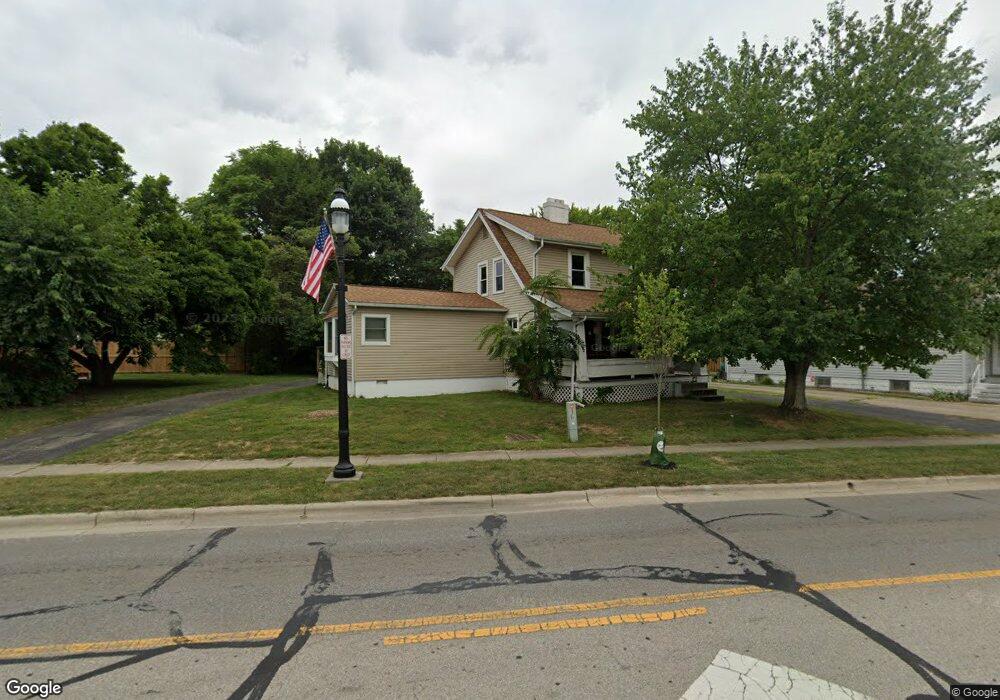
177 Main St Groveport, OH 43125
Estimated Value: $254,000 - $282,000
3
Beds
3
Baths
1,544
Sq Ft
$173/Sq Ft
Est. Value
About This Home
This home is located at 177 Main St, Groveport, OH 43125 and is currently estimated at $267,871, approximately $173 per square foot. 177 Main St is a home located in Franklin County with nearby schools including Groveport Madison High School, Groveport Community School, and Madison Christian School.
Ownership History
Date
Name
Owned For
Owner Type
Purchase Details
Closed on
Jan 13, 2017
Sold by
Bishop Brandon J
Bought by
Bishop Brian T
Current Estimated Value
Purchase Details
Closed on
Jun 27, 2003
Sold by
Winland John M
Bought by
Bishop Brandon J
Purchase Details
Closed on
Mar 4, 1999
Sold by
Winland John M and Winland Sandra E
Bought by
Winland John M and Winland Sandra E
Purchase Details
Closed on
Jun 12, 1974
Bought by
Winland John M and Winland Sandra E
Create a Home Valuation Report for This Property
The Home Valuation Report is an in-depth analysis detailing your home's value as well as a comparison with similar homes in the area
Home Values in the Area
Average Home Value in this Area
Purchase History
| Date | Buyer | Sale Price | Title Company |
|---|---|---|---|
| Bishop Brian T | -- | None Available | |
| Bishop Brandon J | $77,500 | The Title Firm | |
| Winland John M | -- | -- | |
| Winland John M | -- | -- |
Source: Public Records
Tax History Compared to Growth
Tax History
| Year | Tax Paid | Tax Assessment Tax Assessment Total Assessment is a certain percentage of the fair market value that is determined by local assessors to be the total taxable value of land and additions on the property. | Land | Improvement |
|---|---|---|---|---|
| 2024 | $3,620 | $74,030 | $20,200 | $53,830 |
| 2023 | $3,589 | $74,025 | $20,195 | $53,830 |
| 2022 | $2,965 | $48,790 | $8,470 | $40,320 |
| 2021 | $2,976 | $48,790 | $8,470 | $40,320 |
| 2020 | $2,982 | $48,790 | $8,470 | $40,320 |
| 2019 | $2,804 | $40,430 | $7,070 | $33,360 |
| 2018 | $2,559 | $40,430 | $7,070 | $33,360 |
| 2017 | $2,552 | $40,430 | $7,070 | $33,360 |
| 2016 | $2,279 | $29,620 | $5,990 | $23,630 |
| 2015 | $2,300 | $29,620 | $5,990 | $23,630 |
| 2014 | $2,165 | $29,620 | $5,990 | $23,630 |
| 2013 | $970 | $31,150 | $6,300 | $24,850 |
Source: Public Records
Map
Nearby Homes
- 303 Madison St
- 199 Mohr Ave
- 250 Green Ave
- 430 Maple St
- 218-222 Center St
- 287 College St
- 213 Front St
- 135 Front St
- 4822 Elmont Place
- 3450 Rohr Rd
- 3515 Rohr Rd
- 3463 Rohr Rd
- 0 Pontius Rd
- 3461 Rohr Rd
- 7474 Groveport Rd
- 5298 Knight St
- 5777 Ebright Rd
- 5611 Shellbark St
- 5652 Red Alder St
- 5634 Shagbark Place