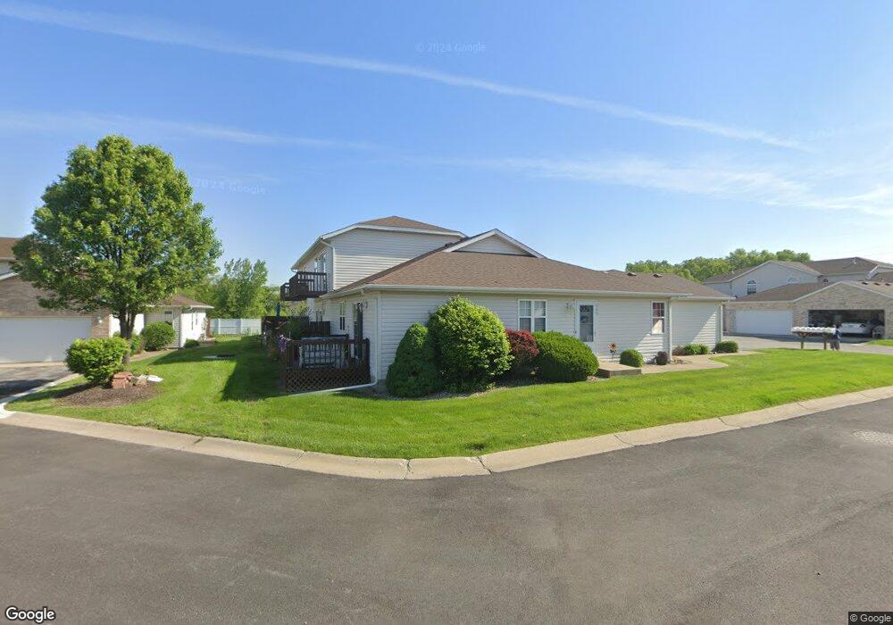
177 Mallard Pointe Dr Unit 9-D Valparaiso, IN 46385
Porter County NeighborhoodEstimated Value: $182,000 - $194,652
2
Beds
2
Baths
1,120
Sq Ft
$168/Sq Ft
Est. Value
About This Home
This home is located at 177 Mallard Pointe Dr Unit 9-D, Valparaiso, IN 46385 and is currently estimated at $187,663, approximately $167 per square foot. 177 Mallard Pointe Dr Unit 9-D is a home located in Porter County with nearby schools including Liberty Elementary School, Liberty Intermediate School, and Chesterton Middle School.
Ownership History
Date
Name
Owned For
Owner Type
Purchase Details
Closed on
Aug 31, 2022
Sold by
Harrigan Patricia R
Bought by
Crum Benji D
Current Estimated Value
Purchase Details
Closed on
Jun 4, 2009
Sold by
Frazier Kevin H
Bought by
Harrigan Patricia R
Home Financials for this Owner
Home Financials are based on the most recent Mortgage that was taken out on this home.
Original Mortgage
$112,917
Interest Rate
4.86%
Mortgage Type
FHA
Purchase Details
Closed on
Aug 3, 2005
Sold by
Duncan Virginia Wireman and Estate Of J L Duncan
Bought by
Frazier Kevin H
Home Financials for this Owner
Home Financials are based on the most recent Mortgage that was taken out on this home.
Original Mortgage
$76,500
Interest Rate
5.82%
Mortgage Type
Fannie Mae Freddie Mac
Create a Home Valuation Report for This Property
The Home Valuation Report is an in-depth analysis detailing your home's value as well as a comparison with similar homes in the area
Home Values in the Area
Average Home Value in this Area
Purchase History
| Date | Buyer | Sale Price | Title Company |
|---|---|---|---|
| Crum Benji D | -- | -- | |
| Harrigan Patricia R | -- | Ticor Title Insurance | |
| Frazier Kevin H | -- | -- |
Source: Public Records
Mortgage History
| Date | Status | Borrower | Loan Amount |
|---|---|---|---|
| Previous Owner | Harrigan Patricia R | $112,917 | |
| Previous Owner | Frazier Kevin H | $76,500 |
Source: Public Records
Tax History Compared to Growth
Tax History
| Year | Tax Paid | Tax Assessment Tax Assessment Total Assessment is a certain percentage of the fair market value that is determined by local assessors to be the total taxable value of land and additions on the property. | Land | Improvement |
|---|---|---|---|---|
| 2024 | $2,490 | $143,200 | $6,800 | $136,400 |
| 2023 | $2,235 | $139,300 | $6,500 | $132,800 |
| 2022 | $730 | $126,000 | $6,500 | $119,500 |
| 2021 | $694 | $97,100 | $6,500 | $90,600 |
| 2020 | $665 | $96,200 | $5,600 | $90,600 |
| 2019 | $588 | $87,600 | $5,600 | $82,000 |
| 2018 | $1,062 | $87,600 | $5,600 | $82,000 |
| 2017 | $1,085 | $87,200 | $5,600 | $81,600 |
| 2016 | $1,129 | $87,600 | $6,000 | $81,600 |
| 2014 | $1,411 | $96,100 | $6,000 | $90,100 |
| 2013 | -- | $91,800 | $6,000 | $85,800 |
Source: Public Records
Map
Nearby Homes
- 186 Mallard Pointe Dr
- 792 Merganser Ln
- 231 Southwind Dr
- 244 Falcon Way
- 240 Southwind Dr
- 812 Concord St
- 748 N 200 W
- 210 Papillon Dr
- 120 W Us Highway 6
- 122 W 850 N
- 249 W 700 N
- 229 W 700 N
- 244 W 700 N
- 776-1 Baltimore Rd
- 275 W 700 N
- 761 Capitol Rd
- 746-1 Capitol Rd
- 775-1 Eagle Creek Rd
- 794 Eagle Creek Rd
- 723 Capitol Rd
- 177 Mallard Pointe Dr
- 175 Mallard Pointe Dr Unit 9
- 173 Mallard Pointe Dr
- 171 Mallard Pointe Dr
- 171 Mallard Pointe Dr
- 171 Mallard Pointe Dr Unit 1
- 171 Mallard Pointe Dr Unit 9-A
- 179 Mallard Pointe Dr
- 179 Mallard Pointe Dr Unit 14-D
- 181 Mallard Pointe Dr
- 181 Mallard Pointe Dr Unit 181
- 181 Mallard Pointe Dr Unit 14-C
- 182 Mallard Pointe Dr
- 182 Mallard Pointe Dr Unit 1
- 0 Mallard Pointe Dr
- 0 Mallard Pointe Dr
- 0 Mallard Pointe Dr Unit NRA352844
- 183 Mallard Pointe Dr
- 183 Mallard Pointe Dr Unit 14-B
- 180 Mallard Pointe Dr