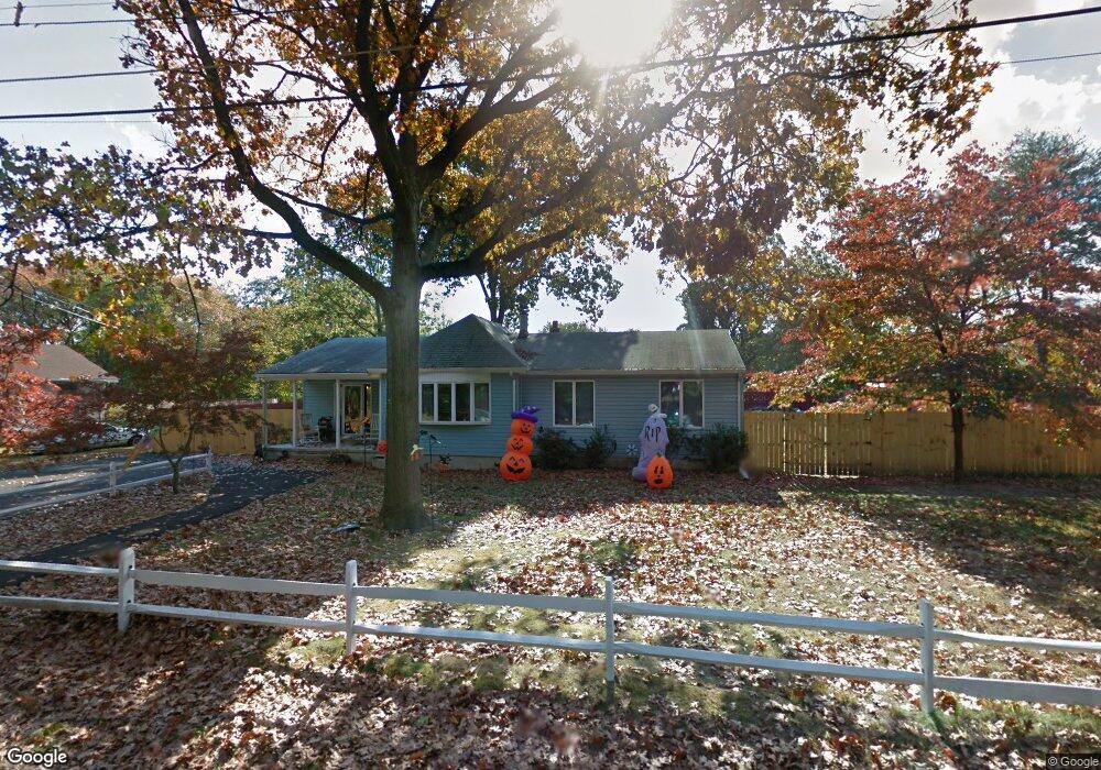
177 Maple Ave West Deptford, NJ 08086
West Deptford Township NeighborhoodEstimated Value: $289,818 - $394,000
--
Bed
--
Bath
1,640
Sq Ft
$210/Sq Ft
Est. Value
About This Home
This home is located at 177 Maple Ave, West Deptford, NJ 08086 and is currently estimated at $344,205, approximately $209 per square foot. 177 Maple Ave is a home located in Gloucester County with nearby schools including Red Bank Elementary School, Oakview Elementary School, and Green-Fields Elementary School.
Ownership History
Date
Name
Owned For
Owner Type
Purchase Details
Closed on
Nov 30, 2022
Sold by
Thompson Michael D and Thompson Marjorie
Bought by
Conway Christen N
Current Estimated Value
Home Financials for this Owner
Home Financials are based on the most recent Mortgage that was taken out on this home.
Original Mortgage
$140,000
Interest Rate
6.31%
Mortgage Type
New Conventional
Purchase Details
Closed on
Jun 4, 2013
Sold by
Conway Marjorie and Conway John
Bought by
Conway Marjorie and Thompson Michael D
Purchase Details
Closed on
Apr 9, 2013
Sold by
Conway John and Conway Marjorie
Bought by
Conway Marjorie and Thompson Michael E
Create a Home Valuation Report for This Property
The Home Valuation Report is an in-depth analysis detailing your home's value as well as a comparison with similar homes in the area
Home Values in the Area
Average Home Value in this Area
Purchase History
| Date | Buyer | Sale Price | Title Company |
|---|---|---|---|
| Conway Christen N | $280,000 | Land Title | |
| Conway Christen N | $280,000 | Land Title | |
| Conway Marjorie | -- | None Available | |
| Conway Marjorie | -- | None Available |
Source: Public Records
Mortgage History
| Date | Status | Borrower | Loan Amount |
|---|---|---|---|
| Previous Owner | Conway Christen N | $140,000 |
Source: Public Records
Tax History Compared to Growth
Tax History
| Year | Tax Paid | Tax Assessment Tax Assessment Total Assessment is a certain percentage of the fair market value that is determined by local assessors to be the total taxable value of land and additions on the property. | Land | Improvement |
|---|---|---|---|---|
| 2025 | $6,740 | $193,000 | $50,200 | $142,800 |
| 2024 | $6,653 | $193,000 | $50,200 | $142,800 |
| 2023 | -- | $193,000 | $50,200 | $142,800 |
| 2022 | -- | $193,000 | $50,200 | $142,800 |
| 2021 | $0 | $193,000 | $50,200 | $142,800 |
| 2020 | $6,005 | $193,000 | $50,200 | $142,800 |
| 2019 | $0 | $193,000 | $50,200 | $142,800 |
| 2018 | $0 | $193,000 | $50,200 | $142,800 |
| 2017 | $0 | $193,000 | $50,200 | $142,800 |
| 2016 | $0 | $193,000 | $50,200 | $142,800 |
| 2015 | -- | $204,300 | $61,500 | $142,800 |
| 2014 | -- | $204,300 | $61,500 | $142,800 |
Source: Public Records
Map
Nearby Homes
- 176 Columbia Ave
- 811 Philadelphia Ave
- 106 N Lincoln Ave
- 1113 Hessian Ave
- 704 Wesley Ave
- 0 S Jefferson Ave Unit NJGL2053472
- 814 Hessian Ave
- 631 Wesley Ave
- 904 Princeton Ave
- 3 N Grove Ave
- 1726 3rd St
- 1676 Miller Ave
- 1678 Miller Ave
- 301 N 5th St
- 320 New Jersey Ave
- 1156 Hessian Ave
- 1134 Brewer Ave
- 1448 Victory Ave
- 304 Monument Ave
- 300 Asbury Ave
- 179 Maple Ave
- 173 Maple Ave
- 176 Lincoln Ave
- 174 Lincoln Ave
- 178 Lincoln Ave
- 171 Maple Ave
- 172 Lincoln Ave
- 170 Lincoln Ave
- 169 Maple Ave
- 177 Lincoln Ave
- 175 Lincoln Ave
- 179 Lincoln Ave
- 173 Lincoln Ave
- 1403 Red Bank Ave
- 1405 Red Bank Ave
- 1401 Red Bank Ave
- 171 Lincoln Ave
- 176 Philadelphia Ave
- 174 Philadelphia Ave
- 178 Philadelphia Ave