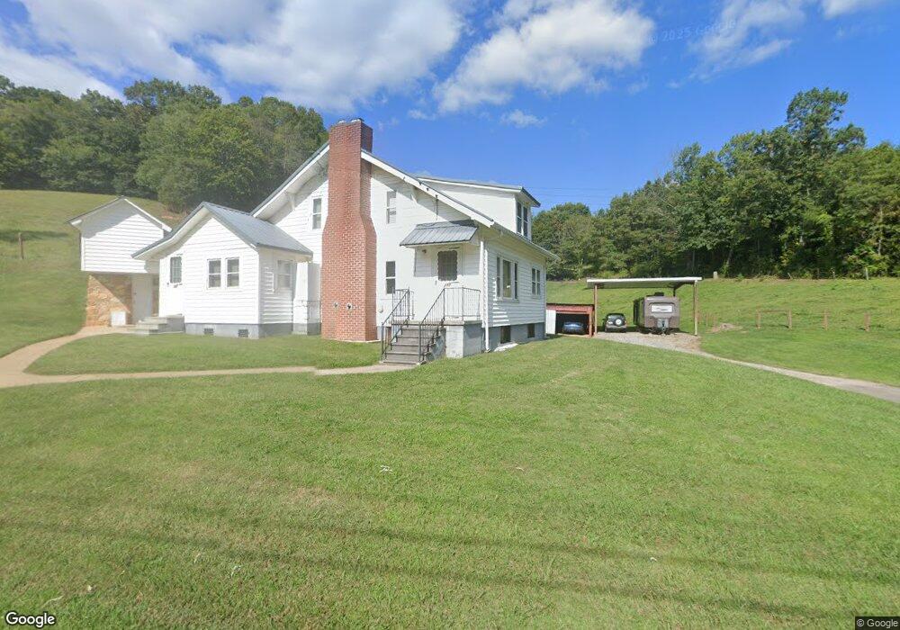
177 Morgan Branch Rd Leicester, NC 28748
Estimated Value: $375,367 - $441,000
3
Beds
2
Baths
1,386
Sq Ft
$292/Sq Ft
Est. Value
About This Home
This home is located at 177 Morgan Branch Rd, Leicester, NC 28748 and is currently estimated at $405,342, approximately $292 per square foot. 177 Morgan Branch Rd is a home located in Buncombe County with nearby schools including Leicester Elementary School, Clyde A. Erwin High School, and Clyde A. Erwin Middle School.
Ownership History
Date
Name
Owned For
Owner Type
Purchase Details
Closed on
Dec 22, 2016
Sold by
Mehaffey Scott Dale and Mehaffey Jennifer Diane
Bought by
Mehaffey Scott Dale and Mehaffey Jennifer Diane
Current Estimated Value
Home Financials for this Owner
Home Financials are based on the most recent Mortgage that was taken out on this home.
Original Mortgage
$165,000
Interest Rate
4.08%
Mortgage Type
New Conventional
Purchase Details
Closed on
Dec 2, 2009
Sold by
Mehaffey R Dale
Bought by
Mehaffey Scott Dale
Create a Home Valuation Report for This Property
The Home Valuation Report is an in-depth analysis detailing your home's value as well as a comparison with similar homes in the area
Home Values in the Area
Average Home Value in this Area
Purchase History
| Date | Buyer | Sale Price | Title Company |
|---|---|---|---|
| Mehaffey Scott Dale | -- | None Available | |
| Mehaffey Scott Dale | -- | None Available |
Source: Public Records
Mortgage History
| Date | Status | Borrower | Loan Amount |
|---|---|---|---|
| Closed | Mehaffey Scott Dale | $165,000 |
Source: Public Records
Tax History Compared to Growth
Tax History
| Year | Tax Paid | Tax Assessment Tax Assessment Total Assessment is a certain percentage of the fair market value that is determined by local assessors to be the total taxable value of land and additions on the property. | Land | Improvement |
|---|---|---|---|---|
| 2025 | -- | $159,200 | $48,000 | $111,200 |
| 2024 | -- | $190,700 | $63,000 | $127,700 |
| 2023 | $1,198 | $190,700 | $63,000 | $127,700 |
| 2022 | $1,198 | $190,700 | $0 | $0 |
| 2021 | $1,198 | $190,700 | $0 | $0 |
| 2020 | $1,067 | $159,500 | $0 | $0 |
| 2019 | $1,067 | $159,500 | $0 | $0 |
| 2018 | $1,067 | $159,500 | $0 | $0 |
| 2017 | $1,083 | $141,400 | $0 | $0 |
| 2016 | $1,052 | $141,400 | $0 | $0 |
| 2015 | $1,052 | $141,400 | $0 | $0 |
| 2014 | $1,010 | $141,400 | $0 | $0 |
Source: Public Records
Map
Nearby Homes
- 263 Morgan Branch Rd
- 315 Morgan Branch Rd
- 36 Brooks Branch Rd
- 61 Brooks Branch Rd
- 00 Potato Branch Rd
- 51 Homefire Cove
- 111 Oak Mountain Dr
- 99999 Hidden Cove Rd
- 1451 Newfound Rd
- 1455 Newfound Rd
- 00 Michele Ln Unit 4
- 19 Mossy Rock Ln Unit 76
- 70 Stonegate Trail
- 119 Pinnacle Mountain Rd
- 99999 Dark Cove Rd
- 99 Margaret Dr
- 171 View Ridge Pkwy
- 185 Blossom Ridge
- 1567 Newfound Rd
- 25 View Ridge Pkwy
- 00 Sunny Acres Ln
- 201 Morgan Branch Rd
- 148 Morgan Branch Rd
- 209 Morgan Branch Rd
- 219 Morgan Branch Rd
- 117 Morgan Branch Rd
- 1 Potato Branch Rd
- 4 Potato Branch Rd
- 259 Morgan Branch Rd
- 208 Morgan Branch Rd
- 29 Morgan Branch Rd
- 210 Brooks Branch Rd
- 210 Brooks Branch Rd Unit Lot B
- 210 Brooks Branch Rd Unit Lot A
- 87 Morgan Branch Rd
- 36 Potato Branch Rd
- 27 Morgan Branch Rd
- 75 Morgan Branch Rd
- 321 Morgan Branch Rd
- 198 Brooks Branch Rd