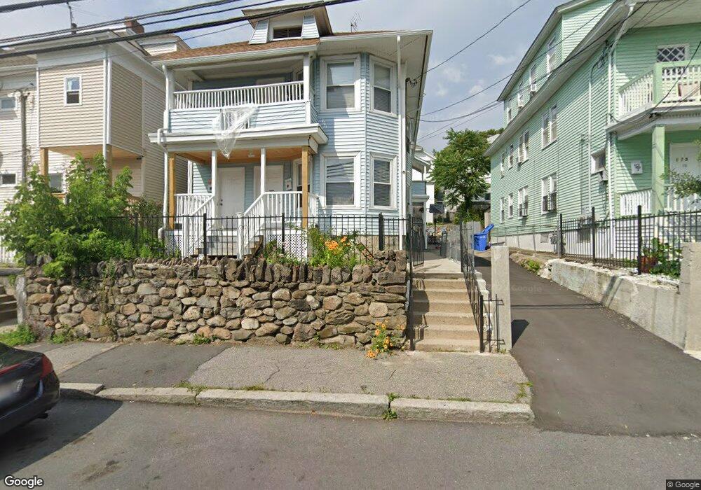
177 Saratoga St Unit 179 Lawrence, MA 01841
Arlington NeighborhoodEstimated Value: $605,491 - $762,000
6
Beds
2
Baths
2,592
Sq Ft
$260/Sq Ft
Est. Value
About This Home
This home is located at 177 Saratoga St Unit 179, Lawrence, MA 01841 and is currently estimated at $672,873, approximately $259 per square foot. 177 Saratoga St Unit 179 is a home located in Essex County with nearby schools including School For Exceptional Studies and Central Catholic High School.
Ownership History
Date
Name
Owned For
Owner Type
Purchase Details
Closed on
Aug 14, 2002
Sold by
Pena Ramon M and Pena Gloria
Bought by
Perez Mercedes
Current Estimated Value
Home Financials for this Owner
Home Financials are based on the most recent Mortgage that was taken out on this home.
Original Mortgage
$190,950
Outstanding Balance
$81,147
Interest Rate
6.61%
Mortgage Type
Purchase Money Mortgage
Estimated Equity
$591,726
Create a Home Valuation Report for This Property
The Home Valuation Report is an in-depth analysis detailing your home's value as well as a comparison with similar homes in the area
Home Values in the Area
Average Home Value in this Area
Purchase History
| Date | Buyer | Sale Price | Title Company |
|---|---|---|---|
| Perez Mercedes | $201,000 | -- |
Source: Public Records
Mortgage History
| Date | Status | Borrower | Loan Amount |
|---|---|---|---|
| Open | Perez Mercedes | $190,950 | |
| Previous Owner | Perez Mercedes | $134,800 | |
| Previous Owner | Perez Mercedes | $30,000 |
Source: Public Records
Tax History Compared to Growth
Tax History
| Year | Tax Paid | Tax Assessment Tax Assessment Total Assessment is a certain percentage of the fair market value that is determined by local assessors to be the total taxable value of land and additions on the property. | Land | Improvement |
|---|---|---|---|---|
| 2025 | $4,800 | $545,500 | $100,700 | $444,800 |
| 2024 | $4,712 | $509,400 | $105,800 | $403,600 |
| 2023 | $4,961 | $488,300 | $102,100 | $386,200 |
| 2022 | $4,688 | $409,800 | $96,300 | $313,500 |
| 2021 | $4,580 | $373,300 | $96,300 | $277,000 |
| 2020 | $4,419 | $355,500 | $80,200 | $275,300 |
| 2019 | $3,781 | $276,400 | $59,700 | $216,700 |
| 2018 | $3,494 | $244,000 | $54,000 | $190,000 |
| 2017 | $3,284 | $214,100 | $51,200 | $162,900 |
| 2016 | $3,085 | $198,900 | $40,000 | $158,900 |
| 2015 | $2,846 | $188,200 | $40,000 | $148,200 |
Source: Public Records
Map
Nearby Homes
- 5 Arlington Terrace
- 129-131 Lexington St
- 169 Berkeley St
- 183 Berkeley St
- 364 Lawrence St
- 2 Lawrence St
- 83 Oakside Ave
- 82 Oakside Ave
- 87 Oakside Ave
- 7 Magnolia Rd
- 434-438 Hampshire St
- 18 Larchwood Rd
- 24 Bennington St
- 6 Longwood Dr
- 29 Center St
- 27 Exchange St
- 32 Alma St Unit 32
- 29 Willow St Unit B
- 20 Knox St Unit 43
- 20 Knox St Unit 23
- 171 Saratoga St Unit 173
- 48 Stearns Ave Unit 50
- 48-50 Stearns Ave
- 2-4 Birch Dr
- 167 Saratoga St Unit 169
- 182 Saratoga St Unit 184
- 18 Birch St Unit 20
- 14 Birch St Unit 18
- 28 Birch St
- 178 Saratoga St Unit 180
- 2 Stearns Ave
- 163 Saratoga St Unit 165
- 174 Saratoga St Unit 176
- 10 Birch St
- 10 Birch St Unit 12
- 170 Saratoga St Unit 172
- 194 Saratoga St Unit 196
- 81-83 Stearns Ave
- 17 Birch St Unit 19
- 81 Stearns Ave Unit 83