Estimated Value: $348,000 - $419,000
3
Beds
2
Baths
2,174
Sq Ft
$177/Sq Ft
Est. Value
About This Home
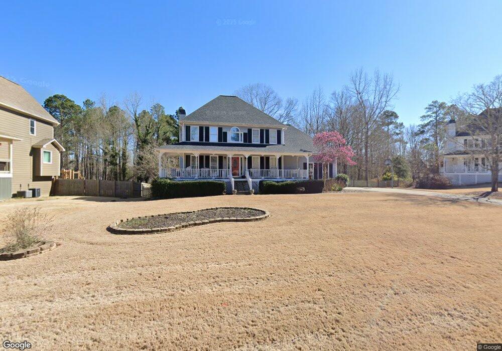
This home is located at 177 Somersby Ln, Hiram, GA 30141 and is currently estimated at $383,788, approximately $176 per square foot. 177 Somersby Ln is a home located in Paulding County with nearby schools including Bessie L. Baggett Elementary School, J. A. Dobbins Middle School, and Hiram High School.
Ownership History
Date
Name
Owned For
Owner Type
Purchase Details
Closed on
Jul 22, 2021
Sold by
Sanders Rayford Stuart
Bought by
Sanders Rayford Stuart and Sanders Elizabeth Ashley
Current Estimated Value
Purchase Details
Closed on
Jun 30, 2004
Sold by
Mooneyham Alan W and Mooneyham Edwin L
Bought by
Sanders Rayford S
Home Financials for this Owner
Home Financials are based on the most recent Mortgage that was taken out on this home.
Original Mortgage
$151,900
Interest Rate
5.38%
Mortgage Type
New Conventional
Create a Home Valuation Report for This Property
The Home Valuation Report is an in-depth analysis detailing your home's value as well as a comparison with similar homes in the area
Home Values in the Area
Average Home Value in this Area
Purchase History
| Date | Buyer | Sale Price | Title Company |
|---|---|---|---|
| Sanders Rayford Stuart | -- | -- | |
| Sanders Rayford S | $189,900 | -- |
Source: Public Records
Mortgage History
| Date | Status | Borrower | Loan Amount |
|---|---|---|---|
| Previous Owner | Sanders Rayford S | $151,900 |
Source: Public Records
Tax History Compared to Growth
Tax History
| Year | Tax Paid | Tax Assessment Tax Assessment Total Assessment is a certain percentage of the fair market value that is determined by local assessors to be the total taxable value of land and additions on the property. | Land | Improvement |
|---|---|---|---|---|
| 2024 | $3,314 | $136,456 | $14,000 | $122,456 |
| 2023 | $3,691 | $144,120 | $14,000 | $130,120 |
| 2022 | $3,349 | $130,328 | $14,000 | $116,328 |
| 2021 | $3,099 | $108,504 | $14,000 | $94,504 |
| 2020 | $2,511 | $86,380 | $14,000 | $72,380 |
| 2019 | $2,343 | $79,612 | $14,000 | $65,612 |
| 2018 | $2,462 | $83,588 | $12,000 | $71,588 |
| 2017 | $2,130 | $71,576 | $12,000 | $59,576 |
| 2016 | $1,822 | $62,124 | $12,000 | $50,124 |
| 2015 | $2,008 | $67,092 | $12,000 | $55,092 |
| 2014 | $1,682 | $55,132 | $12,000 | $43,132 |
| 2013 | -- | $56,160 | $16,000 | $40,160 |
Source: Public Records
Map
Nearby Homes
- 554 Morningside Dr
- 589 Linda Ln
- 288 Valerie Cir
- 820 Bennett Rd
- 81 Lawanda Ln
- 214 S Lake Dr
- 0 Morris Rd Unit 7337374
- 0 Morris Rd Unit 10626403
- 0 Morris Rd Unit 10352308
- 2794 Cleburne Pkwy
- 480 Pool Rd
- 24 Echo Ridge Dr
- 259 Pine Valley Dr
- 67 Haley Ct
- 175 Arnold Ln
- 954 Pool Rd
- 4291 Defoors Farm Trail
- 485 Angham Rd
- 64 Cove Dr
- 45 Laird Rd
- 141 Somersby Ln
- 185 Somersby Ln
- 125 Somersby Ln
- 125 Somerby Ln
- 125 Somerby Ln Unit 125
- 178 Somersby Ln
- 156 Somersby Ln
- 186 Somersby Ln
- 103 Somersby Ln
- 136 Somersby Ln
- 440 Cotton Mill Dr
- 422 Cotton Mill Dr
- 506 Cotton Mill Dr
- 118 Somersby Ln
- 518 Cotton Mill Dr
- 630 Morningside Dr
- 484 Cotton Mill Dr
- 384 Cotton Mill Dr
- 658 Morningside Dr
- 81 Somersby Ln