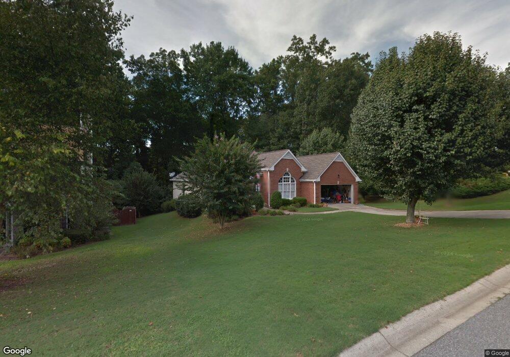
1770 Clayton Cir Cumming, GA 30040
Estimated Value: $432,424 - $497,000
3
Beds
2
Baths
1,980
Sq Ft
$232/Sq Ft
Est. Value
About This Home
This home is located at 1770 Clayton Cir, Cumming, GA 30040 and is currently estimated at $459,356, approximately $231 per square foot. 1770 Clayton Cir is a home located in Forsyth County with nearby schools including Cumming Elementary School, Otwell Middle School, and Forsyth Central High School.
Ownership History
Date
Name
Owned For
Owner Type
Purchase Details
Closed on
Jun 30, 2009
Sold by
Walton Barry W and Walton Mendy L
Bought by
Schroeder Linda E
Current Estimated Value
Home Financials for this Owner
Home Financials are based on the most recent Mortgage that was taken out on this home.
Original Mortgage
$100,000
Outstanding Balance
$63,520
Interest Rate
4.79%
Mortgage Type
New Conventional
Estimated Equity
$395,836
Purchase Details
Closed on
Jun 30, 1998
Sold by
D R Horton Inc
Bought by
Walton Barry W and Walton Mendy L
Home Financials for this Owner
Home Financials are based on the most recent Mortgage that was taken out on this home.
Original Mortgage
$145,200
Interest Rate
7.04%
Mortgage Type
VA
Create a Home Valuation Report for This Property
The Home Valuation Report is an in-depth analysis detailing your home's value as well as a comparison with similar homes in the area
Home Values in the Area
Average Home Value in this Area
Purchase History
| Date | Buyer | Sale Price | Title Company |
|---|---|---|---|
| Schroeder Linda E | $172,000 | -- | |
| Walton Barry W | $142,400 | -- |
Source: Public Records
Mortgage History
| Date | Status | Borrower | Loan Amount |
|---|---|---|---|
| Open | Schroeder Linda E | $100,000 | |
| Previous Owner | Walton Barry W | $145,200 |
Source: Public Records
Tax History Compared to Growth
Tax History
| Year | Tax Paid | Tax Assessment Tax Assessment Total Assessment is a certain percentage of the fair market value that is determined by local assessors to be the total taxable value of land and additions on the property. | Land | Improvement |
|---|---|---|---|---|
| 2025 | $526 | $165,856 | $40,000 | $125,856 |
| 2024 | $526 | $158,324 | $38,000 | $120,324 |
| 2023 | $423 | $153,268 | $30,000 | $123,268 |
| 2022 | $525 | $102,272 | $30,000 | $72,272 |
| 2021 | $571 | $102,272 | $30,000 | $72,272 |
| 2020 | $572 | $102,536 | $30,000 | $72,536 |
| 2019 | $560 | $86,640 | $18,000 | $68,640 |
| 2018 | $534 | $73,984 | $18,000 | $55,984 |
| 2017 | $551 | $75,144 | $18,000 | $57,144 |
| 2016 | $493 | $67,944 | $16,000 | $51,944 |
| 2015 | $493 | $67,944 | $16,000 | $51,944 |
| 2014 | $415 | $61,252 | $0 | $0 |
Source: Public Records
Map
Nearby Homes
- 1515 Adair Blvd
- 526 Sawnee Dr Unit D61
- 1525 Camden Cove Dr
- 1895 Nestledown Dr
- 460 Tribble Gap Rd Unit 102
- 460 Tribble Gap Rd Unit 604
- 306 Somerton Place
- 1725 Mountainside Dr
- 514 Sawnee Village Blvd Unit D55
- 99 Mountain Brook Dr
- 516 Sawnee Village Blvd Unit D56
- 518 Sawnee Village Blvd Unit D57
- 520 Sawnee Village Blvd Unit D58
- 522 Sawnee Village Blvd Unit D59
- 524 Sawnee Village Blvd Unit D60
- 528 Sawnee Village Blvd Unit D62
- 536 Sawnee Village Blvd Unit D66
- 533 Godfrey Dr
- 542 Sawnee Village Blvd Unit 69
- 1780 Clayton Cir
- 1750 Clayton Cir
- 1790 Clayton Cir
- 1775 Clayton Cir
- 1765 Clayton Cir
- 1785 Clayton Cir
- 0 Clayton Cir Unit 7414392
- 0 Clayton Cir Unit 7391683
- 0 Clayton Cir Unit 8669317
- 0 Clayton Cir Unit 8173611
- 0 Clayton Cir Unit 8568427
- 0 Clayton Cir
- 1755 Clayton Cir
- 1740 Clayton Cir
- 1660 Glenwood Cir
- 1650 Glenwood Cir
- 1800 Clayton Cir
- 1640 Glenwood Cir
- 1795 Clayton Cir
- 1805 Clayton Cir