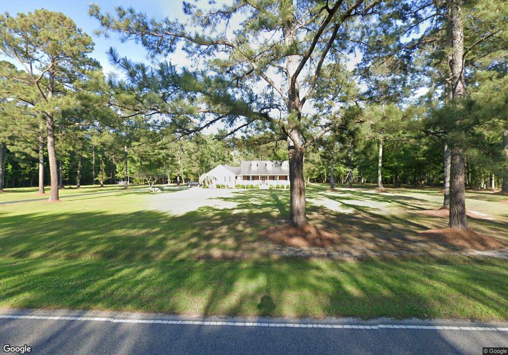
1770 Dirty Branch Rd Conway, SC 29527
Estimated Value: $290,000 - $400,803
3
Beds
3
Baths
1,946
Sq Ft
$166/Sq Ft
Est. Value
About This Home
This home is located at 1770 Dirty Branch Rd, Conway, SC 29527 and is currently estimated at $323,701, approximately $166 per square foot. 1770 Dirty Branch Rd is a home located in Horry County with nearby schools including Pee Dee Elementary School, Whittemore Park Middle School, and Conway High School.
Create a Home Valuation Report for This Property
The Home Valuation Report is an in-depth analysis detailing your home's value as well as a comparison with similar homes in the area
Home Values in the Area
Average Home Value in this Area
Tax History Compared to Growth
Tax History
| Year | Tax Paid | Tax Assessment Tax Assessment Total Assessment is a certain percentage of the fair market value that is determined by local assessors to be the total taxable value of land and additions on the property. | Land | Improvement |
|---|---|---|---|---|
| 2024 | $963 | $14,668 | $4,400 | $10,268 |
| 2023 | $963 | $8,273 | $1,673 | $6,600 |
| 2021 | $872 | $9,892 | $1,740 | $8,152 |
| 2020 | $764 | $9,892 | $1,740 | $8,152 |
| 2019 | $764 | $9,892 | $1,740 | $8,152 |
| 2018 | $689 | $7,194 | $1,454 | $5,740 |
| 2017 | $674 | $7,194 | $1,454 | $5,740 |
| 2016 | -- | $7,194 | $1,454 | $5,740 |
| 2015 | $674 | $7,194 | $1,454 | $5,740 |
| 2014 | $623 | $7,194 | $1,454 | $5,740 |
Source: Public Records
Map
Nearby Homes
- 1911 Dirty Branch Rd
- 3230 Merganser Dr
- 3120 Merganser Dr
- 1300 Ruddy Ct
- 2812 Highway 378
- 3524 Merganser Dr
- 1301 Mandarin Dr
- 2626 Highway 378
- 0 Juniper Bay Rd
- 2706 Green Pond Cir
- 1036 MacAla Dr
- 1233 Dunraven Ct
- 4005 Cosmos Ct Unit Dunlin- Lot 761
- 4004 Cosmos Ct Unit Ibis- Lot 759
- TBD New Rd
- 1048 Cadbury Ct
- 1049 Augustus Dr
- 5241 Cates Bay Hwy
- 7.4 Acs Cates Bay Hwy Unit Lot 10
- 5.47 Acs Cates Bay Hwy Unit Lot 4
- 1750 Dirty Branch Rd
- 1746 Dirty Branch Rd
- 0 Dirty Branch Rd SW Unit 1801532
- Dirty Branch Rd Dirty Branch Rd
- TBD 28.82 Acres Dirty Branch Rd
- 1775 Dirty Branch Rd
- 1749 Dirty Branch Rd
- 1879 Dirty Branch Rd
- 1882 Dirty Branch Rd
- 1951 Dirty Branch Rd Unit 1952 Dirty Branch Rd
- 1949 Dirty Branch Rd
- 4201 Ossie Ln
- 1688 Dirty Branch Rd
- 1952 Dirty Branch Rd
- 9433 Carrington Dr
- 1676 Dirty Branch Rd
- 4213 Ossie Ln
- TBD Dirty Branch Rd Unit 28.28 Acres Dirty Br
- TBD Dirty Branch Rd
- 1959 Dirty Branch Rd