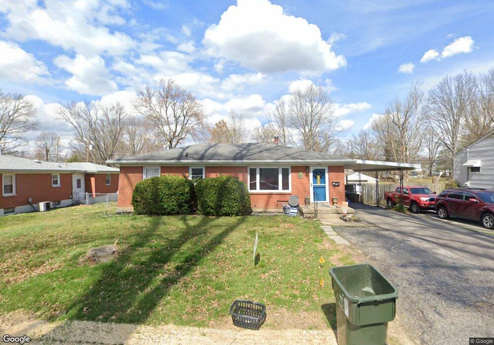
1770 N Audubon Dr New Albany, IN 47150
Estimated Value: $188,000 - $240,000
3
Beds
2
Baths
1,652
Sq Ft
$130/Sq Ft
Est. Value
About This Home
This home is located at 1770 N Audubon Dr, New Albany, IN 47150 and is currently estimated at $214,770, approximately $130 per square foot. 1770 N Audubon Dr is a home located in Floyd County with nearby schools including Fairmont Elementary School, Hazelwood Middle School, and New Albany Senior High School.
Ownership History
Date
Name
Owned For
Owner Type
Purchase Details
Closed on
Oct 22, 2021
Sold by
Davis David M
Bought by
Bostock Angelyn R
Current Estimated Value
Home Financials for this Owner
Home Financials are based on the most recent Mortgage that was taken out on this home.
Original Mortgage
$176,739
Outstanding Balance
$161,356
Interest Rate
2.88%
Mortgage Type
FHA
Estimated Equity
$53,414
Purchase Details
Closed on
Mar 7, 2008
Sold by
Hancock Doris G and Hancock George R
Bought by
Davis David M
Home Financials for this Owner
Home Financials are based on the most recent Mortgage that was taken out on this home.
Original Mortgage
$109,186
Interest Rate
5.51%
Mortgage Type
FHA
Create a Home Valuation Report for This Property
The Home Valuation Report is an in-depth analysis detailing your home's value as well as a comparison with similar homes in the area
Home Values in the Area
Average Home Value in this Area
Purchase History
| Date | Buyer | Sale Price | Title Company |
|---|---|---|---|
| Bostock Angelyn R | $360,000 | None Available | |
| Davis David M | -- | None Available |
Source: Public Records
Mortgage History
| Date | Status | Borrower | Loan Amount |
|---|---|---|---|
| Open | Bostock Angelyn R | $176,739 | |
| Previous Owner | Davis David M | $109,186 |
Source: Public Records
Tax History Compared to Growth
Tax History
| Year | Tax Paid | Tax Assessment Tax Assessment Total Assessment is a certain percentage of the fair market value that is determined by local assessors to be the total taxable value of land and additions on the property. | Land | Improvement |
|---|---|---|---|---|
| 2024 | $1,334 | $128,600 | $18,000 | $110,600 |
| 2023 | $1,524 | $131,100 | $18,000 | $113,100 |
| 2022 | $1,396 | $132,300 | $18,000 | $114,300 |
| 2021 | $1,202 | $117,800 | $18,000 | $99,800 |
| 2020 | $1,160 | $117,800 | $18,000 | $99,800 |
| 2019 | $1,122 | $117,800 | $18,000 | $99,800 |
| 2018 | $882 | $103,600 | $18,000 | $85,600 |
| 2017 | $777 | $96,300 | $18,000 | $78,300 |
| 2016 | $792 | $100,900 | $18,000 | $82,900 |
| 2014 | $749 | $93,500 | $18,000 | $75,500 |
| 2013 | -- | $91,100 | $18,000 | $73,100 |
Source: Public Records
Map
Nearby Homes
- 1749 McDonald Ln
- 8 Robin Ct
- 2550 Broadway St
- 2548 Broadway St
- 1672 Garretson Ln
- 1709 Millerwood Dr
- 2705 Charlestown Rd
- 3105 Murr Ln
- 823 Elmwood Ave
- 1655 Harriett Ct
- 2218 Fairmont Ave
- 6369 Indiana 111
- 805 Elmwood Ave
- 1651 Summit Ave
- 1324 Roosevelt Ave
- 1352 Miller Ln
- 1435 Bellemeade Dr
- 1413 Silver Slate Dr
- 2127 Willard Ave
- 2115 Loop Island Way
- 1768 N Audubon Dr
- 1772 N Audubon Dr
- 2634 Roanoke Ave
- 1764 N Audubon Dr
- 1771 N Audubon Dr
- 1769 N Audubon Dr
- 1775 N Audubon Dr
- 1 Brookview Dr
- 2632 Roanoke Ave
- 1762 N Audubon Dr
- 1765 N Audubon Dr
- 34 Brookview Dr
- 2631 Roanoke Ave
- 2 Brookview Dr
- 1763 N Audubon Dr
- 1770 S Audubon Dr
- 2629 Roanoke Ave
- 1768 S Audubon Dr
- 1774 S Audubon Dr
- 33 Brookview Dr