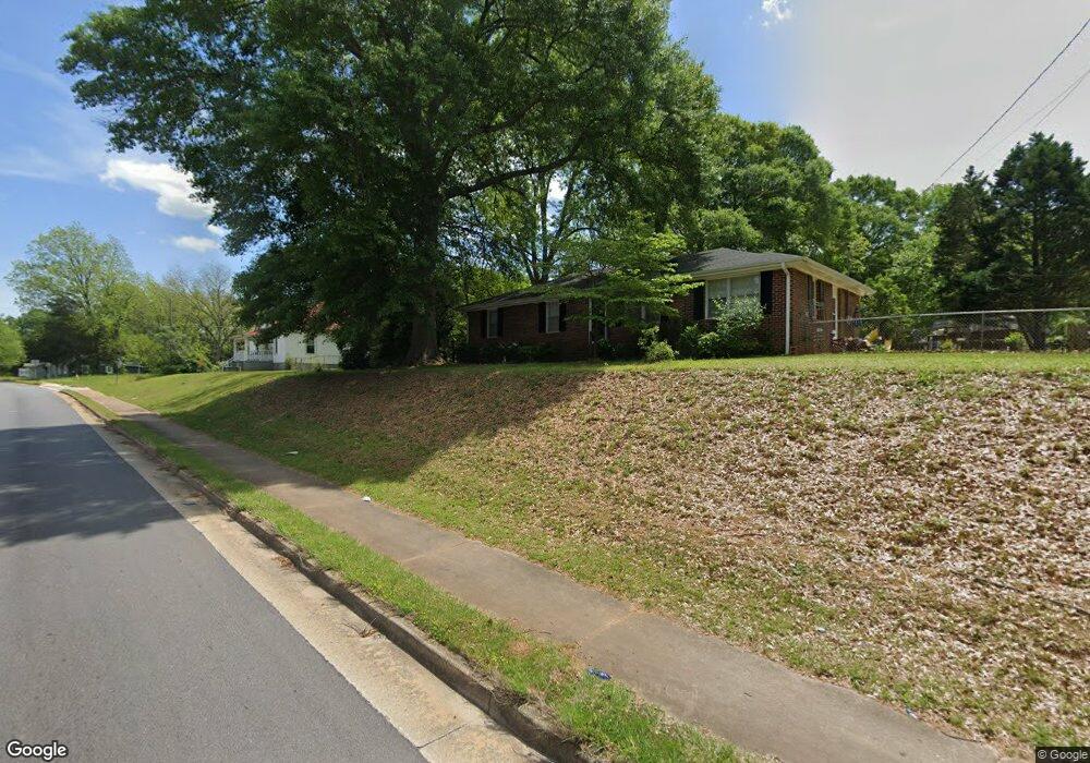
1770 W Mcintosh Rd Griffin, GA 30223
Spalding County NeighborhoodEstimated Value: $176,000 - $212,000
3
Beds
2
Baths
1,485
Sq Ft
$129/Sq Ft
Est. Value
About This Home
This home is located at 1770 W Mcintosh Rd, Griffin, GA 30223 and is currently estimated at $191,107, approximately $128 per square foot. 1770 W Mcintosh Rd is a home located in Spalding County with nearby schools including Cowan Road Elementary School, Cowan Road Middle School, and Griffin High School.
Ownership History
Date
Name
Owned For
Owner Type
Purchase Details
Closed on
Nov 10, 1989
Sold by
Snow Theresa
Bought by
Mann Brenda L
Current Estimated Value
Purchase Details
Closed on
Mar 28, 1986
Sold by
Snow Kenneth Tim and Snow Theresa
Bought by
Snow Theresa
Purchase Details
Closed on
Apr 12, 1984
Sold by
Manning James R
Bought by
Snow Kenneth Tim and Snow Theresa
Purchase Details
Closed on
Jan 16, 1983
Sold by
Manning James and Manning Paula S
Bought by
Manning James R
Purchase Details
Closed on
Sep 8, 1975
Sold by
Shivers J B
Bought by
Manning James and Manning Paula S
Purchase Details
Closed on
Feb 7, 1947
Bought by
Shivers J B
Create a Home Valuation Report for This Property
The Home Valuation Report is an in-depth analysis detailing your home's value as well as a comparison with similar homes in the area
Home Values in the Area
Average Home Value in this Area
Purchase History
| Date | Buyer | Sale Price | Title Company |
|---|---|---|---|
| Mann Brenda L | $57,000 | -- | |
| Snow Theresa | -- | -- | |
| Snow Kenneth Tim | $41,500 | -- | |
| Manning James R | -- | -- | |
| Manning James | -- | -- | |
| Shivers J B | -- | -- |
Source: Public Records
Tax History Compared to Growth
Tax History
| Year | Tax Paid | Tax Assessment Tax Assessment Total Assessment is a certain percentage of the fair market value that is determined by local assessors to be the total taxable value of land and additions on the property. | Land | Improvement |
|---|---|---|---|---|
| 2024 | $576 | $66,140 | $8,640 | $57,500 |
| 2023 | $576 | $66,140 | $8,640 | $57,500 |
| 2022 | $834 | $55,484 | $7,200 | $48,284 |
| 2021 | $306 | $33,356 | $5,760 | $27,596 |
| 2020 | $455 | $33,356 | $5,760 | $27,596 |
| 2019 | $463 | $33,356 | $5,760 | $27,596 |
| 2018 | $450 | $30,816 | $5,760 | $25,056 |
| 2017 | $612 | $30,270 | $5,760 | $24,510 |
Source: Public Records
Map
Nearby Homes
- 115 1st Ave
- 1611 Hallmark Hills Dr
- 1643 Hallmark Hills Dr
- 1652 Hallmark Hills Dr
- 4038 W Mcintosh Rd
- 164 Crystal Brook
- 153 Crystal Brook Unit 2
- 1812 W Mcintosh Rd
- 1804, 1796 W Mcintosh Rd
- 150 Crystal Brook
- 1527 Ridgewood Dr
- 105 Wedgewood Walk
- 110 Wedgewood Walk
- 1464 Beatty St
- 116 Crystal Brook
- 1807 Ridge St
- 86 Crystal Brook Unit 3
- 82 Crystal Brook
- 1429 Beatty St
- 1414 Lucky St
- 412 Overcup Ct
- 1756 W Mcintosh Rd
- 1775 W Mcintosh Rd
- 1602 Morgan Dr
- 1789 W Mcintosh Rd
- 1777 W Mcintosh Rd
- 104 2nd Ave
- 107 1st Ave
- 1604 Morgan Dr
- 106 2nd Ave
- 1742 W Mcintosh Rd
- 1801 W Mcintosh Rd
- 109 1st Ave
- 108 1st Ave
- 82 AC E McIntosh and 2nd St
- 1732 W Mcintosh Rd
- 103 2nd Ave
- 1606 Morgan Dr
- 108 2nd Ave
- 1601 Hallmark Dr