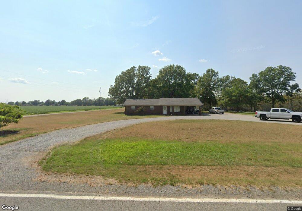
17700 Highway 13 S Humnoke, AR 72072
Estimated Value: $38,000 - $113,000
--
Bed
2
Baths
1,493
Sq Ft
$49/Sq Ft
Est. Value
About This Home
This home is located at 17700 Highway 13 S, Humnoke, AR 72072 and is currently estimated at $73,008, approximately $48 per square foot. 17700 Highway 13 S is a home located in Lonoke County with nearby schools including Carlisle Elementary School and Carlisle High School.
Ownership History
Date
Name
Owned For
Owner Type
Purchase Details
Closed on
Dec 2, 2020
Sold by
Watson Brenda G and Schuk Michael
Bought by
Wilson Michael and Wilson Dana
Current Estimated Value
Purchase Details
Closed on
Sep 23, 2011
Sold by
Jones Thomas F and Jones Betty J
Bought by
Watson Brenda G
Purchase Details
Closed on
Jan 18, 2005
Bought by
Crawford, Joan E Rev Trust
Purchase Details
Closed on
Jun 10, 1996
Sold by
Jones Thomas F and Jones Betty J
Bought by
Watson Brenda G
Purchase Details
Closed on
Feb 14, 1994
Bought by
Crawford
Create a Home Valuation Report for This Property
The Home Valuation Report is an in-depth analysis detailing your home's value as well as a comparison with similar homes in the area
Home Values in the Area
Average Home Value in this Area
Purchase History
| Date | Buyer | Sale Price | Title Company |
|---|---|---|---|
| Wilson Michael | $25,000 | None Available | |
| Wilson Michael | $25,000 | None Listed On Document | |
| Watson Brenda G | -- | -- | |
| Crawford, Joan E Rev Trust | -- | -- | |
| Watson Brenda G | -- | -- | |
| Crawford | $27,300 | -- | |
| Crawford | $27,300 | -- |
Source: Public Records
Tax History Compared to Growth
Tax History
| Year | Tax Paid | Tax Assessment Tax Assessment Total Assessment is a certain percentage of the fair market value that is determined by local assessors to be the total taxable value of land and additions on the property. | Land | Improvement |
|---|---|---|---|---|
| 2025 | $259 | $14,140 | $1,480 | $12,660 |
| 2024 | $259 | $14,140 | $1,480 | $12,660 |
| 2023 | $259 | $14,140 | $1,480 | $12,660 |
| 2022 | $309 | $14,140 | $1,480 | $12,660 |
| 2021 | $309 | $14,140 | $1,480 | $12,660 |
| 2020 | $74 | $13,570 | $1,480 | $12,090 |
| 2019 | $52 | $13,570 | $1,480 | $12,090 |
| 2018 | $77 | $13,570 | $1,480 | $12,090 |
| 2017 | $427 | $13,570 | $1,480 | $12,090 |
| 2016 | $77 | $13,570 | $1,480 | $12,090 |
| 2015 | $427 | $13,970 | $1,480 | $12,490 |
| 2014 | $77 | $13,970 | $1,480 | $12,490 |
Source: Public Records
Map
Nearby Homes
- 0 Hwy 165 Unit 24-2125
- 738 Flynn Bridge Rd
- 260 Jackson St
- 1516 Ball Rd
- 1423 Ball Rd
- 000 Burlison Ln
- 000 Perry Rd
- 000 Henderson Rd Unit Indian Bayou, Lonoke
- 106 S Main St
- 0 Clearpoint Brasko Rd Unit 24511204
- 516 S Hickory St
- 3061 Highway 79 S
- 4704 Central High Rd
- 000 Senning Loop
- 0 Tbd Tar Bottom Rd
- 000 Hwy 79 Hwy
- 0 Tbd Highway 15
- 1820 Beumer St
- 1004 Stone Ln
- 2106 Beumer St
- 17685 Highway 13 S
- 17667 Highway 13 S
- 217 Crooked Creek Ln
- 17888 Highway 13 S
- 17355 Highway 13 S
- 17355 Highway 13 S
- 17433 Highway 13 S
- 220 Rockwell Rd
- 350 Crooked Creek Ln
- 17905 Highway 13 S
- 17189 Highway 13 S
- 386 Rockwell Rd
- 512 Rockwell Rd
- 485 Rockwell Rd
- 534 Rockwell Rd
- 567 Rockwell Rd
- 541 Rockwell Rd
- 619 Rockwell Rd
- 18605 Highway 13 S
- 18201 Highway 13 S