Estimated Value: $173,000 - $202,500
3
Beds
2
Baths
1,542
Sq Ft
$122/Sq Ft
Est. Value
About This Home
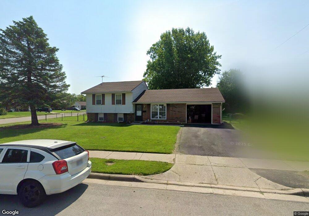
This home is located at 1771 Atkinson Dr, Xenia, OH 45385 and is currently estimated at $188,625, approximately $122 per square foot. 1771 Atkinson Dr is a home located in Greene County with nearby schools including Xenia High School, Summit Academy Community School for Alternative Learners - Xenia, and Legacy Christian Academy.
Ownership History
Date
Name
Owned For
Owner Type
Purchase Details
Closed on
Dec 13, 2013
Sold by
Federal Home Loan Mortgage Corporation
Bought by
Anjo Rental Holdings Llc
Current Estimated Value
Purchase Details
Closed on
Jul 24, 2013
Sold by
Tolley Norman L and Strider Shawn
Bought by
Federal Home Loan Mortgage Corp
Purchase Details
Closed on
Jan 24, 2008
Sold by
Strider Shawn and Tolley Norman L
Bought by
Strider Shawn and Tolley Norman L
Purchase Details
Closed on
Jun 26, 2003
Sold by
Hanes Mary L
Bought by
Tolley Norman L and Strider Shawn E
Home Financials for this Owner
Home Financials are based on the most recent Mortgage that was taken out on this home.
Original Mortgage
$88,553
Interest Rate
5.4%
Mortgage Type
FHA
Purchase Details
Closed on
Aug 29, 2002
Sold by
Hanes Ralph J and Hanes Mary L
Bought by
Hanes Mary L and The Mary L Hanes Revocable Living Trust
Create a Home Valuation Report for This Property
The Home Valuation Report is an in-depth analysis detailing your home's value as well as a comparison with similar homes in the area
Home Values in the Area
Average Home Value in this Area
Purchase History
| Date | Buyer | Sale Price | Title Company |
|---|---|---|---|
| Anjo Rental Holdings Llc | -- | None Available | |
| Federal Home Loan Mortgage Corp | $54,000 | None Available | |
| Strider Shawn | -- | None Available | |
| Strider Shawn | -- | None Available | |
| Tolley Norman L | $89,900 | -- | |
| Hanes Mary L | -- | -- |
Source: Public Records
Mortgage History
| Date | Status | Borrower | Loan Amount |
|---|---|---|---|
| Previous Owner | Tolley Norman L | $88,553 |
Source: Public Records
Tax History Compared to Growth
Tax History
| Year | Tax Paid | Tax Assessment Tax Assessment Total Assessment is a certain percentage of the fair market value that is determined by local assessors to be the total taxable value of land and additions on the property. | Land | Improvement |
|---|---|---|---|---|
| 2024 | $1,989 | $46,490 | $12,620 | $33,870 |
| 2023 | $1,989 | $46,490 | $12,620 | $33,870 |
| 2022 | $1,640 | $32,700 | $7,430 | $25,270 |
| 2021 | $1,663 | $39,020 | $7,430 | $31,590 |
| 2020 | $1,901 | $39,020 | $7,430 | $31,590 |
| 2019 | $1,553 | $30,020 | $7,460 | $22,560 |
| 2018 | $1,560 | $30,020 | $7,460 | $22,560 |
| 2017 | $1,587 | $31,450 | $7,460 | $23,990 |
| 2016 | $982 | $18,550 | $7,460 | $11,090 |
| 2015 | $985 | $18,550 | $7,460 | $11,090 |
| 2014 | -- | $18,550 | $7,460 | $11,090 |
Source: Public Records
Map
Nearby Homes
- 1866 Roxbury Dr
- 1403 Texas Dr
- 1908 Whitt St
- 1829 Gayhart Dr
- 1255 Colorado Dr
- 1769 Gayhart Dr
- 1778 Arapaho Dr
- 1107 Arkansas Dr
- 2499 Jenny Marie Dr
- 1653 Seneca Dr
- 1618 Navajo Dr
- 2257 Maryland Dr
- 2540 Jenny Marie Dr
- 2345 Tennessee Dr
- 2421 Louisiana Dr
- 1272 Bellbrook Ave
- 2540 Cornwall Dr
- 2142 Michigan Dr
- 1208 Bellbrook Ave
- 0 Berkshire Dr Unit 942854
- 1750 Roxbury Dr
- 1783 Atkinson Dr
- 1768 Roxbury Dr
- 1815 Crase Dr
- 1706 Roxbury Dr
- 1788 Atkinson Dr
- 1788 Roxbury Dr
- 1738 Atkinson Dr
- 1829 Crase Dr
- 1804 Roxbury Dr
- 1743 Roxbury Dr
- 1686 Roxbury Dr
- 1677 Roxbury Dr
- 1804 Atkinson Dr
- 1815 Atkinson Dr
- 1670 Commonwealth Dr
- 1755 Roxbury Dr
- 1826 Crase Dr
- 1818 Roxbury Dr
- 1684 Commonwealth Dr