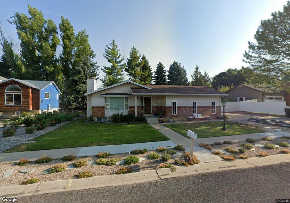
1771 E 1700 N Logan, UT 84341
Hillcrest NeighborhoodEstimated Value: $483,000 - $524,000
5
Beds
3
Baths
2,696
Sq Ft
$187/Sq Ft
Est. Value
About This Home
This home is located at 1771 E 1700 N, Logan, UT 84341 and is currently estimated at $504,589, approximately $187 per square foot. 1771 E 1700 N is a home located in Cache County with nearby schools including Hillcrest Elementary School, Mount Logan Middle School, and Logan High School.
Ownership History
Date
Name
Owned For
Owner Type
Purchase Details
Closed on
Sep 27, 2021
Sold by
Goldston Margery I
Bought by
The Ds Legacy Trust
Current Estimated Value
Purchase Details
Closed on
Sep 30, 2019
Sold by
Cannon Scoff Roy and Sr Cannon Revocable Living Tru
Bought by
Goldston Margery L and Stepherson Donna
Purchase Details
Closed on
Jun 5, 2019
Sold by
Cannon Scott R
Bought by
Cannon Scott Roy and Sr Cannon Revocable Living Tru
Create a Home Valuation Report for This Property
The Home Valuation Report is an in-depth analysis detailing your home's value as well as a comparison with similar homes in the area
Home Values in the Area
Average Home Value in this Area
Purchase History
| Date | Buyer | Sale Price | Title Company |
|---|---|---|---|
| The Ds Legacy Trust | -- | Northern Title Company | |
| Goldston Margery I | -- | Northern Title Company | |
| Goldston Margery L | -- | Northern Title Company | |
| Cannon Scott Roy | -- | Advanced Title |
Source: Public Records
Tax History
| Year | Tax Paid | Tax Assessment Tax Assessment Total Assessment is a certain percentage of the fair market value that is determined by local assessors to be the total taxable value of land and additions on the property. | Land | Improvement |
|---|---|---|---|---|
| 2025 | $2,186 | $282,690 | $0 | $0 |
| 2024 | $2,257 | $282,690 | $0 | $0 |
| 2023 | $2,354 | $281,040 | $0 | $0 |
| 2022 | $2,101 | $234,290 | $0 | $0 |
| 2021 | $1,989 | $342,680 | $65,000 | $277,680 |
| 2020 | $1,912 | $296,400 | $65,000 | $231,400 |
| 2019 | $1,768 | $262,182 | $65,000 | $197,182 |
| 2018 | $1,714 | $232,104 | $65,000 | $167,104 |
| 2017 | $1,526 | $109,265 | $0 | $0 |
| 2016 | $1,582 | $109,265 | $0 | $0 |
| 2015 | $1,584 | $109,265 | $0 | $0 |
| 2014 | $1,218 | $92,940 | $0 | $0 |
| 2013 | -- | $92,940 | $0 | $0 |
Source: Public Records
Map
Nearby Homes
- 1720 N 1850 E
- 1901 Southpointe Ct
- 1586 N Sharptail Cir
- 1949 Deer Crest Cir Unit 49
- 1959 Deer Crest Cir
- 1902 E 1500 N
- 1475 N Aspen Dr Unit 16
- 1451 N Aspen Dr
- 1405 N Aspen Dr
- 1810 N 2070 E Unit 10
- 1440 N 1600 E
- 1450 N 1525 E
- 1535 E 1385 N
- 2025 N 1550 E
- 1454 N 1400 E
- 1782 E 1250 N
- 1336 E Talmage Ln Unit 38
- 1512 E 1260 N
- 1374 N 1250 E Unit 48
- 1354 N 1250 E Unit 46
Your Personal Tour Guide
Ask me questions while you tour the home.