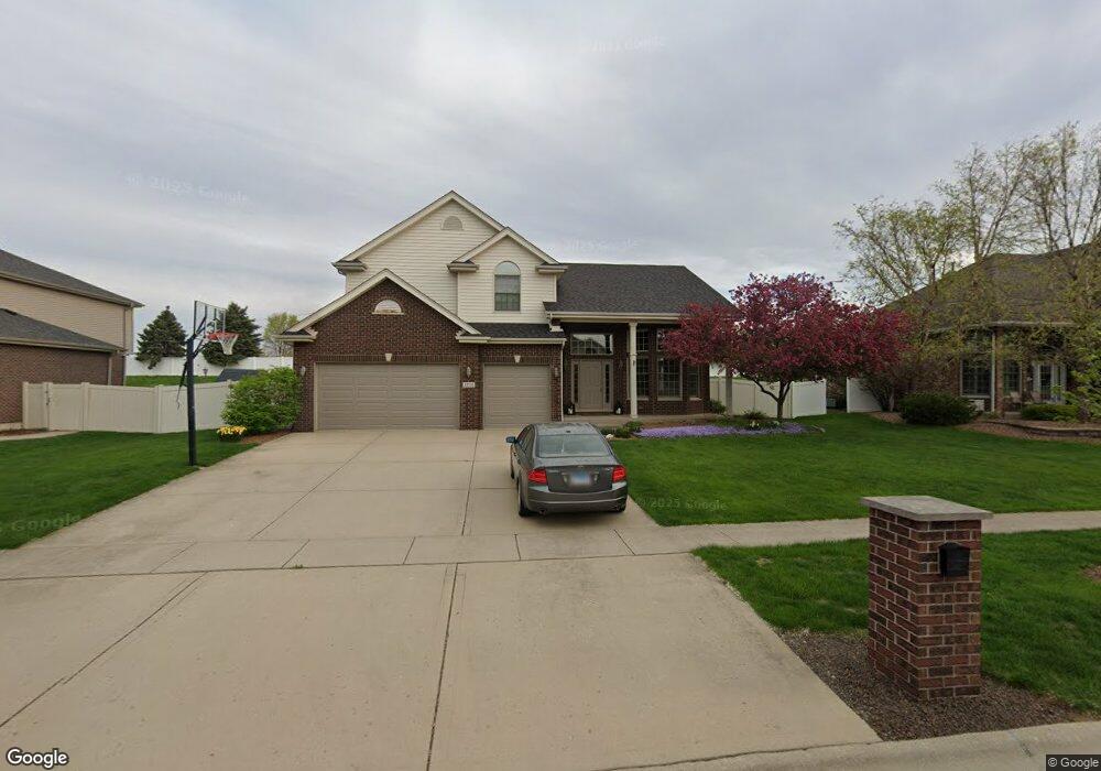
1771 Edmonds Ave New Lenox, IL 60451
Estimated Value: $538,622 - $598,000
4
Beds
3
Baths
3,000
Sq Ft
$190/Sq Ft
Est. Value
About This Home
This home is located at 1771 Edmonds Ave, New Lenox, IL 60451 and is currently estimated at $571,156, approximately $190 per square foot. 1771 Edmonds Ave is a home located in Will County with nearby schools including Oster-Oakview School, Haines Elementary School, and Lincoln Way West.
Ownership History
Date
Name
Owned For
Owner Type
Purchase Details
Closed on
Aug 7, 2006
Sold by
Prairie Bank & Trust Co
Bought by
Mcgann Christopher J and Mcgann Brandi
Current Estimated Value
Home Financials for this Owner
Home Financials are based on the most recent Mortgage that was taken out on this home.
Original Mortgage
$302,483
Outstanding Balance
$182,787
Interest Rate
6.88%
Mortgage Type
Purchase Money Mortgage
Estimated Equity
$388,369
Purchase Details
Closed on
Mar 17, 2005
Sold by
Queen Bean Inc
Bought by
Prairie Bank & Trust Co and Trust #04-056
Home Financials for this Owner
Home Financials are based on the most recent Mortgage that was taken out on this home.
Original Mortgage
$844,000
Interest Rate
5.5%
Mortgage Type
Purchase Money Mortgage
Purchase Details
Closed on
Nov 12, 2004
Sold by
First Midwest Bank
Bought by
Queen Bean Inc
Create a Home Valuation Report for This Property
The Home Valuation Report is an in-depth analysis detailing your home's value as well as a comparison with similar homes in the area
Home Values in the Area
Average Home Value in this Area
Purchase History
| Date | Buyer | Sale Price | Title Company |
|---|---|---|---|
| Mcgann Christopher J | $378,500 | Chicago Title Insurance Co | |
| Prairie Bank & Trust Co | $1,055,000 | Chicago Title Insurance Comp | |
| Queen Bean Inc | $915,000 | Chicago Title Insurance Co |
Source: Public Records
Mortgage History
| Date | Status | Borrower | Loan Amount |
|---|---|---|---|
| Open | Mcgann Christopher J | $302,483 | |
| Previous Owner | Prairie Bank & Trust Co | $844,000 |
Source: Public Records
Tax History Compared to Growth
Tax History
| Year | Tax Paid | Tax Assessment Tax Assessment Total Assessment is a certain percentage of the fair market value that is determined by local assessors to be the total taxable value of land and additions on the property. | Land | Improvement |
|---|---|---|---|---|
| 2024 | $12,283 | $159,353 | $36,940 | $122,413 |
| 2023 | $12,283 | $145,263 | $33,674 | $111,589 |
| 2022 | $11,060 | $133,822 | $31,022 | $102,800 |
| 2021 | $10,504 | $125,855 | $29,175 | $96,680 |
| 2020 | $10,285 | $121,364 | $28,134 | $93,230 |
| 2019 | $9,773 | $117,601 | $27,262 | $90,339 |
| 2018 | $9,550 | $113,548 | $26,323 | $87,225 |
| 2017 | $9,077 | $110,283 | $25,566 | $84,717 |
| 2016 | $8,813 | $107,332 | $24,882 | $82,450 |
| 2015 | $8,536 | $103,954 | $24,099 | $79,855 |
| 2014 | $8,536 | $102,670 | $23,801 | $78,869 |
| 2013 | $8,536 | $104,054 | $24,122 | $79,932 |
Source: Public Records
Map
Nearby Homes
- 1920 Edmonds Ave
- 13420 Florence Rd
- Lot 108 S Richard Ave
- 13621 W Maple Rd
- 1261 S Regan Rd
- Lot 122 S Lynn Pkwy
- 13741 Elizabeth Ln
- 12001 W Route 6
- 208 Redwood Ave
- 200 Redwood Ave
- 807 Picardy Place
- 0000 W Regan Rd
- 1344 N Cedar Rd
- 18400 S Parker Rd
- 1231 Town Crest Dr Unit E
- 1108 Plaza Dr
- 133 Barbara Ln
- 18670 S Cornflower Ct
- 224 Hauser Ct
- Will Cook Rd.+ Southwest Hwy
- 1771 Edmond Ave
- 1781 Edmonds Ave
- 1761 Edmonds Ave
- 1781 Edmond Ave
- 1791 Edmonds Ave
- 1751 Edmonds Ave
- 1751 Edmond Ave
- 1791 Edmond Ave
- 1780 Edmonds Ave
- 1760 Edmond Ave
- 1760 Edmonds Ave
- 1770 Edmond Ave
- 1750 Edmonds Ave
- 1741 Edmond Ave Unit 2
- 1780 Edmond Ave
- 1750 Edmond Ave
- 1801 Edmond Ave
- 1740 Edmonds Ave
- 1800 Edmonds Ave