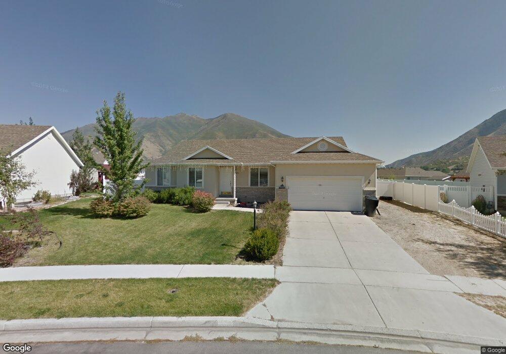
1771 S 2750 E Spanish Fork, UT 84660
Estimated Value: $513,000 - $571,889
6
Beds
3
Baths
3,000
Sq Ft
$182/Sq Ft
Est. Value
About This Home
This home is located at 1771 S 2750 E, Spanish Fork, UT 84660 and is currently estimated at $545,963, approximately $181 per square foot. 1771 S 2750 E is a home located in Utah County with nearby schools including Spanish Oaks Elementary School, Mapleton Junior High School, and Maple Mountain High School.
Ownership History
Date
Name
Owned For
Owner Type
Purchase Details
Closed on
Jul 31, 2017
Sold by
Cotton Bettridge Jesse and Cotton Bettridge Dalila
Bought by
Peterson Dane C and Peterson Krista C
Current Estimated Value
Home Financials for this Owner
Home Financials are based on the most recent Mortgage that was taken out on this home.
Original Mortgage
$269,600
Outstanding Balance
$224,656
Interest Rate
3.91%
Mortgage Type
New Conventional
Estimated Equity
$321,307
Purchase Details
Closed on
Apr 10, 2015
Sold by
Cotton Betteridge Jesse
Bought by
Cotton Betteridge Jesse and Cotton Betteridge Dalila
Home Financials for this Owner
Home Financials are based on the most recent Mortgage that was taken out on this home.
Original Mortgage
$208,000
Interest Rate
3.8%
Mortgage Type
New Conventional
Purchase Details
Closed on
Mar 2, 2007
Sold by
Cotton Betteridge Jesse
Bought by
Cotton Betteridge Jesse and Cotton Betteridge Dalila
Home Financials for this Owner
Home Financials are based on the most recent Mortgage that was taken out on this home.
Original Mortgage
$212,000
Interest Rate
6.21%
Mortgage Type
Purchase Money Mortgage
Purchase Details
Closed on
Dec 2, 2004
Sold by
Reese Daniel L and Reese Cheryl L
Bought by
Reese Daniel L and Reese Cheryl L
Purchase Details
Closed on
Nov 8, 2001
Sold by
Hubble Homes Llc
Bought by
Reese Daniel L and Reese Cheryl L
Purchase Details
Closed on
Aug 23, 2001
Sold by
H E Davis Family Ltd Partnership
Bought by
Hubble Homes Llc
Home Financials for this Owner
Home Financials are based on the most recent Mortgage that was taken out on this home.
Original Mortgage
$8,500,000
Interest Rate
7.09%
Mortgage Type
Construction
Purchase Details
Closed on
Aug 9, 2001
Sold by
H E Davis Family Ltd Partnership
Bought by
Hubble Homes Llc
Home Financials for this Owner
Home Financials are based on the most recent Mortgage that was taken out on this home.
Original Mortgage
$8,500,000
Interest Rate
7.09%
Mortgage Type
Construction
Create a Home Valuation Report for This Property
The Home Valuation Report is an in-depth analysis detailing your home's value as well as a comparison with similar homes in the area
Home Values in the Area
Average Home Value in this Area
Purchase History
| Date | Buyer | Sale Price | Title Company |
|---|---|---|---|
| Peterson Dane C | -- | Gt Title Services | |
| Cotton Betteridge Jesse | -- | Accommodation | |
| Cotton Betteridge Jesse | -- | Meridian Title Co | |
| Cotton Betteridge Jesse | -- | Gt Title Services Spanish | |
| Cotton Betteridge Jesse | -- | Gt Title Services Spanish | |
| Reese Daniel L | -- | -- | |
| Reese Daniel L | -- | First American Title Insuran | |
| Hubble Homes Llc | -- | First American Title Insuran | |
| Hubble Homes Llc | -- | First American Title Insuran |
Source: Public Records
Mortgage History
| Date | Status | Borrower | Loan Amount |
|---|---|---|---|
| Open | Peterson Dane C | $269,600 | |
| Previous Owner | Cotton Betteridge Jesse | $208,000 | |
| Previous Owner | Cotton Betteridge Jesse | $212,000 | |
| Previous Owner | Cotton Betteridge Jesse | $39,750 | |
| Previous Owner | Hubble Homes Llc | $8,500,000 | |
| Previous Owner | Hubble Homes Llc | $8,500,000 |
Source: Public Records
Tax History
| Year | Tax Paid | Tax Assessment Tax Assessment Total Assessment is a certain percentage of the fair market value that is determined by local assessors to be the total taxable value of land and additions on the property. | Land | Improvement |
|---|---|---|---|---|
| 2025 | $2,641 | $290,070 | -- | -- |
| 2024 | $2,641 | $272,250 | $0 | $0 |
| 2023 | $2,701 | $278,685 | $0 | $0 |
| 2022 | $2,736 | $276,870 | $0 | $0 |
| 2021 | $2,340 | $378,900 | $123,400 | $255,500 |
| 2020 | $2,216 | $348,800 | $112,200 | $236,600 |
| 2019 | $1,980 | $327,900 | $93,500 | $234,400 |
| 2018 | $1,940 | $310,600 | $88,200 | $222,400 |
| 2017 | $1,633 | $140,470 | $0 | $0 |
| 2016 | $1,534 | $130,240 | $0 | $0 |
| 2015 | $1,439 | $120,725 | $0 | $0 |
| 2014 | $1,364 | $114,840 | $0 | $0 |
Source: Public Records
Map
Nearby Homes
- 804 E 1610 S Unit 91
- 824 E 1610 S Unit 92
- 2968 E Canyon Meadows Dr
- 2662 E 1600 S
- 1627 S 3050 E
- 3033 E Canyon Glen Loop
- 3134 E Canyon Crest Dr Unit 326
- 3182 E Canyon Meadows Dr Unit 212
- 3182 E Canyon Meadows Dr
- 2387 E Canyon Crest Dr Unit 44
- 3154 E Canyon Crest Dr Unit 325
- 3013 E Canyon Meadows Dr Unit 314
- 3147 E 1530 S
- 3032 E Canyon Meadows Dr Unit 331
- 3056 E Canyon Meadows Dr Unit 330
- 1617 S Oak View Ln
- 3074 E Canyon Meadows Dr
- 2984 E Canyon Meadows Dr
- 2972 E Canyon Meadows Dr Unit 335
- 2376 E 1610 S
- 1783 S 2750 E
- 1759 S 2750 E
- 1716 S 2900 E
- 1716 S 2900 E St
- 1728 S 2900 E
- 1704 S 2900 E
- 2783 E Canyon Crest Dr
- 1797 S 2750 E
- 1737 S 2750 E
- 2742 E 1720 S
- 2899 E Canyon Crest Dr
- 1792 S 2750 E
- 2771 E Canyon Crest Dr
- 1682 S 2900 E
- 1713 S 2750 E
- 1721 S 2900 E
- 1709 S 2900 E
- 2738 E 1720 S
- 2733 Stony Hill Way
- 1739 S 2900 E Unit 118
Your Personal Tour Guide
Ask me questions while you tour the home.